
Photo: MetService screenshot
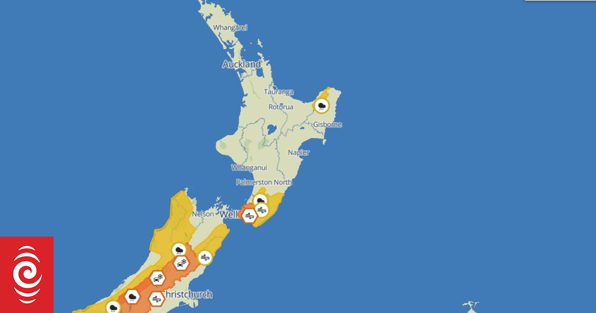
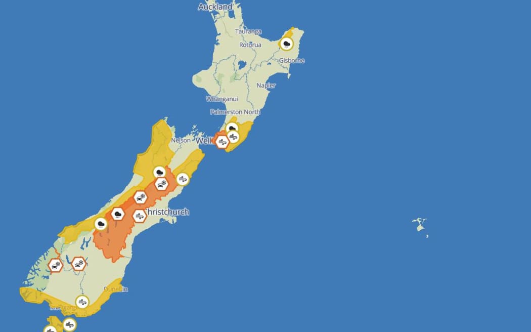
Severe weather warnings are in place for much of New Zealand on Friday and Saturday with high winds forecast for parts of the lower North Island while heavy rain, thunderstorms and snow are expected across the South Island.
Waka Kotahi warned Wellington drivers to take care as winds buffeted the region today.
Gusts of up to 120 kilometres an hour were forecast for exposed routes such as State Highway 2, Remutaka Hill and the Wainui Saddle of State Highway 1, through Transmission Gully – while northwest winds could approach severe gales in the Wairarapa.
The Transport agency said the bad weather was likely to coincide with peak afternoon and evening traffic and they urged drivers to stay on the alert for debris, downed power lines and felled trees.
MetService Meteorologist Silvia Martino said Remutaka Hill had already recorded gusts up to 137 km/h and the strong winds were building in remote parts of the east coast of the lower North Island.
“We’ve already seen some very strong winds through the Wairarapa and Wellington region with gusts getting up to 120 km/h in exposed bits and even stronger right out on the east coast of Wairarapa.
“Where people live it’s not quite as strong yet – unless anyone’s out at the Castle Point light house – they’re probably not seeing them quite yet,” Martino said.
She said motorists in high-sided vehicles and motorcyclists should be careful on the roads across the region.
“As you get into Wellington Central [we’re] not expecting quite as strong winds but still something to watch out for,” Martino said.
She said – further south – heavy rain and “a whole lot of thunderstorms” would hit central parts of the Southern Alps and northern parts of Westland such as the Grey and Buller districts.
Up to 90 millimetres if rain is expected around the headwaters of the Canterbury lakes as well as rivers about and below Arthur’s Pass ahead of 5pm today.
“That thunderstorm activity is expected to confine itself to the western side of the divide by this afternoon and we’ve got thunderstorms down into Fiordland as well that could have heavy rain with those.
“Things are easing from the south – so our rain warning for the headwaters of Canterbury lakes and rivers is running through till five pm today – but slowly improving. Areas like Westland, Grey, Buller ranges [are] all slowly easing from the south so – by night time – should be getting a little better through there,” Martino said.
Showers were forecast to turn into snow over the Crown Range Road late this afternoon – bringing up four centimetres of snow about the summit.
While State Highway 94 on Milford Road could see up to 10cm of snow accumulating about the Homer Tunnel entrance from this afternoon with another 2-4cm expected to fall in the area – above 500 metres – on Saturday morning.
“We might see flurries lower than that but that’s where we’re expecting snow to accumulate to. For the Crown Range we’re talking about snow about the summit and then lesser amounts – down to 800 metres – but lower than that there is the possibility you’ll get flurries that don’t settle,” Martino said.
She also said people in Grey and Buller could see localised heavy downpours that were not necessarily visible on the wider forecast.
Martino said people should keep an eye on updates for snowfall in affected areas and strong south westerly winds passing through southern parts of Fiordland and Southland – as well as Clutha and Dunedin – with a fast moving front tomorrow.
“It’s looking pretty spring like,” Martino said.
The Transport Agency was also warning of potentially damaging wind gusts for motorists on State Highways 7 and 73 in the central South Island.
An orange wind warning was in force for the Canterbury High Country until 3pm, and gusts of about 100 km/h had been recorded near Ashburton and the Canterbury Plains.
“Driving may be difficult, especially for high-sided vehicles and motorcycles,” the Transport Agency said.
Waka Kotahi said a large number of lightning strikes had been detected on the West Coast through the early hours of Friday.
“In one instance lightning strikes are affecting railway signals and level crossings around Otira on State Highway 73. KiwiRail is working to rectify the situation,” it said.
Sign up for Ngā Pitopito Kōrero, a daily newsletter curated by our editors and delivered straight to your inbox every weekday.