
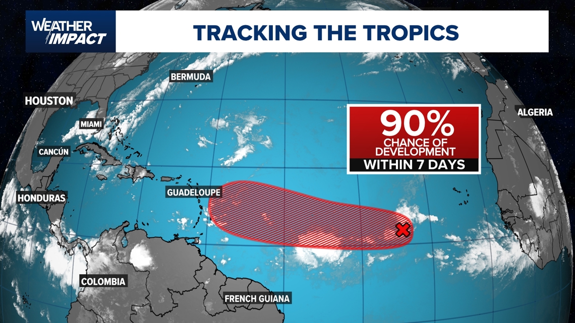
A tropical wave thousands of miles from the U.S. coastline has a 90% chance of development in the next couple of days.
HOUSTON — As the Atlantic hurricane season nears its statistical peak on Sept. 10, forecasters are keeping a close eye on a tropical wave thousands of miles from the U.S. coastline. The National Hurricane Center now gives the system a 90% chance of development over the next couple of days.
KHOU 11 Chief Meteorologist David Paul said the disturbance is showing early signs of organization, including a low-level swirl and clusters of thunderstorms. It hasn’t yet been classified as a depression or tropical storm, but conditions suggest that could soon change.
Computer models disagree on what happens next with the developing wave.
The American model (GFS) shows the system strengthening into a tropical storm or even a hurricane by early next week. That track would bring it toward the northern islands of the eastern Caribbean, including Guadeloupe and Puerto Rico.
The European model (ECMWF) paints a weaker picture. It develops the wave initially, but then has it fizzle out as Saharan dust suppresses the storm.
Paul said the difference comes down to how each model handles the dust forecast. Dust moving off Africa can sometimes choke off tropical systems before they can grow.
For now, the tropical wave remains far out in the Atlantic, posing no immediate threat to the Gulf of Mexico or the U.S. mainland. But Paul warns that September is the prime time for long-track hurricanes to form and move west across the ocean.
The next storm name on the 2025 Atlantic list is Gabrielle.
Seasonal forecasts call for an above-average year in the Atlantic. Colorado State researchers predict 16 named storms, compared to a normal 14. They also expect eight hurricanes, including three majors. So far, the season has only produced one hurricane — Erin, a Category 5 that fortunately stayed out to sea without striking land.
Got a news tip or story idea? Text it to us at 713-526-1111.