
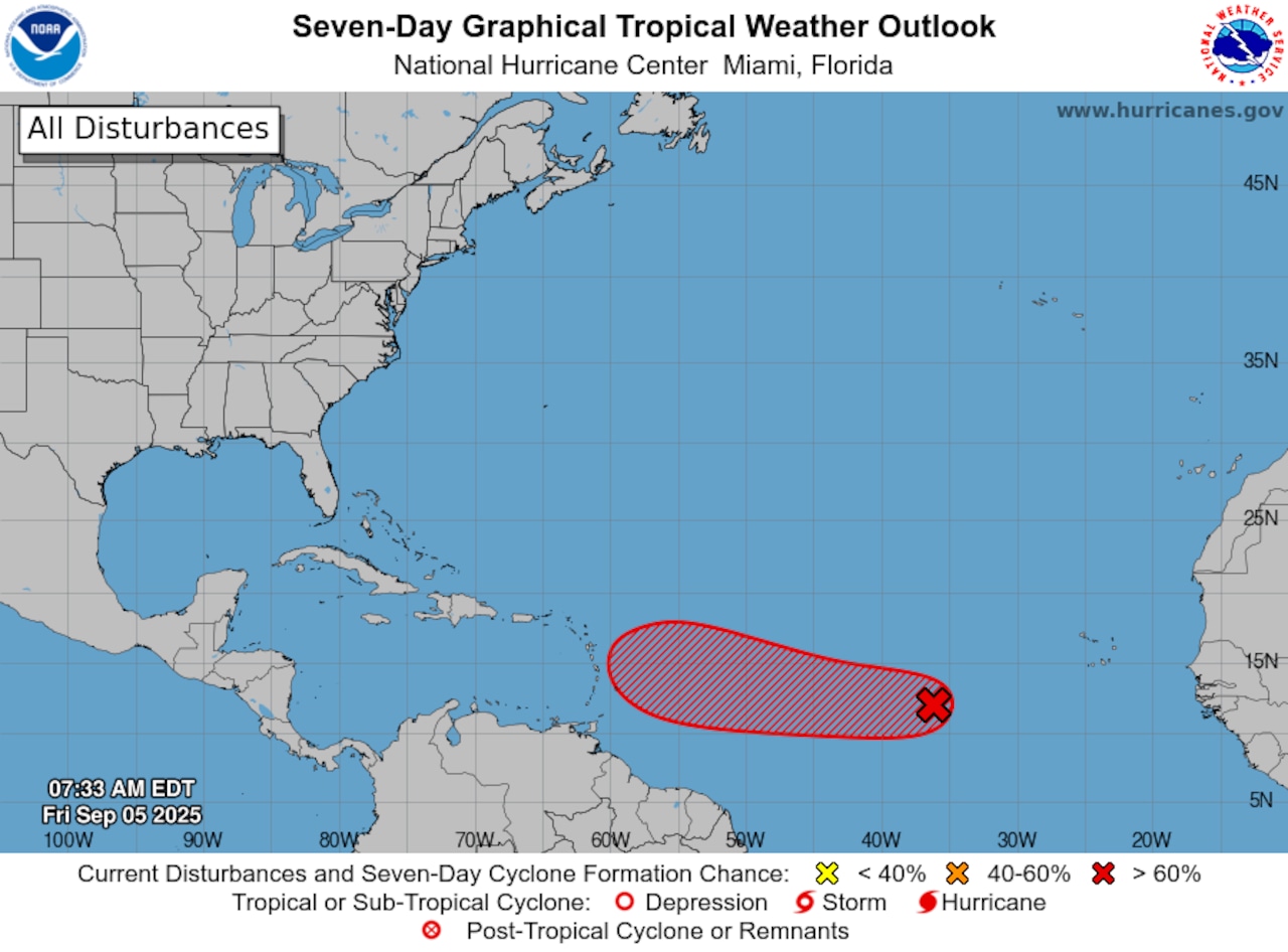
The National Hurricane Center on Friday continued to track a tropical disturbance that is likely to become the next named tropical storm soon.
As of Friday morning the system was in the eastern Atlantic and days away from potentially affecting any land areas.
The hurricane center said it will likely become a tropical depression this weekend or early next week as it continues on a slow path westward, in the general direction of the Lesser Antilles.
But it’s too soon to say whether the system will affect the islands or eventually the continental United States.
A storm has to have a defined surface circulation and winds of at least 39 mph to be classified as a tropical storm and get a name. The next name on the 2025 Atlantic storm list is Gabrielle.
Weather watchers have been frustrated by the lack of a clear direction from forecast models. Some show a track closer to the islands while others curve the storm to the north and east and out to sea.
On Friday the hurricane center said the system remained disorganized but is in an area favorable for continued development.
It is expected to continue to track slowly to the west at 5 to 10 mph.
Forecasters expect the disturbance to be near the Lesser Antilles by the middle or later part of next week, “and interests there should monitor its progress.”
There were no other disturbances being watched by the hurricane center as of Friday, which is unusual for this period near the peak of the Atlantic hurricane season.
The season began June 1 and will end on Nov. 30.
If you purchase a product or register for an account through a link on our site, we may receive compensation. By using this site, you consent to our User Agreement and agree that your clicks, interactions, and personal information may be collected, recorded, and/or stored by us and social media and other third-party partners in accordance with our Privacy Policy.