Before and after satellite pictures show super typhoon destruction in Taiwanpublished at 10:52 BST
10:52 BST
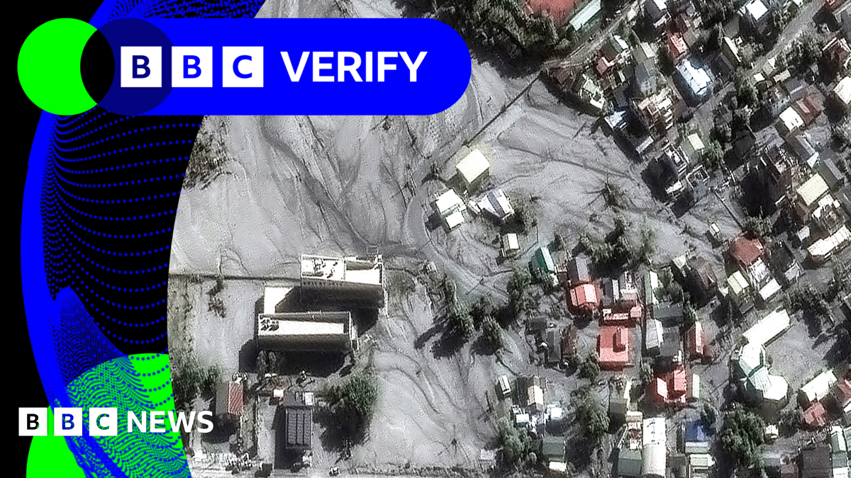
Thomas Copeland and Yi Ma
BBC Verify
We’ve been reviewing some new satellite images taken yesterday that show the devastating impact of Super Typhoon Ragasa on Taiwan.
The township of Guangfu in the eastern county of Hualien has been hit particularly hard after heavy rainfall from this week’s storm breached the Matai’an Creek barrier lake 11km (7 miles) upstream. It was formed just a few months ago after a series of landslides.
The lake holds around 91 million tonnes of water, enough to fill 36,000 Olympic-sized swimming pools. About three-quarters of that water was released suddenly after the lake burst its banks. At least 15 people were killed and nine others remain unaccounted for.
The force of the water unleashed by the lake bursting could be compared to a tsunami, an expert has told the BBC.
Earlier this week we brought you verified drone footage of Matai’an Creek Bridge, just north of Guangfu which was submerged under the fast flowing water released from the lake.
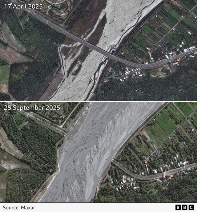
In this side-by-side comparison of satellite images from before and after the typhoon, we can now clearly see the bridge has been completely washed away with just six vertical supports still standing.
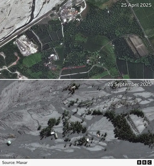
In this second set of images we can see that an area of fields, trees and small buildings next to the riverbank has now been completely submerged in mud and silt.