
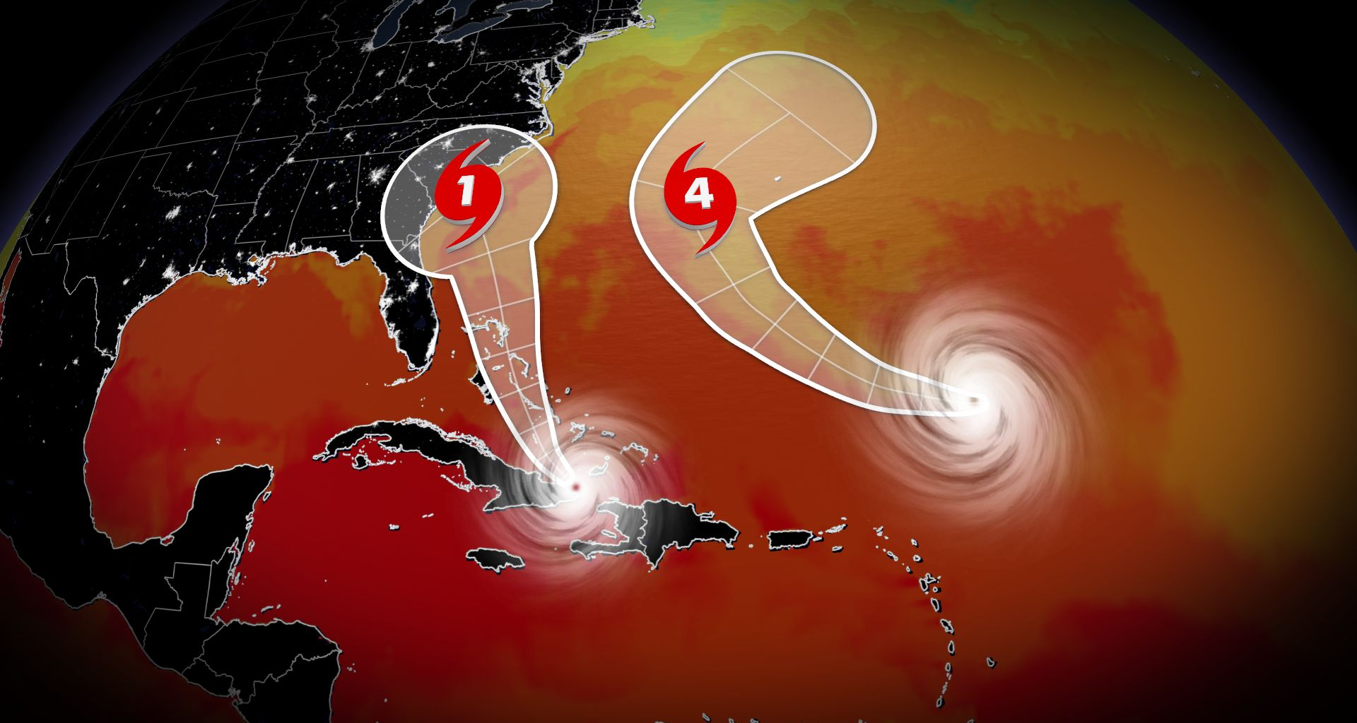
Future Imelda brewing near the Bahamas
Another system nearby may cause some serious issues across the southeastern U.S. early next week.
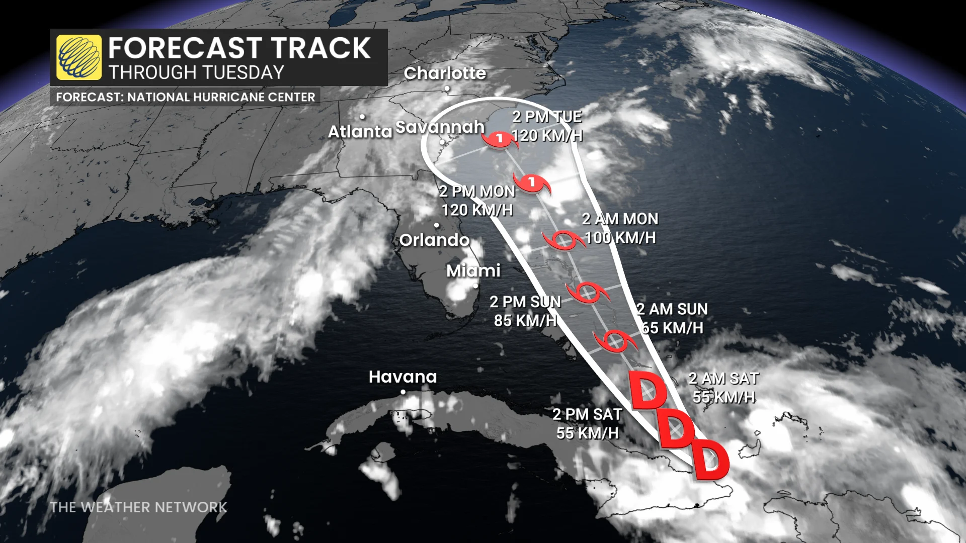
The NHC began issuing advisories on Potential Tropical Cyclone Nine on Friday evening. This special designation allows forecasters to issue watches and warnings on a tropical disturbance that’s expected to develop and hit land within the next 24 to 48 hours.
RELATED: The high-stakes factors that decide where a hurricane tracks
Meteorologists expect this system to organize into Tropical Storm Imelda by Saturday as it moves through the Bahamas.
The forecast grows trickier from there. The latest trends indicate that the system will strengthen and approach the southeastern United States with gusty winds and flooding rains. Some areas could easily see 200-400+ mm of rainfall through the middle of next week.
Uncertainty is greater than usual, though, and there’s a chance that Hurricane Humberto interferes with this developing system and pulls it farther out to sea.
Anyone with interests in the Bahamas, Georgia, the Carolinas, or Virginia should closely monitor the progress of this system heading into early next week.