
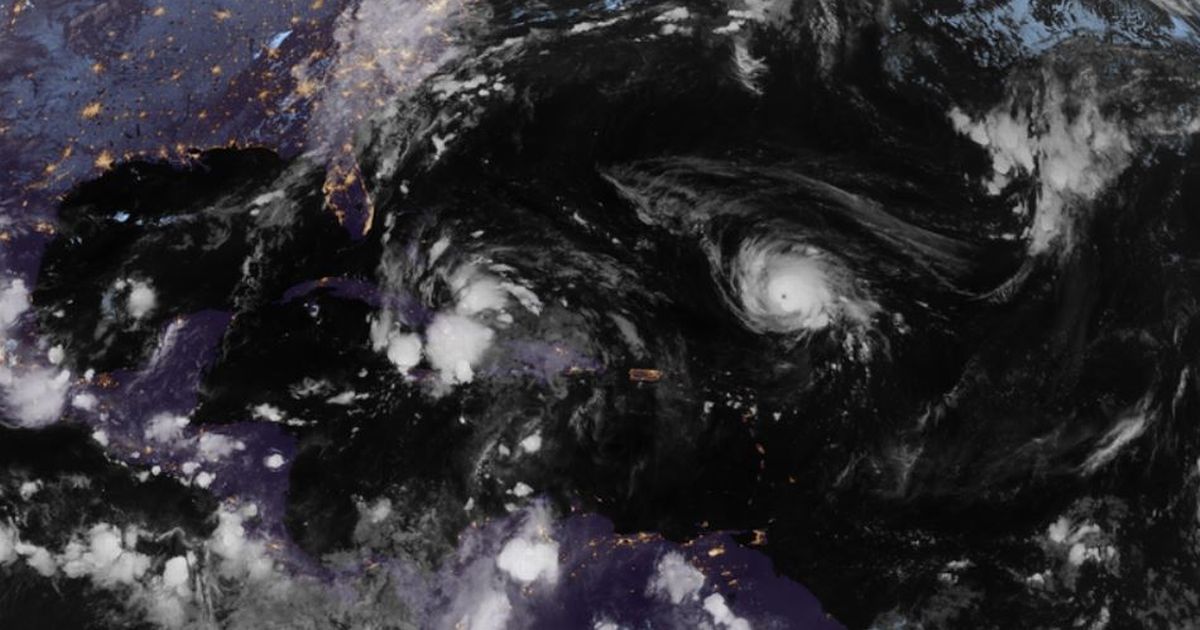
Met Eireann has issued a rare warning as Hurricane Humberto brews, with its remnants potentially bringing heavy rain and strong winds to Ireland soon.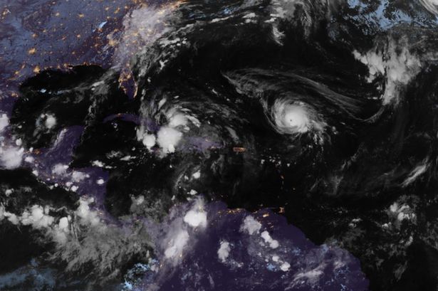 Satellite image of Hurricane Humberto in the Atlantic(Image: CIRA/RAMMB/NOAA)
Ireland has been enjoying a spell of settled weather in recent days, with sunshine and mild temperatures giving the country an unexpected taste of early autumn warmth. Over the coming days, Met Eireann says we can expect somewhat of an ‘Indian Summer’ with temperatures forecast to reach nearly 20C in some parts of the country.
However, this mild spell is unlikely to last. The national forecaster has taken the unusual step of issuing an early warning for Hurricane Humberto. The monster storm developed into a Category 1 hurricane yesterday, and models from the US Hurricane Center show it tracking towards the Bahamas and Florida over the next few days before turning east across the Atlantic, potentially heading in the direction of Ireland.
In a stark warning issued this morning, Met Eireann said: “The remnants of hurricane Humberto could move close to or over us”. Ireland’s meteorological agency rarely comments on tropical storms before they have fully crossed the Atlantic, making this warning highly unusual.
The national forecaster highlighted the potential for disruption next Friday, Saturday, and Sunday. It said: “While there’s a good deal of uncertainty in the detail, due to the presence of what will be ex-hurricane Humberto at this stage in the Atlantic, it’s likely to turn more unsettled generally on Friday, with a band of heavy rain spreading eastwards for a time.
“Our weather will continue changeable next weekend with some drier spells but with the chance of some heavy rain and strong winds at times, as the remnants of hurricane Humberto move close to or over us.”
Until Humberto’s remnants potentially affect Ireland, the country can expect a brief spell of milder, more settled conditions. Met Eireann said: “The week ahead will be mild with mixed conditions. While high pressure will remain close by for a time, weather fronts will move in from the Atlantic occasionally, bringing some rain and drizzle at times, especially to the west and north, with the best of the drier weather to the east and south. It’s likely to turn generally more unsettled and changeable later in the week and next weekend.”
Giving a day-by-day breakdown of what to expect for the rest of this weekend and early next week, it said: “It’ll be a wet morning Saturday to begin across the eastern half of the country, with some heavy rain continuing to spread eastwards, leading to some spot flooding, especially in the northeast. A brighter start further west with sunshine and well scattered showers and with those conditions continuing to extend elsewhere through the morning and afternoon, as the rain clears eastwards. However, the rain will be slow to clear the northeast, with further heavy falls likely to continue there into the early evening. Highest temperatures of 13C to 16C or 17C in mostly light to moderate west to northwest winds, moderate to fresh southerly in the east and northeast for a time.
“The band of showers will quickly clear from eastern parts early Sunday morning. The rest of the day will be mainly dry with sunshine, though with a few well scattered showers developing. Highest temperatures of 13C to 17C in light westerly or variable breezes.
“The mist and fog will clear on Monday morning and while it’ll be a mainly dry day for most, there’ll be a little patchy light rain and drizzle at times in the west and northwest, especially later in the day. While there’ll be a good deal of cloud, there’ll be some bright or hazy sunny spells too, mainly in the midlands, east and south. Highest temperatures of 14C to 17C in mostly light to moderate south to southwest winds, fresher in western and northwestern coastal parts.
“Tuesday will bring a good lot of cloud with scattered outbreaks of light rain and drizzle, along with areas of mist and hill fog. A few limited bright or sunny spells are likely. A mild day with highest temperatures of 15C to 18C or 19C in mostly moderate southerly winds.
“Another fairly cloudy day generally on Wednesday and while there’ll be a little patchy light rain and drizzle to begin, it’ll become dry in most areas through the morning. A few bright or sunny spells are likely, mainly in the south and east. There’ll probably be further scattered outbreaks of rain and drizzle though in parts of the west and northwest. Highest temperatures of 15C to 18C in mostly moderate southerly winds, fresh to strong in coastal parts of the west and northwest.
“Mostly cloudy Thursday with scattered outbreaks of rain and drizzle, heavy at times in the west and north. Drier in the east and south. Highest temperatures of 15C to 18C or 19C in mostly moderate southerly winds, fresh to strong along the west coast.”
Subscribe to our newsletter for the latest news from the Irish Mirror direct to your inbox: Sign up here.