

Dangerous rip currents are likely up and down the U.S. East Coast into early next week, potentially reaching Atlantic Canada later in the week. Rip currents are a deadly hazard to even the strongest swimmers.
Next storm may threaten southeastern U.S.
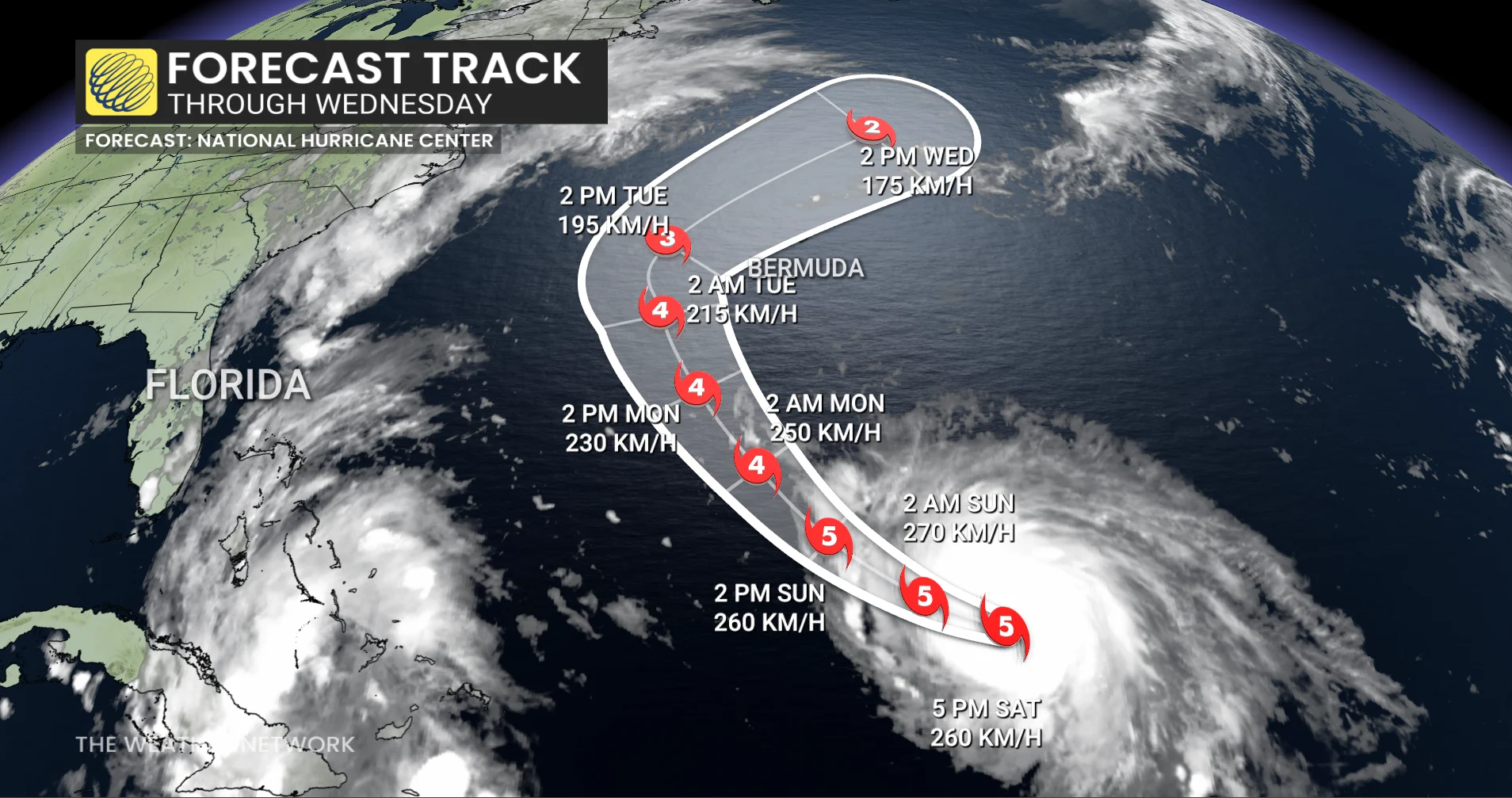
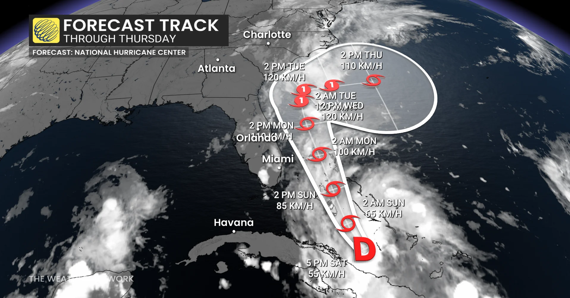
Farther west, Tropical Depression Nine continued to gradually organize as it pushed north through the Bahamas on Saturday.
This system, expected to become Tropical Storm Imelda by Sunday, will come close to the southeastern U.S. by Monday and Tuesday. Tropical storm watches are in effect for portions of the Florida coast ahead of the storm’s arrival.
RELATED: The high-stakes factors that decide where a hurricane tracks
A complex atmospheric setup will cause steering currents to collapse around the system as it approaches the U.S. early next week, forcing the storm to slow to a crawl.
Given this setup, we’re seeing higher-than-normal uncertainty surrounding the storm’s future track.
The most likely scenario, reflected in the U.S. National Hurricane Center’s (NHC) forecast, is that Humberto will cause a break in the ridge which will offer the system an ‘escape route’ of sorts to make a hard right turn out to sea by midweek.