

Dangerous rip currents are expected across Bermuda, the U.S. East Coast, and Atlantic Canada this week as Humberto continues to churn through the region.
Imelda finally forms, heading north for now
Tropical Storm Imelda made its long-anticipated appearance over the Bahamas on Sunday as the system gradually got its act together.
Forecasters expect Imelda to strengthen into a hurricane by Tuesday as the storm heads north out of the Bahamas.
RELATED: Hurricane terms everyone should know as the season heats up
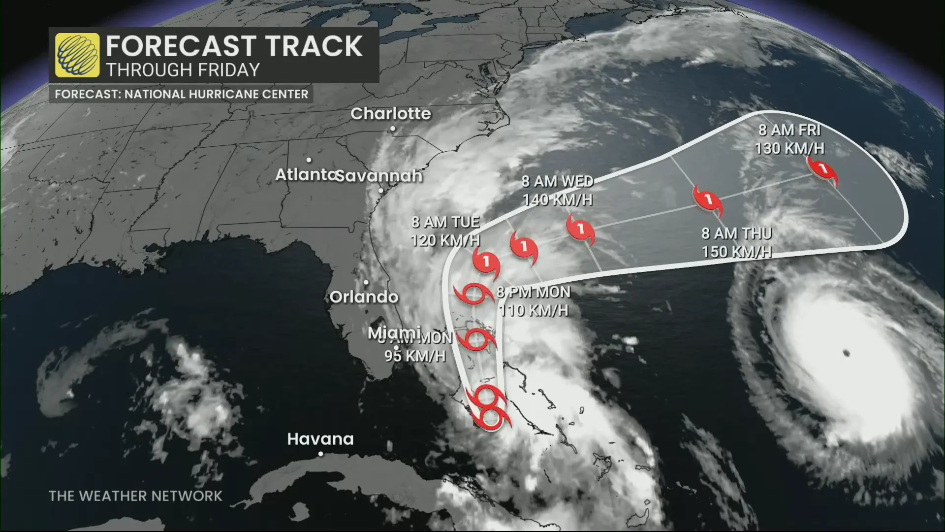
The system’s slow development, and slow forward movement, will likely prove beneficial for the southeastern U.S. coast. Hurricane Humberto will cause a weakness in that ridge of high pressure over the Atlantic, providing Imelda an off-ramp of sorts to make a hard turn toward the east.
This sharp deviation will significantly reduce the amount of wind and rain expected along the U.S. coast.
However, this turn could also put Bermuda directly in the storm’s path by the latter half of this week. Interests on the island should pay close attention to forecast updates in the days ahead.
Header image of Humberto’s eye courtesy of NASA.
WATCH: What’s the difference between hurricanes, typhoons, and cyclones?