

Satellite image shows strategically important Israeli military base on Gaza hillpublished at 13:49 BST
13:49 BST
 Benedict Garman
BBC Verify senior journalist
In an earlier post I outlined the key locations the Israeli military (IDF) would continue to hold in Gaza should a ceasefire go ahead, including the eastern Gaza City neighbourhood of Shejaiya.
Before the war Shejaiya was one of Gaza City’s largest neighbourhoods, filled with shops, homes, schools, and mosques. Little of it remains after being extensively destroyed by Israel.
Recent satellite imagery captured by Planet Labs shows hundreds of structures have been flattened and the IDF has established staging areas, defensive features like berms (high sand banks) and several outposts.
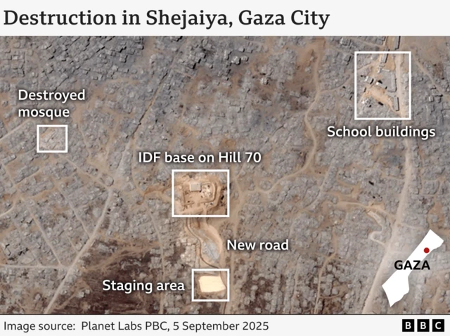
One of the main Israeli forward operating bases in this area is built on a hill called Tel al-Muntar, also known as Hill 70. It has views across most of northern Gaza and is considered strategically critical for the IDF as a result.
Satellite imagery shows this base was paved at the start of this month, which appears to confirm the IDF’s intention to hold onto it long term.
The picture below is a frame from a video published in June showing the view across north Gaza from the base, which BBC Verify has geolocated. It makes clear the extent of the devastation, with almost no buildings visibly left standing.
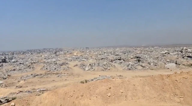 Image source, Twitter