

Scotland is likely to be hit by a snow blast in just days, with up to 10cm expected to fall in some parts across the Highlands as temperatures plummet near the freezing mark
Tasha Hall Showbiz and Trends Reporter
22:38, 09 Oct 2025
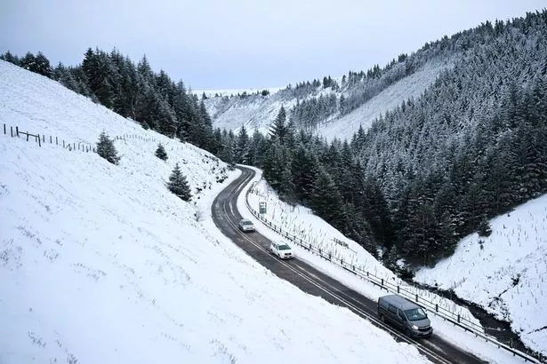
 Parts of Scotland are set to be hit the worst with the snowfall(Image: PA)
Scotland is bracing for a “heavier than expected” snowfall, with up to four inches likely to cover various areas in just a matter of days.
Advanced weather maps reveal parts of the UK could be hit with a layer of snow around October 21, with 10cm accumulations and snow depths likely in the far north.
Scotland is set to bear the brunt of the wintry weather, with temperatures dropping close to freezing, just a couple of degrees above 0C.
Snow flurries are likely to appear in the Scottish Highlands from 6am until noon that day, with data from WXCharts suggesting heavy snow will blanket its landscapes. Edinburgh is also among the areas in the firing line as the snow spreads southwards.
According to WXCharts, which uses Met Desk data, the chilling shift in weather is set to commence from the mid-to-late part of the month as reported by the Mirror.
 There could be up to 10cm accumulations and snow depths likely in the far north of the country(Image: AFP via Getty Images)
The GFS model indicates that some Scots will see a white October before we officially head into winter. Scotland is likely to be worst-hit but separate reports this week suggest snow could also materialise in North Wales before the month is out also.
The Highlands remain at most at risk though, with the Cairngorms National Park potentially seeing substantial amounts. The snow would mark the first flurries of autumn. Elsewhere across the UK, Northern England will face torrential rain.
Netweather TV has issued a warning that high pressure could sweep across England in the coming days. They stated: “High pressure in charge next weekend,” and added: “Continuing mostly dry and settled next week too, with high pressure in control.
“The high pressure system perhaps becoming centred over the Norwegian Sea, which may feed a northeast flow with more the way of cloud across eastern England, perhaps with a few coastal showers, but that’s a long way off.”
However the worst of the weather is far from over, with the edge of the country hit by a further yellow weather warning for wind on Sunday, January 26. This will affect Dumfries and Galloway, Argyll and Bute and south Ayrshire.
Sunday’s yellow wind warning is set to be in place across some parts of Scotland from 8am on Sunday morning, until 3pm in the afternoon. Temperatures are set to fall drastically from Saturday night into Sunday morning, with places hitting minus.
Join the Daily Record’s WhatsApp community here and get the latest news sent straight to your messages.