
The changeover will sweep west to east across the city between 6 p.m. to 8 p.m. Saturday, with the heaviest snow expected in the higher west-end neighbourhoods like Aspen Woods, Signal Hill, and the University of Calgary area, where locally up to 5 cm may accumulate by early Sunday morning.
Specific timing
5 p.m. Saturday
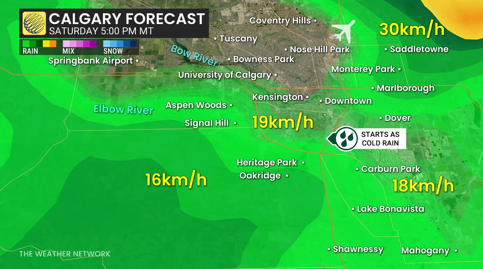
Light rain spreads across most of the city, with just wet roads at this point.
7 p.m. to 8 p.m. Saturday
The rain-snow line cuts straight into the heart of Calgary––starting in the west end (Aspen Woods, Signal Hill, Springbank Airport)
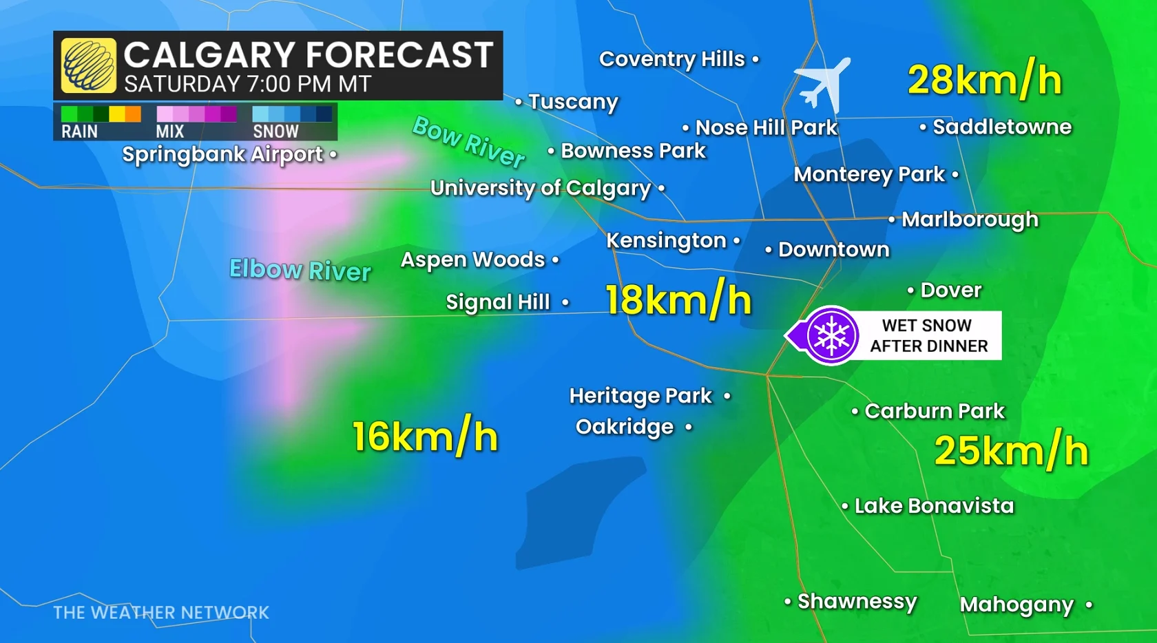
This is the key changeover, and after 8 p.m., downtown Calgary is forecast to transition to a wintry mix. It will still be raining towards Carburn Park, Lake Bonavista, and Mahogany.
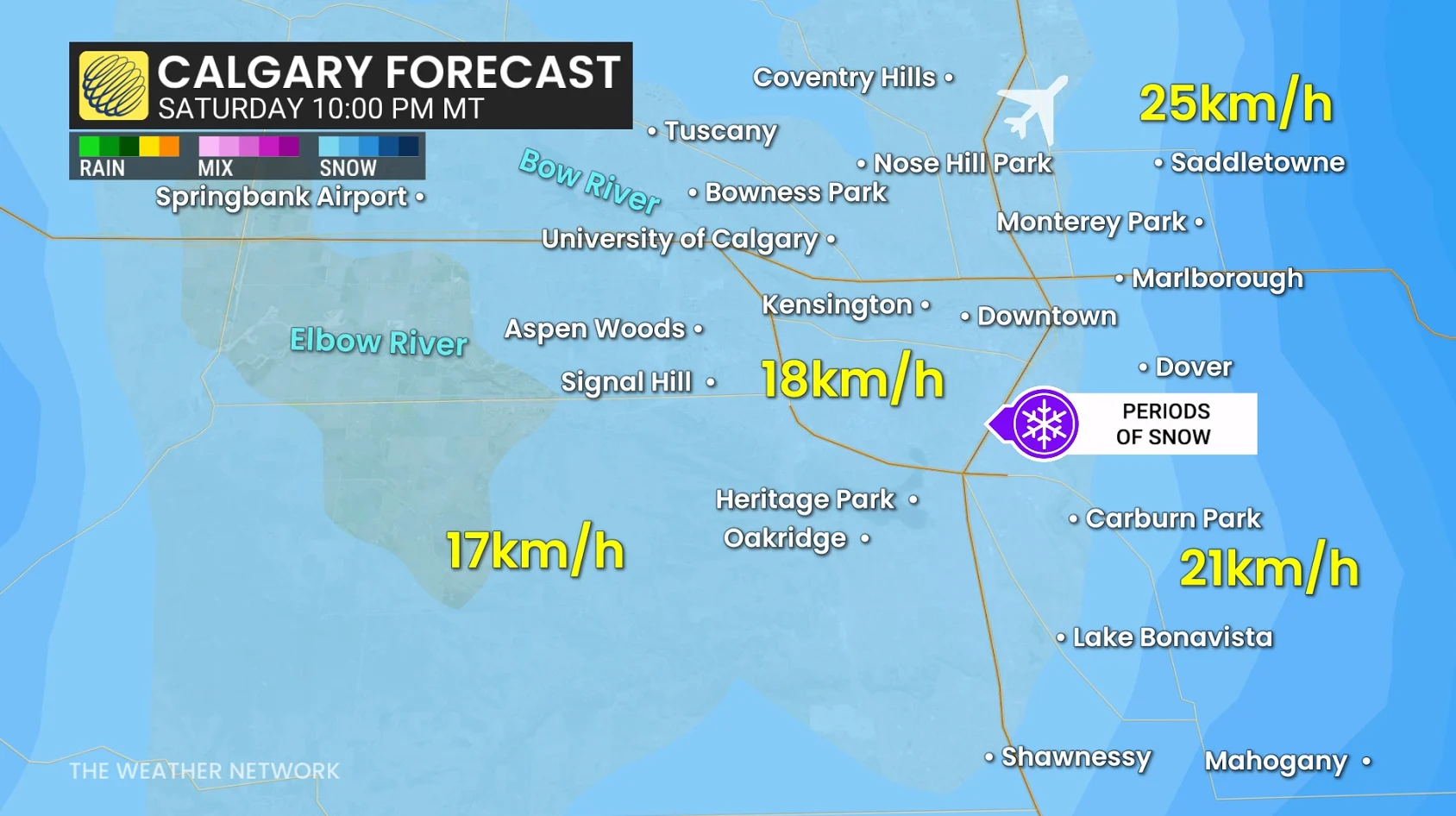
10 p.m. onwards
All wet snow across Calgary, and a general light intensity (less than 1 cm/hour).
Flurries taper from west to east, and precipitation begins to ease after the midnight hour, wrapping up quickly through the overnight.
Localized Calgary snowfall amounts
Heaviest accumulation zones tend to line up with the western half of the city, across higher terrain. Aspen Wood, Signal Hill, Springbank Airport, University of Calgary, and Nose Hill have the greatest odds to pick up 5 cm.