
The same system that brought some severe thunderstorms to Central and Northern Alberta yesterday, albeit much weaker than originally anticipated, could once again trigger severe thunderstorms today. This time, however, we’re looking at two distinct areas across the Prairies where severe thunderstorms could impact.
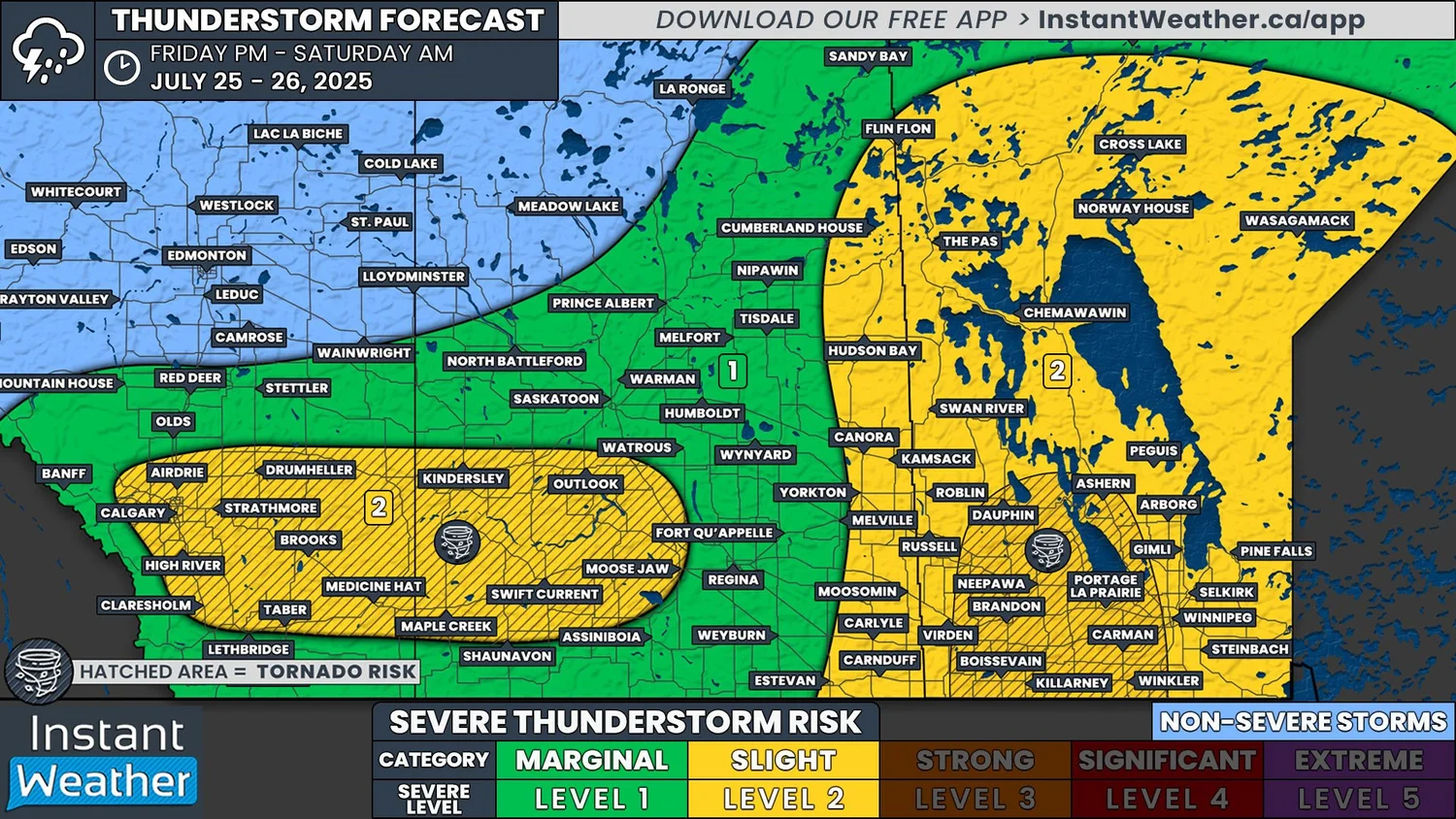
The first area of concern is across the southern half of Manitoba and in Eastern Saskatchewan, along the provincial border.
Isolated thunderstorms could start to develop along Saskatchewan-Manitoba border, especially in the area from Hudson Bay to Cumberland House, around the lunch hour. These storms should then track eastward into Manitoba fairly quickly and they could become severe while still in Saskatchewan. If the storms remain sub-severe as the enter Manitoba, it’s very likely that they will still strengthen to become severe as they continue eastward throughout the afternoon and evening.
Additional thunderstorm development could continue southwestward, back into Southeast Saskatchewan, throughout the afternoon. These storms are also expected to track eastward across Manitoba through the evening and overnight, leading to the widespread severe risk.
It’s worth noting that thunderstorm development throughout this entire area is slightly questionable. The environment will be primed with heat, moisture and instability, but there’s the possibility that capping in the atmosphere will prevent them from even forming in the first place. If this cap breaks, however, we could be looking at some explosive thunderstorm development.
Any storms that do develop will likely have the potential to produce golf ball-sized hail or larger, damaging wind wind gusts in excess of 100km/h, and heavy downpours that could lead to some localized flooding. There is also the risk of a tornado forming from storms that could move through Southwestern Manitoba and into the Interlake and Red River Valley in the evening. It’s possible that the tornado risk could extend into Winnipeg, but there is some uncertainty with how far east it goes.