
After a soggy start to Halloween Eve across Southern Ontario on Thursday, a strong system will cast a gloomy spell over the region with widespread rainfall. But don’t be fooled, as that’s only a taste of what Mother Nature has brewing in her cauldron for Halloween itself.
Last year, we were treated to a mild and friendly Halloween with temperatures that felt more like a trick than a treat. This year, however, it looks like Halloween will send a real shiver down your spine as temperatures drop to levels more fitting for the undead.
Rain from Thursday is expected to linger overnight and into the early hours of Friday, heavy at times, especially across Eastern Ontario. The good news is that the worst of the rainfall should clear out just in time for trick-or-treating across Southwestern Ontario and the Golden Horseshoe. Temperatures will hover around what’s normal for this time of year, ranging from the mid to upper single digits, possibly reaching the low double digits in Deep Southwestern Ontario.
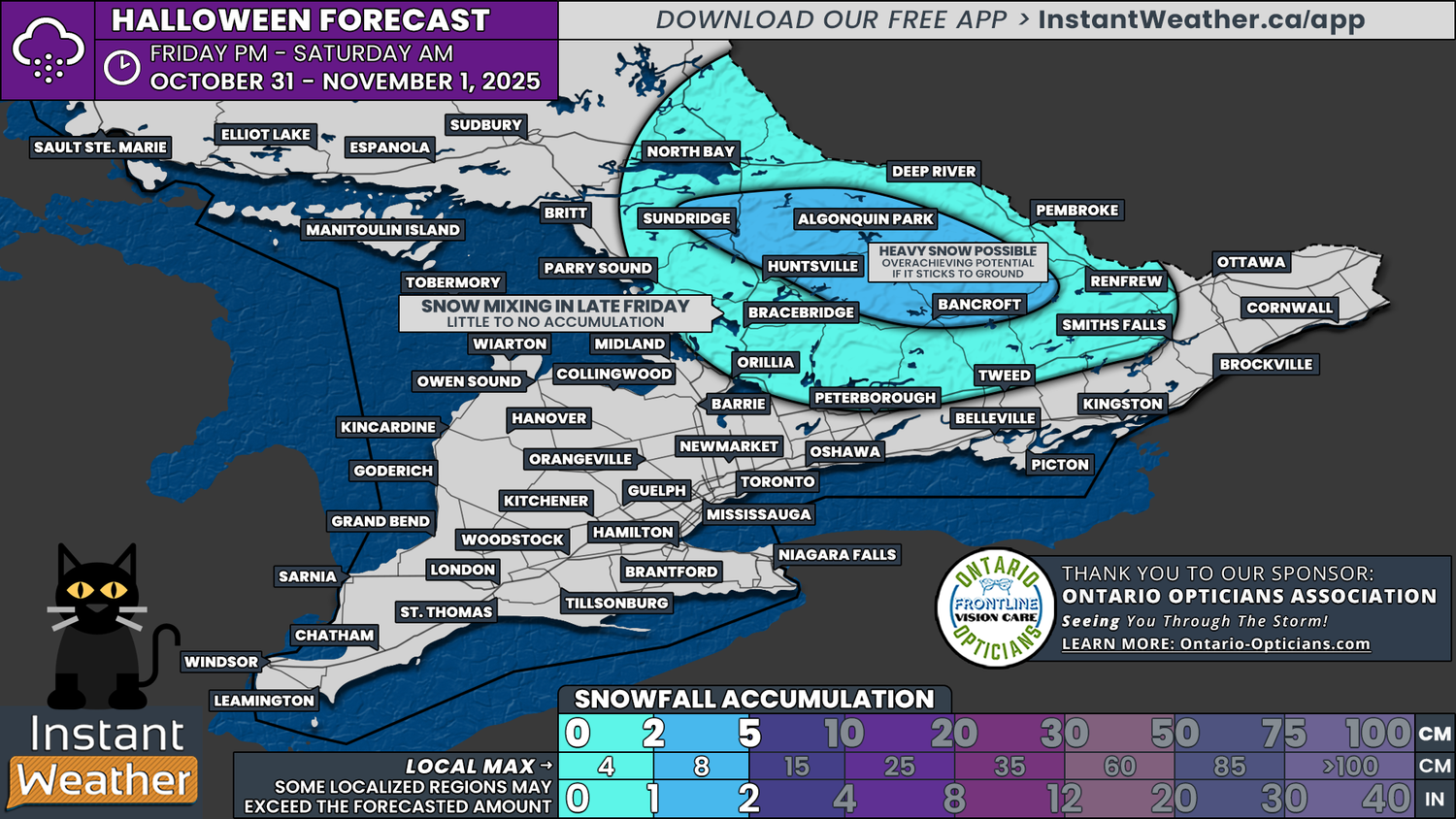
But it’s as if a witch has placed a chilling curse over Central and Eastern Ontario. As the rain lingers through Friday, some areas could begin to see strange white shapes drifting through the sky and no, they aren’t ghosts! These spooky apparitions are far more real, as rain could turn to wet flurries as early as Friday afternoon. Cold air will creep in like a Halloween fog, sending temperatures tumbling toward the freezing mark by evening.
While there’s some disagreement between models (a classic case of meteorological mischief), there’s solid agreement that a wide stretch of Central Ontario may experience at least a few wet flurries on Halloween night.
Where the models differ is in timing and intensity. Some are quite aggressive, conjuring an earlier and more widespread switchover to snow that could even allow for light accumulations in higher elevations. Others show a less frightful outcome, with flurries limited to the hills and highlands later in the day as the rain fizzles out elsewhere.