
Starting in just a few hours
19:52, 03 Nov 2025Updated 19:56, 03 Nov 2025
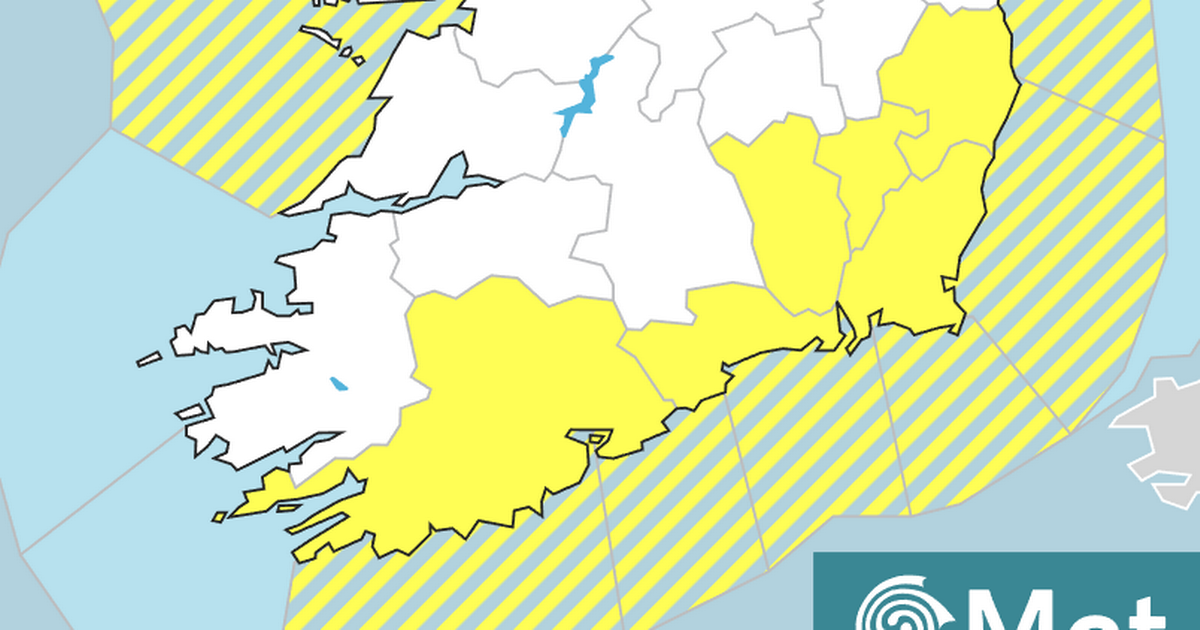
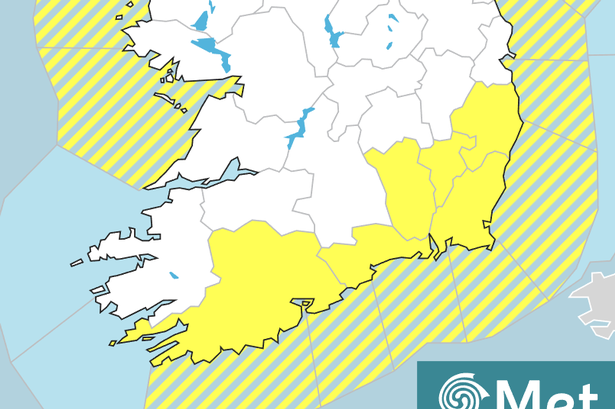 Areas impacted by the rainfall warning issued by Met Éireann this evening
A Status Yellow Rainfall warning has just been issued for six counties across the South and South-east of Ireland, including Cork.
The weather alert will come into effect at midnight tonight and last until 12pm on Tuesday, impacting Carlow, Cork, Kilkenny, Waterford, Wexford, and Wicklow. The national forecaster is warning of a risk of localised flooding.
Difficult travel conditions and poor visibility are also expected, so rush-hour commuters are asked to exercise caution when driving tomorrow morning. Already today, we’ve seen plenty of rainfall in many areas in Co Cork, as an Atlantic low-pressure weather system is currently pushing persistent downpours into Ireland from the west.
And while the warning may end at 12pm tomorrow, don’t expect the rain to stop with it. The national forecaster says we can still expect at least light downpours over Cork city – as well as in parts of the East, West and North of the county – until tomorrow evening, and even late into the night in certain areas.
You can check out Met Éireann’s regional forecast for Munster below:
Cloudy for the rest of today with outbreaks of rain, heavy and persistent at times, which may lead to localised flooding. Drier conditions will develop in some parts of the north and west this evening. Mild and blustery with fresh to strong and gusty southwest winds, which will ease somewhat this evening.
TONIGHT
Rain and drizzle will become confined to the south coast for a time early tonight. However, rain will push northwards again to many parts later tonight and turn heavy in places. Lowest temperatures of 11 to 14 degrees. Southwest winds will become moderate southerly overnight but remain fresh along parts of the coast.
TOMORROW – Tuesday 4th November
Cloudy again on Tuesday. Wet with outbreaks of rain, heavy in places, but the rain will clear to scattered showers later in the day. There will be patchy mist also with fog on hills and along parts of the south coast. Highest temperatures of 14 to 16 degrees. Moderate, locally fresh southerly, winds will ease in the afternoon.
National Outlook
Overview: Unsettled for the rest of the week with frequent spells of wet and blustery weather. Relatively mild and frost free.Tuesday night: Clear spells and showers at first on Tuesday night. It will turn cloudier overnight with scattered outbreaks of rain and drizzle spreading from the south. Lowest temperatures of 8 to 12 degrees, a little milder in the southeast, in light to moderate southeast winds.Wednesday: A wet day with widespread rain, heavy in some western areas. The rain will ease towards evening. Becoming breezier with southwest winds increasing moderate to fresh. Highest temperatures of 13 to 16 degrees.Wednesday night: Remaining largely cloudy overnight with scattered patches of light rain and drizzle. Lowest temperatures of 9 to 13 degrees in moderate to fresh southerly winds.Thursday: A drier and brighter start to Thursday with sunny spells and just a few lingering patches of drizzle. Turning cloudier through the day with a spell of rain spreading from the Atlantic. Blustery in fresh south to southeast winds with highest temperatures of 11 to 14 degrees.Friday: Further outbreaks of rain are likely on Friday. Highest temperatures of 11 to 15 degrees in moderate to fresh southerly winds.Next weekend: There is uncertainty in the details of the forecast but current indications suggest that it will remain unsettled next weekend with Atlantic low pressure systems bringing further spells of rain.