
The Chicago area and parts of Indiana will experience its first snowfall of the season, starting with cold rain Saturday night that will transition into snow overnight.
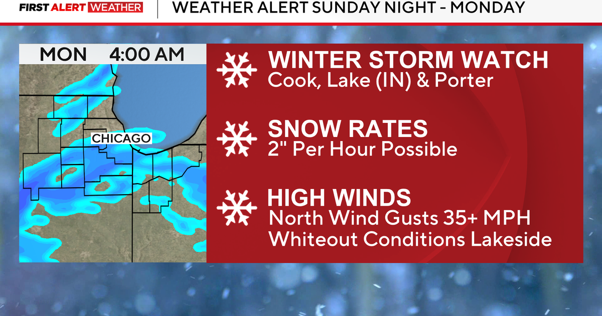
The National Weather Service has issued a Winter Storm Watch for Cook County, parts of Will County, and northwest Indiana counties for the potential of high-impact lake effect snow from late Sunday into Monday.
Chief Meteorologist Albert Ramon gives a timeline of what to expect.
Late Saturday into Sunday afternoon
Cold rain will enter the area Saturday evening that will then transition to snow overnight. The snow will last through Sunday morning, but will taper off by midday.
Expect minor accumulations of 1–2 inches of wet, slushy snow. The good news is it will have little impact on the roads, especially for those heading to the Bears game at Soldier Field, with the game kicking off at noon.

CBS News Chicago
After a Sunday afternoon with some possible sunshine, conditions will worsen again. Meteorologist Mary Kay Kleist advised drivers to look for their snow brushes and fill up the windshield wiper fluids, as they will be needed.
Sunday night through Monday
Lake effect snow develops Sunday night as very cold air moves over the warm lake, creating persistent lake effect snow from Sunday night into Monday afternoon. The Heaviest snow is expected from midnight to 8 a.m. Monday, with snowfall rates of 2–3 inches per hour, possibly higher in localized areas, and winds gusting up to 35 mph, would create blowing snow.

CBS News Chicago

CBS News Chicago
Chief Meteorologist Alber Ramon says the latest data shows that the heaviest snow will likely come from Lake County, Indiana, into parts of Cook County, then spreading south and southwest into Will County. A narrow and intense snow band could shift east or west, creating uncertainty in which areas see the highest totals. Double-digit snow totals are possible where the heaviest band sets up.
Snow will be drier and fluffier Sunday night into Monday, with a ratio around 25:1— meaning 25 inches of snow for every 1 inch of water.
Airports could be affected if heavier snow moves more into central or northern Cook County.
Widespread power outages are not expected, though some localized issues may occur. Significant impacts are likely for Monday morning travel.
Check back with CBS News Chicago for updates.
More from CBS News