
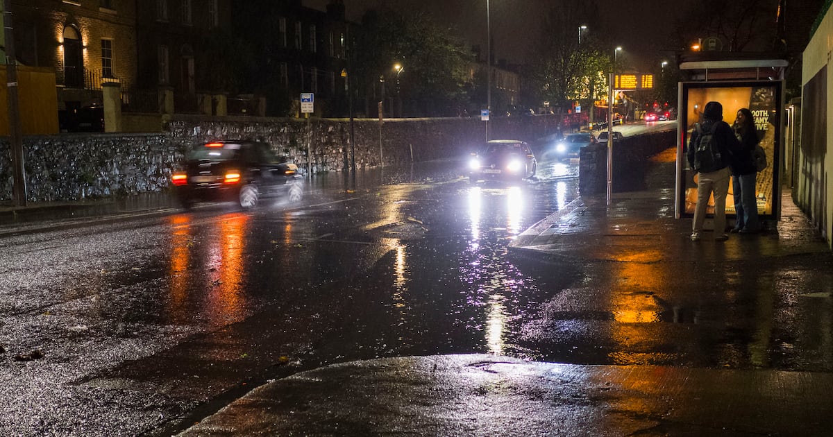
Met Éireann has issued a status orange weather warning for counties Dublin, Wicklow and Wexford for Friday, with heavy rain expected to create the possibility of “significant flooding”.
The forecaster has also issued status yellow rain and wind warnings for a number of other counties from Friday into Saturday.
The State’s storm response body, the National Directorate for Fire & Emergency Management (NDFEM), convened a meeting of local authorities, utility providers and relevant Government departments and State agencies in advance of the heavy rain.
In a statement afterwards, it said “river and surface water flooding is expected in Leinster and Munster on Friday and into the weekend” due to heavy rain falling on already saturated ground.
The orange warning for Dublin, Wexford and Wicklow comes into force at 2pm on Friday and is to remain in place until 11am on Saturday. It says there will be “significant rainfall accumulations, especially on high ground and exposed areas”.
The forecaster said the rain will create hazardous travel conditions.
A number of status yellow warnings will also come into effect on Friday, with heavy and persistent rain in counties Cork, Kerry, Limerick, Tipperary and Waterford expected to lead to flooding and difficult travelling conditions. The warning for these counties comes into force for 24 hours from 9am on Friday.
A separate status yellow rain warning covering counties Carlow, Dublin, Kildare, Kilkenny, Louth, Meath, Wexford, Wicklow has also been issued for a 24-hour period from 11am on Friday.
This also advises that heavy and persistent rain falling on saturated ground could lead to flooding, difficult travelling conditions and poor visibility.
A status yellow wind warning for counties Dublin, Louth, Wexford and Wicklow comes into force at noon on Friday and is to remain in place until 4am on Saturday. Met Éireann said the strong and gusty northeasterly winds will make travel conditions difficult and that there may be wind-related debris.
Keith Leonard, national director of NDFEM, appealed to the public to be mindful of possible issues in their areas and to heed the safety advice associated with this kind of weather.
He advised the public to stay avoid from coastal areas, open riverbanks and canal paths as “water levels and currents may be far stronger than usual”.
Mr Leonard said motorists “need to be wary of potentially hazardous conditions” in their areas.
“I’d ask them to slow down, increase their stopping distances and watch for surface water and debris on roads. If the road ahead is flooded, do not enter – turn around and find another route.”
According to Met Éireann, cloud will move in from the south on Thursday night bringing patchy rain and drizzle, though it should stay mostly dry further north.
Friday will be wet and windy across much of the country, with widespread rain and fresh to strong northeasterly winds. The winds are forecast to be particularly gusty along eastern facing coasts.
“The rain will be heavy at times, particularly in the south and east with flooding expected in places. It will be driest in Ulster and north Connacht with some brighter spells possible. Highest temperatures of 8 to 12 degrees,” Met Éireann said.
Northern areas are likely to see the driest and brightest weather on Saturday, with cloud and patchy rain or drizzle expected in other parts of the country. These showers will become more isolated later. Fresh to strong northeasterly winds will ease as the day goes on. Highest temperatures of seven to 11 degrees are forecast.
Sunday is to be mainly dry with a mix of cloud, sunny spells and highest temperatures of seven to 11 degrees.