
Australia’s first tropical cyclone of the season could reportedly develop as early as next week, as sea surface temperatures warm off the northern coast.
Weatherzone reported that sea surface temperatures in the region were topping 31 degrees, well above the minimum of 26.5 degrees needed for a cyclone to form.
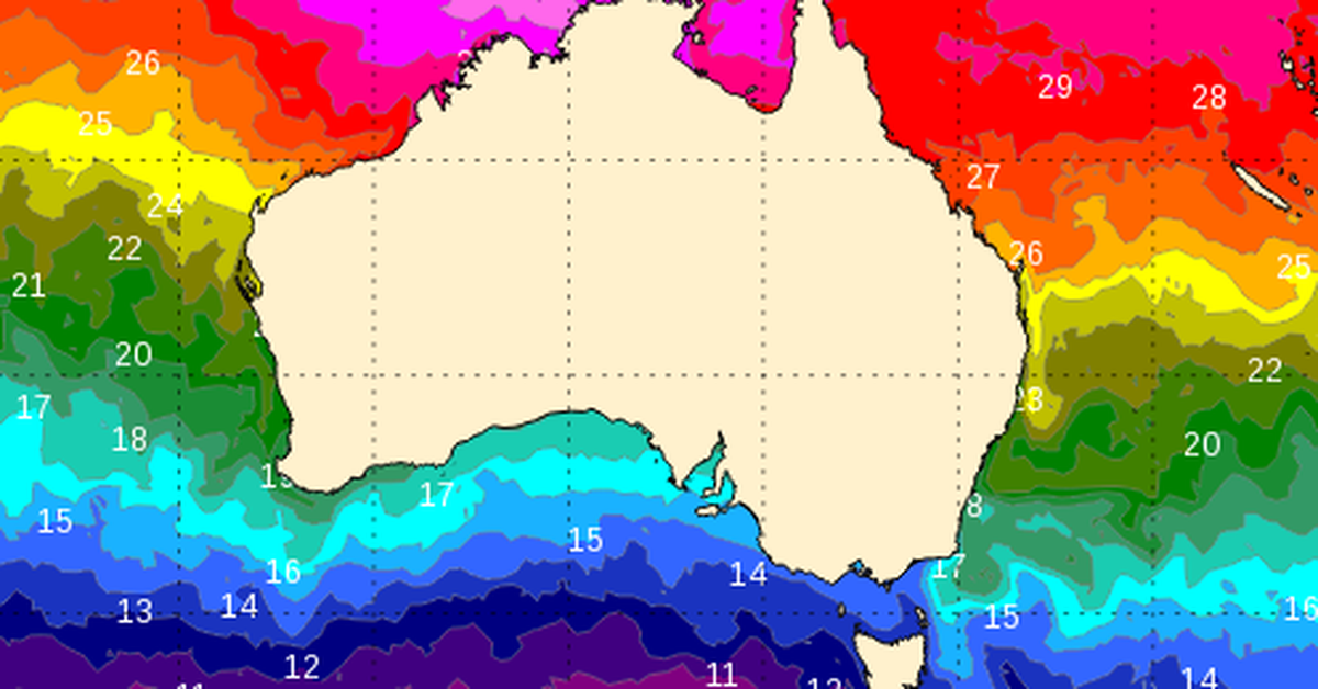
“Water temperatures to the north of Australia are currently sitting around 1 to 2 degrees above average for this time of year, with sea surface temperatures as high as 31 degrees to the west of the Top End and north of the Kimberley,” Weatherzone’s Ben Domensino wrote.
 Sea surface temperatures are heating up off northern Australia. (Bom/Weatherzone)
“The blob of warm water to the northwest of Darwin ranks in the top 10 percent of historical records for this time of year, meaning the ocean is primed to support tropical cyclone development in the coming weeks.”
The Bureau of Meteorology’s tropical cyclone forecast says there is a small chance a storm could form as early as Tuesday next week.
But several forecast models show the odds shortening a bit towards the end of next week.
“Another factor that adds weight to the increasing potential for early-season tropical cyclone activity next week will be a tropical atmospheric wave passing to the north of Australia,” Domensino wrote.
 They could help feed a tropical cyclone. (ECMWF/Weatherzone)
“This wave, called the Madden-Julian Oscillation (MJO), should cause an increase of cloud and thunderstorm activity near northern Australia next week.
“This enhanced storminess can help create low pressure systems that can deepen to become tropical cyclones.”
Despite the overall long odds of a cyclone forming, let alone making landfall in Australia, next week, residents in the country’s north are urged to keep an eye on the Bureau’s weather updates.