
A fire in the eastern Sierra Nevada mountains is spreading at a critical rate and forcing evacuations, as an atmospheric river drops rain in much of Northern California.
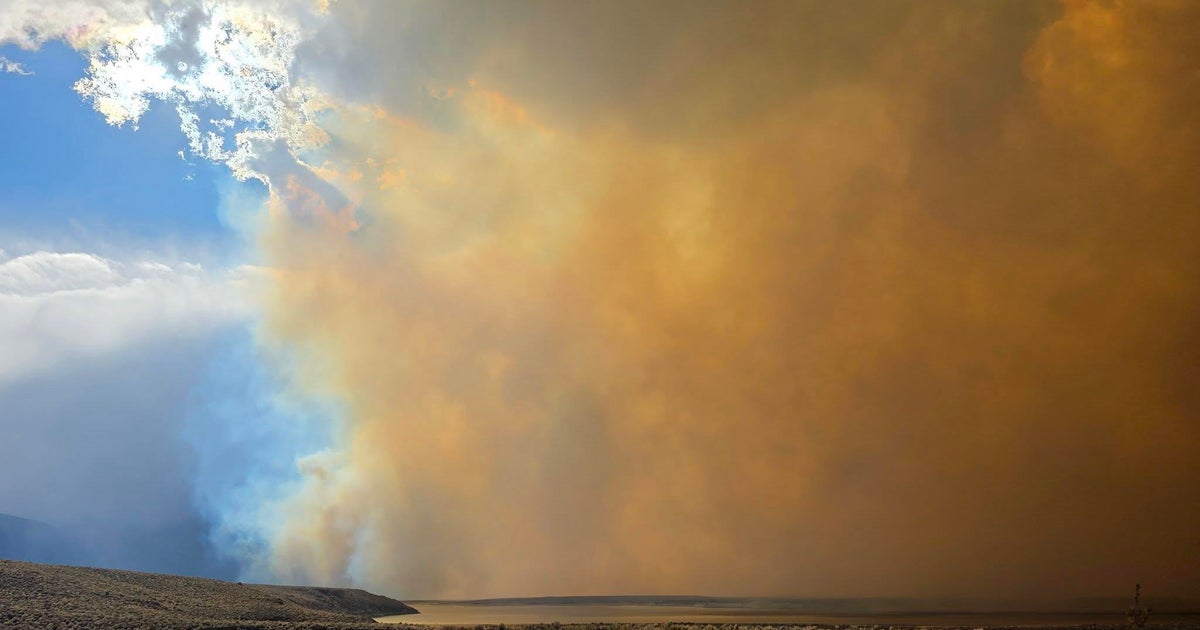
The Pack Fire has burned 3,400 acres with zero containment in the area of Highway 395 and McGee Creek Road, near Lake Crowley in Mono County, Cal Fire said. This is located about 12 miles southeast of the popular Mammoth Mountain ski resort.
Cal Fire said initial reports indicated power lines were down in the area. Crews also reported wind gusts up to 50 mph. Officials said all tankers were released from the fire due to extreme weather.

The Pack Fire burned in Mono County on Thursday, Nov. 13.
Mammoth Lakes Police Department
Firefighters said McGee Creek RV Park was impacted by the fire, with about 15 homes involved.
As of about 2:30 p.m., crews said the fire was pushing toward Crowley Lake, with winds at about 12-16 mph out of the south and gusts up to 24 mph.
The U.S. Forest Service reported the fire about a quarter mile from the lake.
Mono County Office of Emergency Management declared a local emergency. This allows resources to quickly respond to the scene.
Pack Fire evacuations
The fire has forced mandatory evacuations for the Long Valley and McGee Creek communities, Mammoth Lakes police said Thursday night.
Crowley Lake was previously under a mandatory evacuation order, but that has since been downgraded to a warning, with residents allowed to return. Apsen Springs, Hilton Creek, Convict Lake and Sunny Slopes remain under evacuation warnings.
An evacuation center was opened at Mammoth Lakes Middle School at 16000 Meridian Blvd. and at the Tri-County Fairground at 475 Sierra St. in Bishop.
The evacuations do not include the city of Mammoth Lakes at this time.
Pack Fire shuts down Highway 395

ALERTCalifornia
Cal Fire said Highway 395 is shut down from Benton Crossing to Rock Creek. Caltrans said this section of the highway is included in a high-profile provision due to powerful winds. High-profile vehicles are recommended to use Highway 6 in Bishop as a detour.
The fire comes as much of the state gets rain and some snow at higher elevations. ALERTCalifornia cameras show dark clouds over the fire. The cameras also show snow at Mammoth Mountain’s peak.
It’s unknown what caused the fire at this time.
Check back for updates.
More from CBS News