

Published on Nov. 26, 2025, 12:02 PM
Updated on Nov. 26, 2025, 12:50 PM
Lake-effect snow squalls could bring up to 50 cm to parts of southern Ontario by Saturday. Expect rapidly changing and worsening conditions. Another snow system is possible on Sunday. Residents should stock up on essential supplies, such as food, water, medications, and batteries, and ensure their heating systems are working properly as soon as possible before the snow starts.
Winter warnings are widespread across Ontario, with blustery winds and falling temperatures helping to set the stage for a multi-day lake-effect snow squall event that threatens as much as 50 cm by Saturday.
Snow bands will shift, spreading snowfall widely rather than targeting specific areas. Hard-hit regions could see 20-40+ cm, with blowing snow, drifting, and whiteouts likely due to 50-70+ km/h wind gusts through Thursday.
These conditions will result in challenging travel conditions and possible road closures.
Homeowners should check their snow plows for proper functioning by inspecting the blades, fluid levels, and battery, and ensuring they have adequate fuel and any necessary maintenance completed well in advance of the snowstorm.
Visit our Complete Guide to Winter for an in-depth look at the Winter Forecast, tips to plan for it and much more!
Strong winds and plunging temperatures Wednesday
Rain and strong winds will develop Wednesday afternoon in southern Ontario
as the low intensifies.
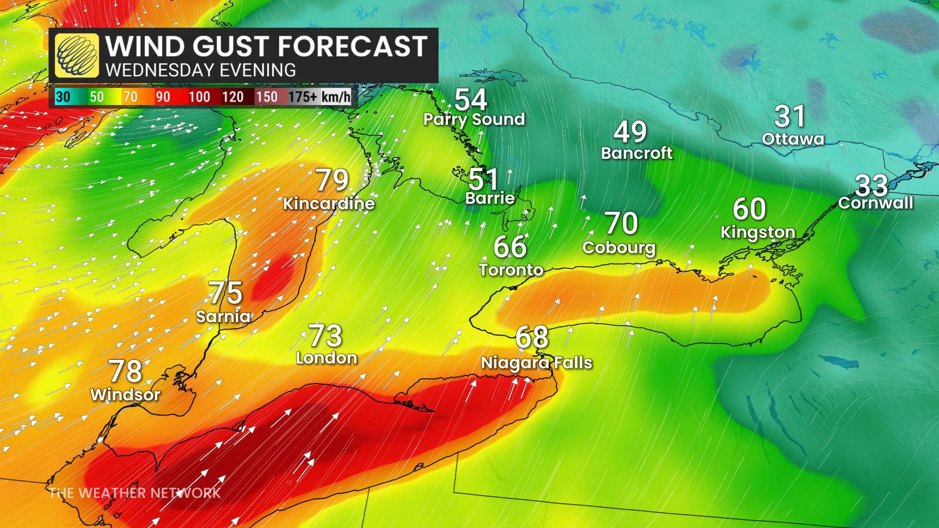
Wind gusts of 60–80+ km/h are expected across southwestern and south-central regions, including Windsor, London, Toronto, and areas east of Kingston, with stronger 80–90+ km/h gusts expected east of Lake Huron and from Long Point to Fort Erie. Folks in these areas should be prepared in case of whiteout conditions and potential power outages.