
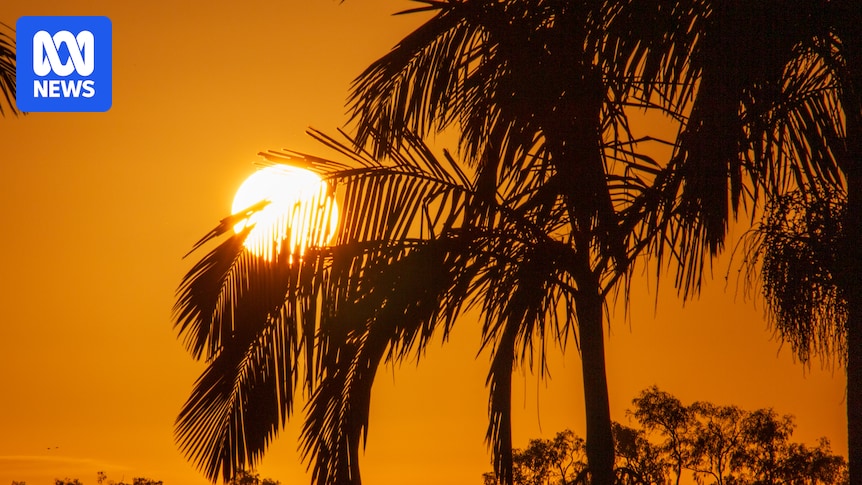
South-east Queensland is set to swelter through the rest of the week, with temperatures expected to climb drastically across the state today.
Brisbane is expected to peak at 36 degrees, with other areas in the region seeing temperatures between three and eight degrees above average.
Heatwave warnings are in place for most of the state’s east and the interior, with temperatures in the west easing today.

Temperatures are expected to soar across Queensland’s south-east today. (ABC News: Liz Pickering)
Wild weather hammered the south-east over three days, damaging properties and causing widespread power outages.
A wind gust of 109 kilometres an hour was recorded in Dalby, north-west of Brisbane, just after 10pm on Wednesday.
The SES received about 240 calls for help on Wednesday afternoon, with multiple roofs torn off or partially torn off in the Warwick area, south-west of Brisbane, overnight.
About 16,000 homes and businesses across south-east Queensland remain without power after the storms — mostly in the Moreton Bay Regional Council area, where residents are still cleaning up after the wild weather.
Loading…Soaring temperatures
The Bureau of Meteorology is forecasting temperatures three to eight degrees above average across large parts of the state.
Senior forecaster Shane Kennedy said today’s widespread, extreme heat would consolidate in the eastern parts of the state.
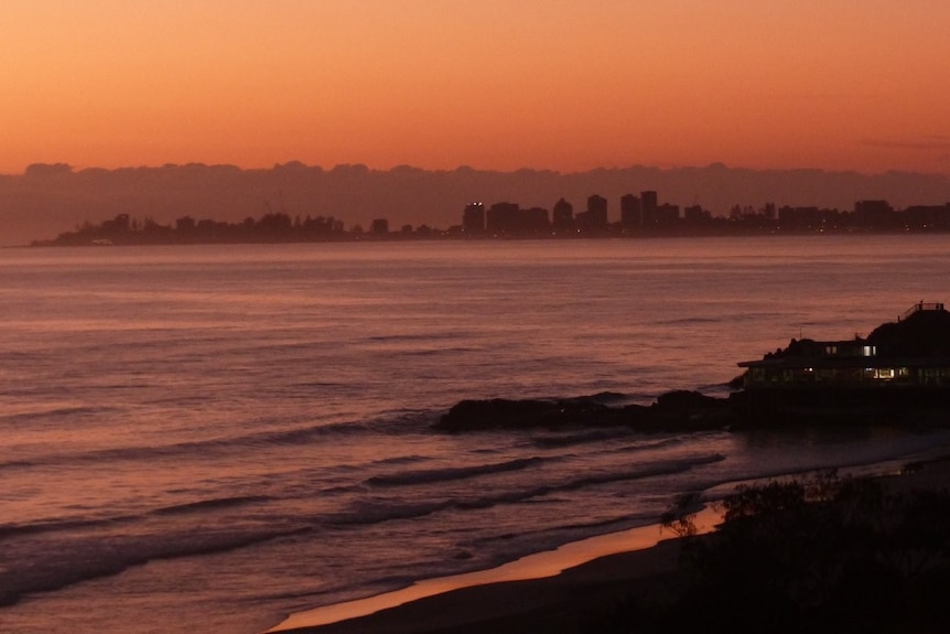
Cooler conditions are forecast to return in the early part of next week. (Supplied: John Arvier)
“That should start to contract more into eastern Queensland from Thursday and continue on Friday as temperatures return more to average in the far west, starting from [today].”
Brisbane is expected to hit 36 degrees today, with Ipswich and Gatton to the west expected to reach 37 and 39 degrees, respectively.
“The heat [is] really peaking in the south-east over the next day or two and likely to see temperatures both overnight and during the afternoon hitting three to eight degrees above average,” Mr Kennedy said.
“We may even see a few places pushing more about 10 degrees above average.”
The high temperatures are expected to last until early next week.
“[We] should start to see some relief from the temperatures as we move into early next week with some cooler and drier air moving in, so we should finally see the cancellation of those heat wave warnings by early next week, most likely on Monday.”
Eastern states to get day of extreme heat, winds and storms
The staggering heat has prompted extreme fire danger ratings for the Darling Downs and Granite Belt, due to “a brief burst of dry and gusty winds”.
Mr Kennedy says the window for fire danger is brief, with winds set to ease further on Friday.
“With the recent rainfall, it should make it a little harder for those fires to start, but if we do get any fires starting in the south-east interior, they will be challenging to battle during that Thursday period,” he said.
Schoolies face the heat
Muggy conditions on the Gold Coast have not slowed the partying efforts of schoolies attendees at Surfers Paradise.
The Glitter Strip hit a maximum temperature of 32 degrees yesterday, with storms rolling through in the evening.
Milly Chappel and Eleanor Macfarlane, from Toowoomba, spent the afternoon swimming at the beach.

Schoolies Milly Chappel and Eleanor Macfarlane say the beach is “refreshing” in the heat. (ABC News: Julia Andre)
“It’s just so hot and we get so exhausted, especially drinking during the day when we’re out in the sun,” Ms Macfarlane said.
“The beach is so cold, so it’s a refreshing way to wake up.”
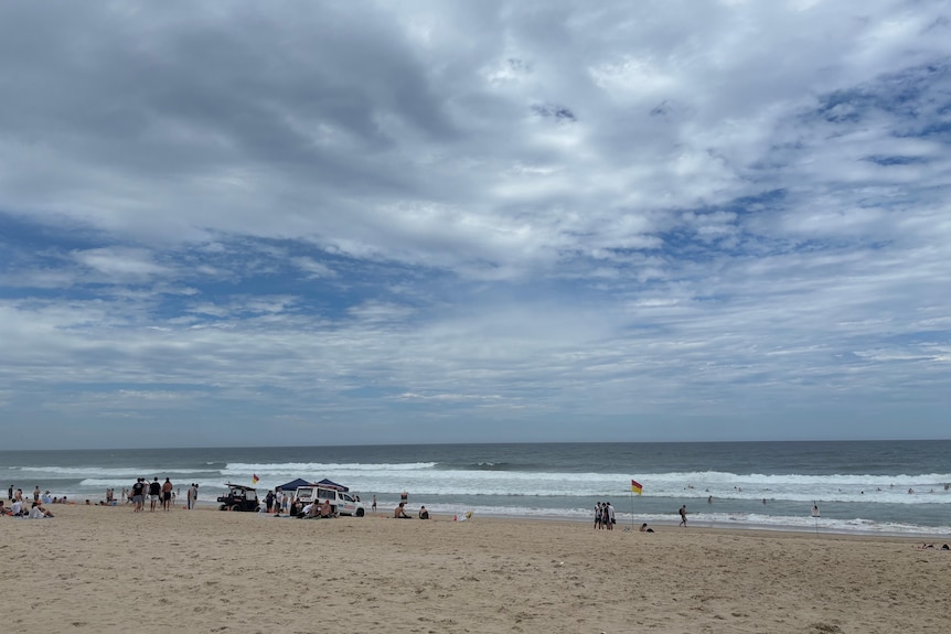
Surfers Paradise hit 32 degrees yesterday, with more severe heat on the way. (ABC News: Julia Andre)
Seth Gilmore and Aiden Micallef drove up the coast from Wollongong on the New South Wales coast for the end of school festivities and were loving the Queensland sun.
“It’s 30-plus degrees every single day up here, it’s awesome, not too hot or too cold,” Mr Micallef said.
More storms on the way
The scorching temperatures are again priming the atmosphere for wild weather, with the weather bureau predicting more storms for south-east Queensland over the next couple of days.
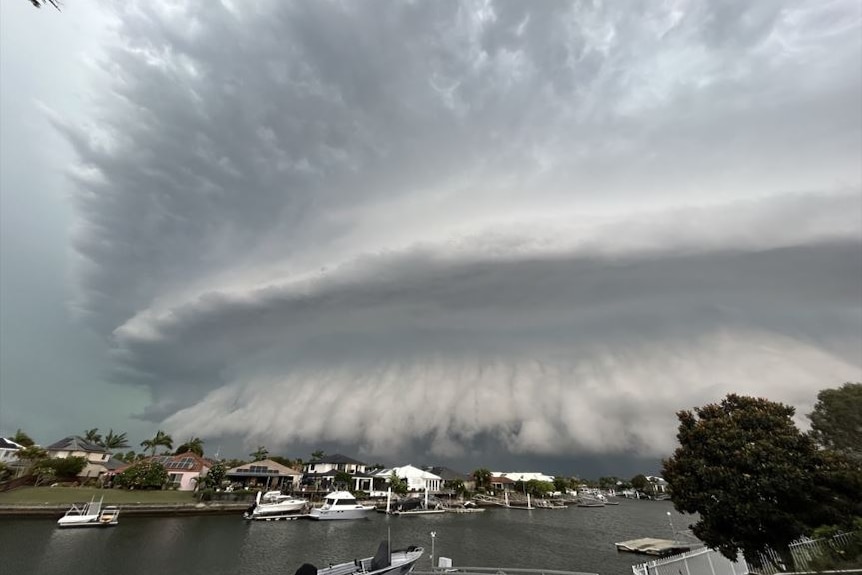
The heatwave conditions are expected to drive further storms over the rest of the week. (Supplied: Bambi Gosbell )
The thunderstorm outbreak will continue later today for large parts of the state, with severe storms likely around south-east and central Queensland.
After a brief respite on Friday when drier air from the interior briefly reaches the coast, the risk of severe thunderstorms will return in the south-east over the weekend.