
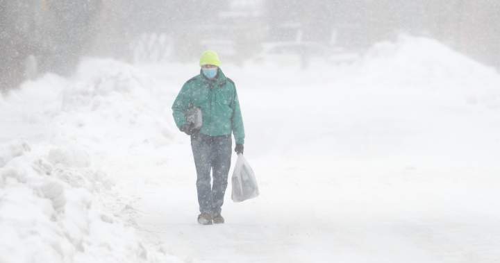
Several regions in southern Ontario are under winter storm and snow squall warnings Thursday.

Environment Canada says those regions include areas off Lake Huron and Georgian Bay, which can expect heavy snowfall as lake-effect snow intensifies across the region.
Lake-effect snow will also affect the South Bruce Peninsula from Tobermory to Feversham. A “yellow” weather alert was issued in the area, warning of strong winds up to 80 km/h and near-zero visibility due to heavy snow. Colour-coded alerts are a part of Environment Canada’s new weather alert system.
Global News meteorologist Anthony Farnell says “orange” snow squall warnings are in place over a large section of the snowbelt Thursday into Friday morning.
Farnell said there could be significant travel disruptions, including some highways needing to be shut down in these squalls.
Story continues below advertisement
“Snowfall rates could reach up to seven centimetres per hour in the most intense squalls, along with potentially some thunder and lightning. The snow combined with wind gusts up to 70km/h will create local whiteout conditions and cause significant drifting and blowing snow,” Farnell added.

Get breaking National news
For news impacting Canada and around the world, sign up for breaking news alerts delivered directly to you when they happen.
“The western, northern and eastern parts of the GTA will also be in line for brief but intense snow, but amounts should be much less, and there will also be some melting with temperatures staying just above freezing.”
Barrie, Orillia, Aurora, and Collingwood are under an orange weather alert for hazardous squalls starting today. Up to 50 centimetres of snow is anticipated with strong winds reducing visibility to near zero.
More on Canada
More videos
People under orange and yellow weather alerts are cautioned against travel due to low visibility, strong winds and possible road closures.
Moderate snowfall of 10 to 15 cm is expected in the Kawartha Lakes, with the area under a snow squall watch, says Environment Canada, with five to 10 cm of snow blowing up into Parry Sound and Huntsville.
Trending Now

FBI seizes rare multi-million dollar supercar linked to wanted man Ryan Wedding

Man charged after $1M lottery winnings from ‘group arrangement’ claimed for himself: police
Environment Canada reminds the public to monitor weather alerts for changes.
Canada launches new alert system to protect people in extreme weather
Environment Canada is now using a colour-coded system to make it easier to understand the severity of extreme weather and any risks that people might need to know about.
Story continues below advertisement
Each type of weather alert will now include a colour — yellow, orange or red — to show the seriousness of the weather event, according to the Canadian government.
Yellow alerts are the most common. They are issued when hazardous weather may cause damage, disruption, or health impacts. Impacts are likely moderate, localized, and/or short-term.
Orange alerts are issued when severe weather is likely to cause significant damage, disruption, or health impacts. Impacts can be major, widespread, and/or may last a few days.
Red alerts are rare. They are issued when very dangerous and possibly life-threatening weather will cause extreme damage and disruption. Impacts have the potential to be extensive, widespread, and prolonged.
— With files from Global News’ Amy Judd
© 2025 Global News, a division of Corus Entertainment Inc.