
We have a lake-effect situation still ongoing today, and another solid snow coming. This next snow will affect all of Michigan. Here is the text of my morning weather broadcast. Or you can watch the video if you like that style of information.
1. Active Lake Effect Snow and Travel Warnings
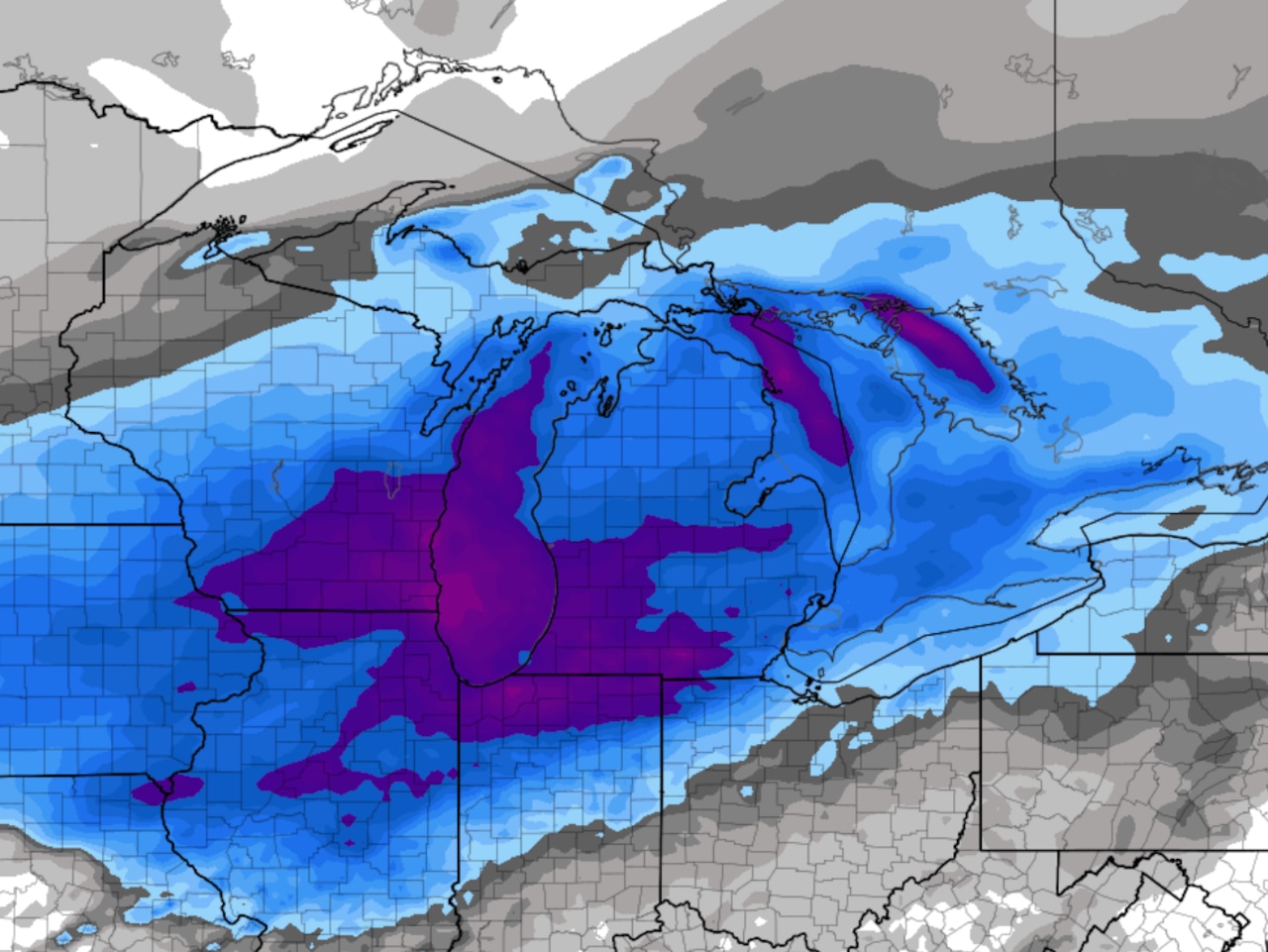
Michigan is currently experiencing a lake effect snow situation, primarily impacting specific “snow belt” regions. Winter storm warnings remain in effect for northwest lower Michigan, including the Traverse City, Cadillac, and Big Rapids areas, with reports of “horrible” and dangerous road conditions. Winter weather advisories are posted for surrounding areas like Grand Rapids, indicating varying road conditions. The east side of the state is largely unaffected. In the Upper Peninsula, a blizzard warning is still in effect. I want to emphasize that this type of snow is often more isolated than weather maps might suggest, leading to vastly different conditions even within short distances. The immediate impact is concentrated in these western and northern areas of the state.
2. Significant Weekend Snowstorm Approaching
A “solid snowstorm” is on track to hit Michigan, creating poor travel conditions from Saturday afternoon through Sunday. I describe this as a “classic textbook winter system” with the storm system features a closed low-pressure center that we meteorologists will track to determine snowfall bands. A winter storm watch has already been issued for areas to the west, including Chicago and Milwaukee, signaling the system’s impending arrival. The timing is particularly bad for holiday travel. I advise you that Saturday morning offers a window for safer travel to return to Michigan before the storm’s full impact is felt, urging you to avoid being on the roads from Saturday evening through Sunday when traffic is high and roads are snowy and icy.
3. Projected Snowfall Totals and Storm Timeline
The storm is expected to begin as light snow in the southwest half of lower Michigan by early Saturday afternoon, becoming steady and widespread by Saturday evening. The heaviest snow is anticipated Saturday night into Sunday morning. The situation looks like a general 4 to 7 inches of snow across most of the lower peninsula. However, areas in the far southeast, like Detroit and Ann Arbor, may see a mix of rain if the low-pressure system tracks in a way that brings warmer air, which would reduce snowfall totals there. The period from Saturday evening through Sunday afternoon is expected to be a “mess” for travel, with dangerous conditions compounded by heavy holiday traffic.
4. Prolonged Cold Weather Signals Winter’s Arrival
Following the weekend storm, a significant drop in temperature is expected, with cold air locking in for an extended period. Roads will not improve quickly on Sunday afternoon as temperatures will fall into the low 20s with brisk winds. The 14-day forecast shows a persistent pattern of cold, with high temperatures remaining in the 20s and low 30s through early December. I am dismissing the possibility of another “week of 40s,” introducing the phrase “We’re in it to winter it” to encourage Michiganders to accept that winter conditions are here to stay for the foreseeable future.
5. A Call to Improve the U.S. Weather Model
In a “weather rant,” I am expressing frustration with the primary U.S. long-range weather model, the Global Forecast System (GFS). I question why our American model is frequently outperformed by its European counterpart, especially for forecasts beyond three days. While praising excellent U.S.-based short-range models like the HRRR for their accuracy with severe weather and lake effect snow, our country’s flagship long-range model should be the global leader. I hope to launch a movement to “Make the GFS great again,” calling on fellow meteorologists and the public to question why the U.S. doesn’t possess the world’s best weather models across all timeframes.
Here’s the video.
Stay updated with this next round of winter storm weather at MLive.com/weather.
Generative AI was used to bring my live video to text for this story, based on my live broadcast video this morning. I used the text as a foundation of the article.