


By Tuesday morning, the ingredients for the storm have moved across the Atlantic Ocean, setting the stage for impressive intensification.
Storm ingredient checklist:
Strong, upper-level support: A powerful jet stream lifts across eastern North America on Tuesday, deepening surface pressure
Energy streams merging: Moisture and instability from the Gulf of Mexico phase with the digging trough, further enhancing lift
Ample, cold air supply: Just ask Ontario and Quebec on Monday as cold air increases the available temperature gradient for storm development
-Warm ocean temperature: Heat and energy from the Gulf Stream can release energy, further fuelling the storm
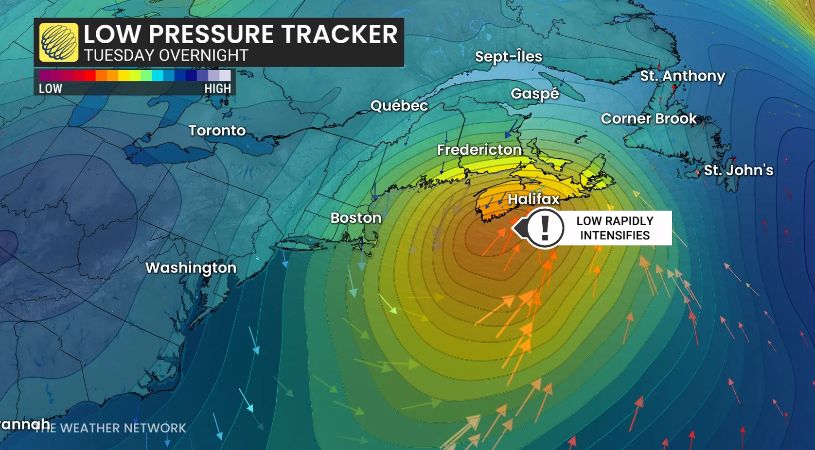
More importantly, where is this nor’easter going?
Models on Saturday were confused and uncertain, but on Sunday, models narrowed the range of solutions to a track that scrapes across the coast of Nova Scotia early Wednesday morning, before crossing eastern Newfoundland in the late day.
A track close to the coast means mixing and heavy rainfall threats increase along the coastline, but where temperatures remain at or slightly below freezing just inland, heavy, wet snow will occur.
The system is tapping into Gulf of Mexico moisture, so there will be plenty of it.
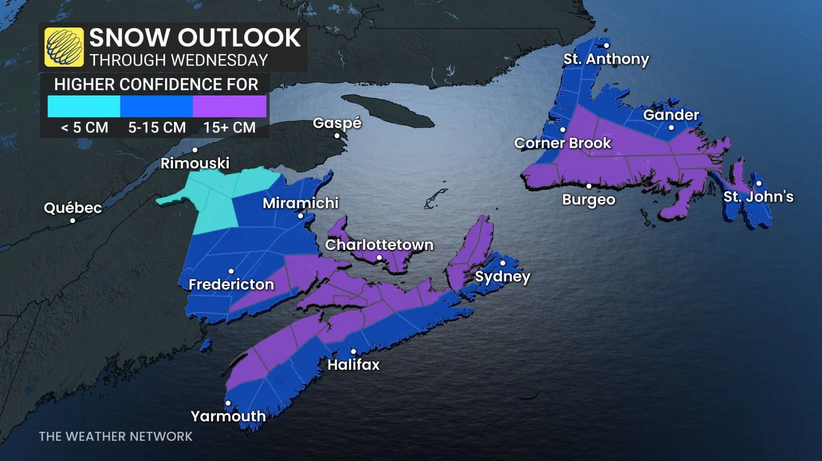
This system is pulling moisture in from the Gulf of Mexico, so the system will be moisture-laden. Regions that don’t experience wet snow will have the risk of more than 40 mm of rainfall.