

Forecasters predict a major snowstorm is on track to hit Massachusetts on Tuesday, with the chance for more than six inches of snow.
Meteorologists from the National Weather Service say the storm will start Tuesday morning and last until sunrise on Wednesday.
However, not every part of the state will receive the same amount of snow — and some areas may only get rain.
Here’s five maps that show what may lie in store on Tuesday.
Accumulation Totals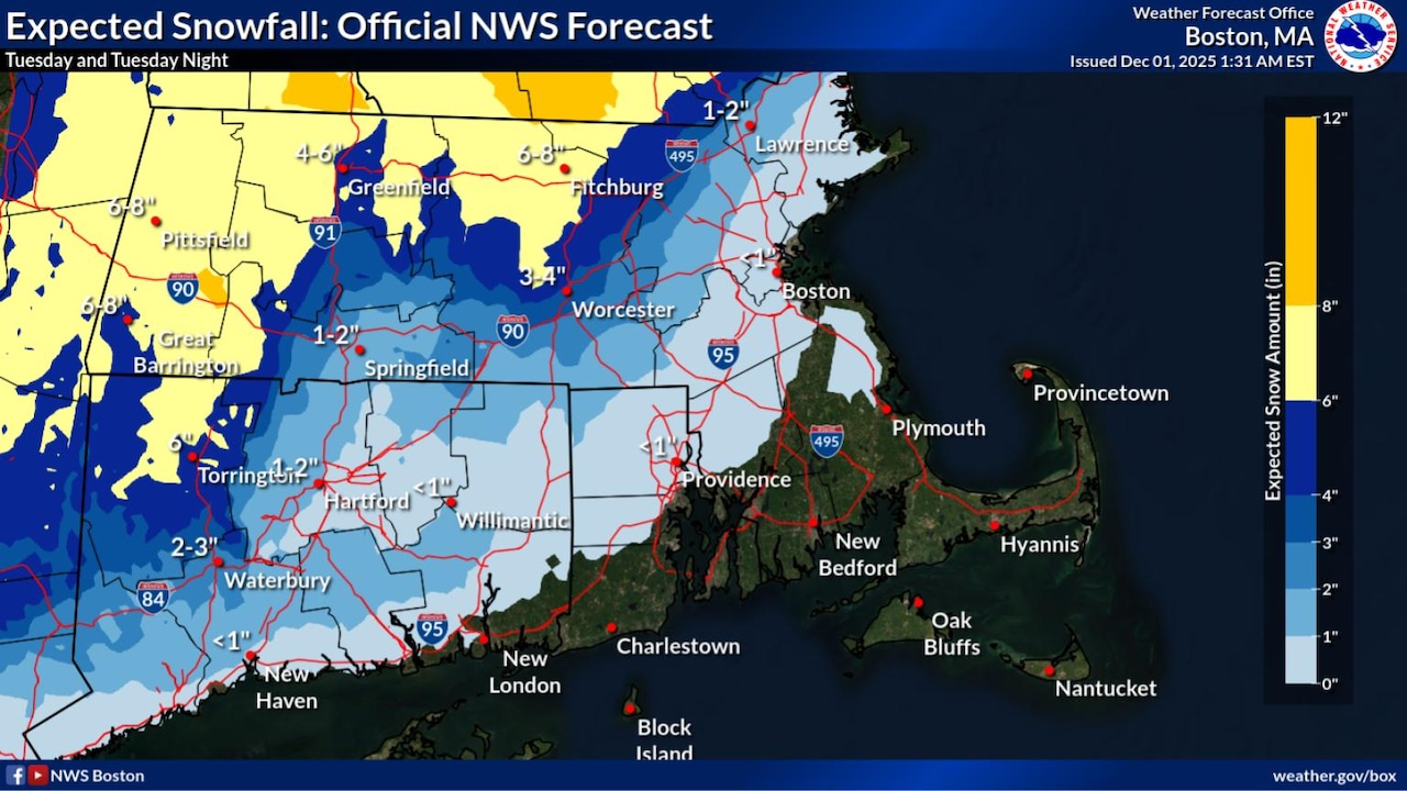 Projected snowfall accumulations in Massachusetts on Dec. 2, 2025.(National Weather Service)
Parts of the state that will receive the most amount of snow include Western and Central Massachusetts, especially those in higher elevations.
While most areas like Pittsfield, Great Barrington and Adams in Western Massachusetts are projected to receive up to six inches, areas could receive localized amounts over eight inches.
Springfield and areas along the Interstate 90 corridor may see up to three inches of snow, while Boston and the North Shore are both likely to get less than an inch.
Ice accumulations are projected to be minimal from the storm, according to the National Weather Service.
Winter Storm Impacts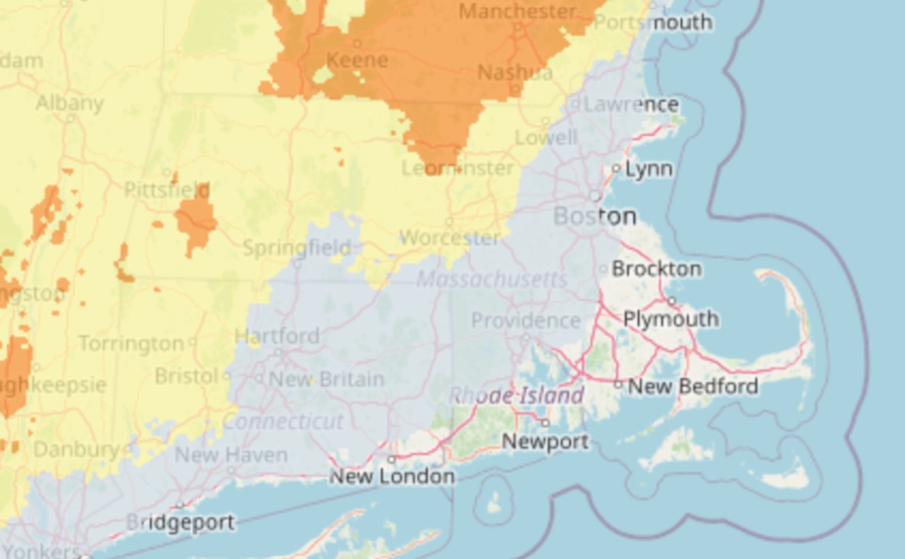 Impact map from the National Weather Service.(National Weather Service)
Nearly all of Massachusetts is considered a “Winter Weather Area” on Tuesday by National Weather Service forecasters.
This means driving conditions will be impacted for most of the state, with some areas considered “hazardous” in Western Massachusetts and higher elevations in Central Massachusetts.
Drivers are advised to use extra caution on Tuesday and to “expect disruptions to daily life,” along with “closures and disruptions to infrastructure.”
Winter Storm Outlook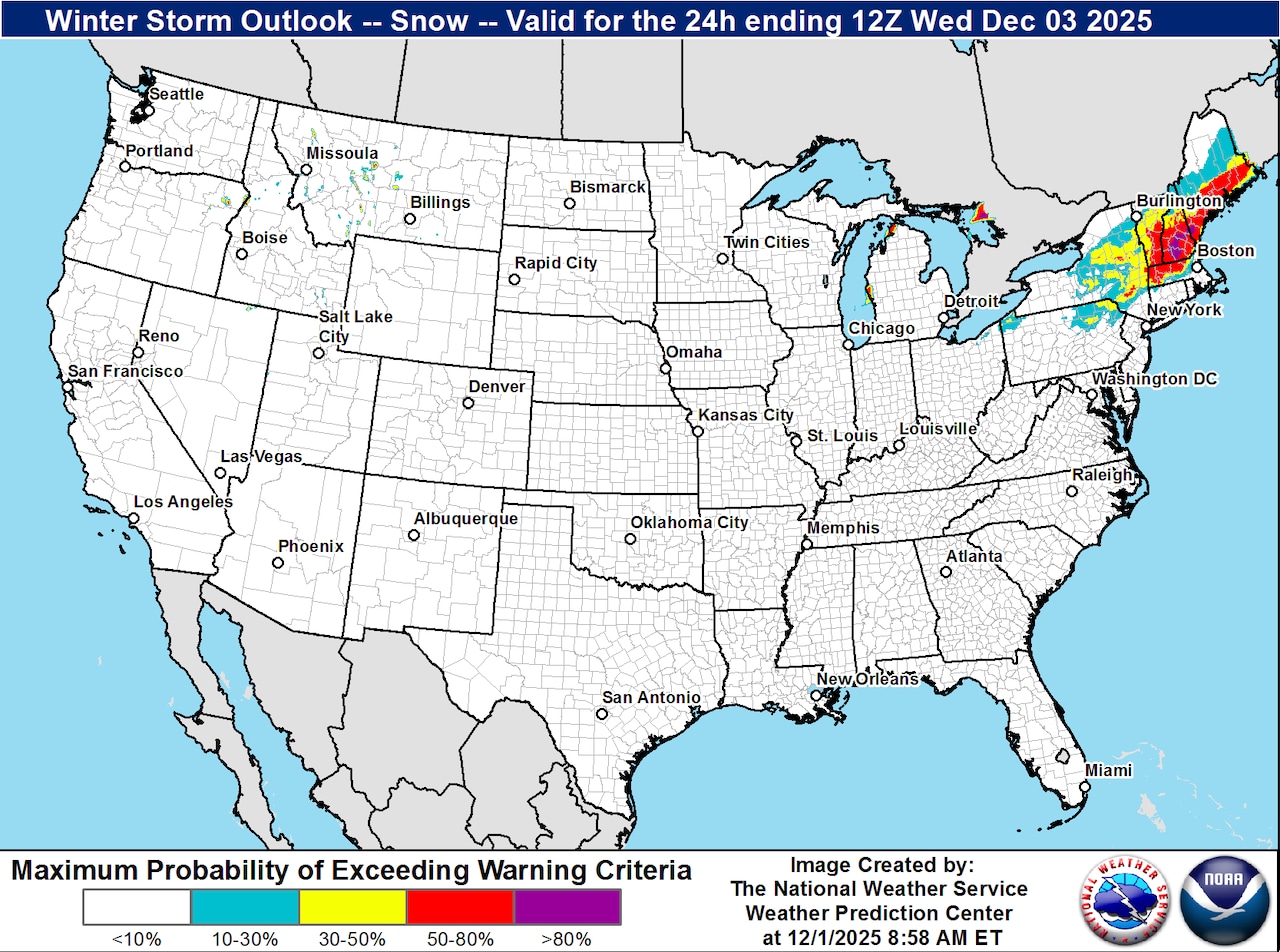 Winter storm outlook map by the National Weather Service on Dec. 2.(National Weather Service)
The majority of New England is in for a heavy storm, forecasters say.
The winter storm outlook projects lighter bands of snow on the edges of the storm ebbing into the Massachusetts state border shared with Connecticut.
The center of the storm appears to be over New Hampshire, with serious snow fall predicted to surround it.
Precipitation Predictions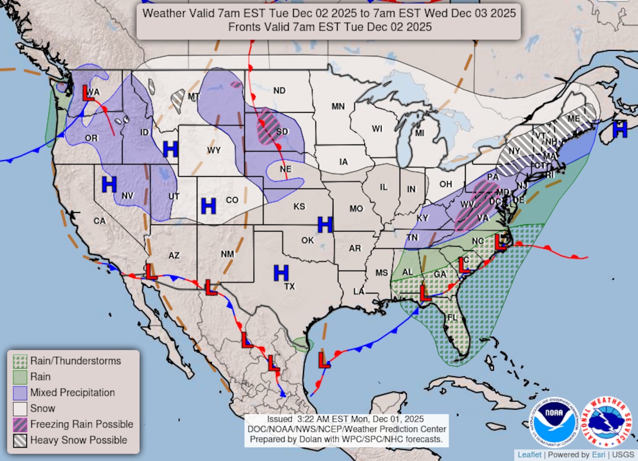 Winter weather map from the National Oceanic and Atmospheric Association.(National Oceanic and Atmospheric Association)
While meteorologists say heavy snow is fully on the radar for most of Massachusetts on Tuesday, there could be a mix of precipitation in store.
All of Massachusetts, save for Cape Cod & the Islands, is under “heavy snow” predictions from the National Oceanic and Atmospheric Association.
And while the state may also see “mixed precipitation,” NOAA maps show, National Weather Service forecasters have ruled out the chance for freezing rain or an ice storm.
Snow Rate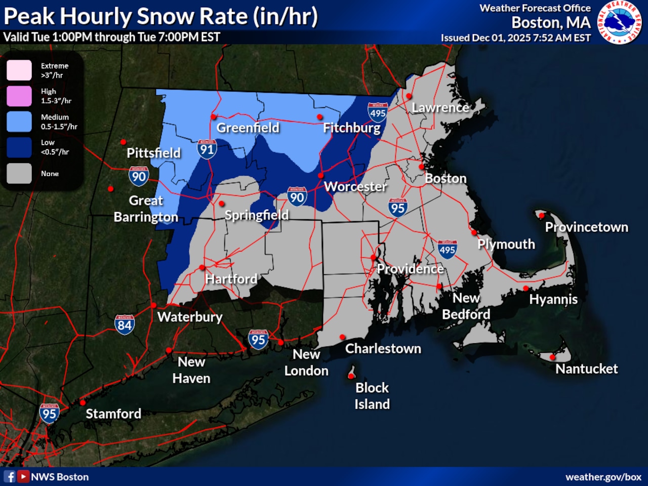 Snow rate map from the National Weather Service.(National Weather Service)
Snowfall is projected to begin on Tuesday morning and last through the night.
The precipitation will pick up on Tuesday afternoon and could bring up to 1.5 inches an hour by 1 p.m., though some parts closest to I-90 may only see rates at a half-inch of snow per hour.
Though snowfall rates will become lighter overnight, the precipitation may not taper off until Wednesday morning.