
The opening salvo of a major atmospheric river hit the Pacific Northwest on Monday, drenching much of Western Washington with heavy rain that is forecast to continue at least until Thursday.
The National Weather Service warned of a high risk of widespread and significant river flooding.
The Snohomish River will likely reach a record high in the city of Snohomish this week, cresting over a foot above the historic high-water mark early Thursday, receding about 24 hours later, according to an updated forecast late Monday.
South of Puget Sound, the Puyallup, Nisqually, Cowlitz and Carbon rivers were already seeing waters about to spill over their banks by 7 p.m. Monday, with serious flooding expected within hours.
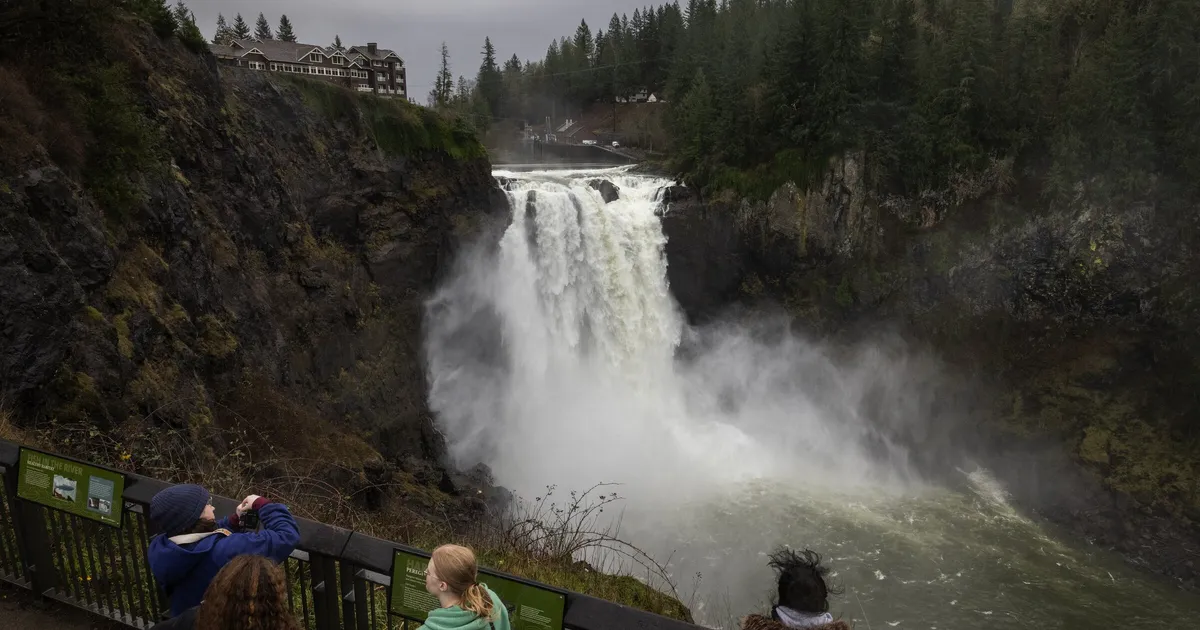
Other rivers including the Skagit, Snoqualmie and Skykomish were set to swell near record highs, with major flooding starting late Monday into Tuesday, according to the National Oceanic and Atmospheric Administration.
The weather service forecast 2 to 6 inches of rain across the lowlands over a 72-hour period through Thursday morning, with 3 to 6 inches south of Seattle and 8 to 12 inches in the Olympic and Cascade mountains. Heavier rain is possible over the southern and central Cascades, where 15 inches or more could fall over the three-day period.
A flood watch will remain in effect for much of the Puget Sound region through Friday afternoon.
The super soaker stream of water vapor stretched about 3,500 miles offshore early Monday, from northwest of Hawaiʻi to the Pacific Northwest, bringing unseasonably warm air and heavy rain that are trademarks of a pineapple express, according to the National Weather Service.
Snow levels were expected to remain above 5,000 feet in the Cascades for much of the week, meaning lots of precipitation falling as rain rather than snow, swelling rivers that flow out to Puget Sound.
Floods were expected to come in a “double crest,” with a second big pulse of water moving through the major rivers 24 to 48 hours after the first one, according to the weather service forecast. Especially near the mouth of the bigger rivers, the second round of flooding will likely linger until Friday.
Gov. Bob Ferguson said his team is working with the National Guard, which activated its operations center, to prepare for the severe weather.
Seattle avoided the heaviest rainfall Monday, and precipitation maps showed a rain shadow-like ring around the city. Harrison Rademacher, a meteorologist at the National Weather Service, said it’s not abnormal to see lighter rainfall in the city.
“When the pattern has flow from the west trying to go over the Olympics, (it’s) very common to have some sort of a shadowing effect in the Seattle area,” he said Monday.
One person was rescued from a car partially submerged along the Snohomish River west of Snohomish on Monday afternoon. The water was up to the car’s seats when Snohomish firefighters rescued the person around 2 p.m. in the 4600 block of Riverview Road, according to Snohomish County Fire District 4. The person was taken to a Monroe hospital with minor injuries.
In Carnation, residents living near the Snoqualmie and Tolt rivers were grabbing free sandbags, said city spokesperson Ashlyn Farnworth. When the rains come down and the two intersecting rivers swell, the main worry is that the city will “become an island” as Highway 203 and local roads and bridges close for flooding, Farnworth said. The Snoqualmie River near Carnation will likely see flooding more than a foot above major flood stage Tuesday morning until Thursday night, save for a short break Wednesday.
The small city, about 30 miles east of Seattle, floods almost yearly, Farnworth said.
“It’s not our first rodeo,” she said.
Along Highway 20 in Skagit County, Hamilton residents who live in an RV park were temporarily moving their homes away from the Skagit River, said Town Clerk/Treasurer Kym Eldridge.
Heeding advice from town officials, on Monday afternoon about eight to 10 RVs from the park were already taking refuge at the local Hamilton First Baptist Church to wait out the rain.
The Skagit River will most likely be inches over major flood stage by 4 a.m. Tuesday near Concrete and by nightfall Tuesday near Mount Vernon. The city of 35,000 last flooded in 2021, damaging property and scattering debris across the downtown area, which spans just over one square mile.
Hamilton is no stranger to inundation, having been struck by flooding over the years, Eldridge said. Residents aren’t “used to it,” per se, but “they know what to do.”
Winds gusted above 30 mph Monday around Puget Sound, and over 6,000 customers of Puget Sound Energy had lost power by 10 p.m.
Expect blustery weather to continue throughout the week.
The National Weather Service also warned of heightened landslide risks, as soil will be sopping up rain for the foreseeable future.
Seattle Times staff reporter Caitlyn Freeman contributed to this report.