
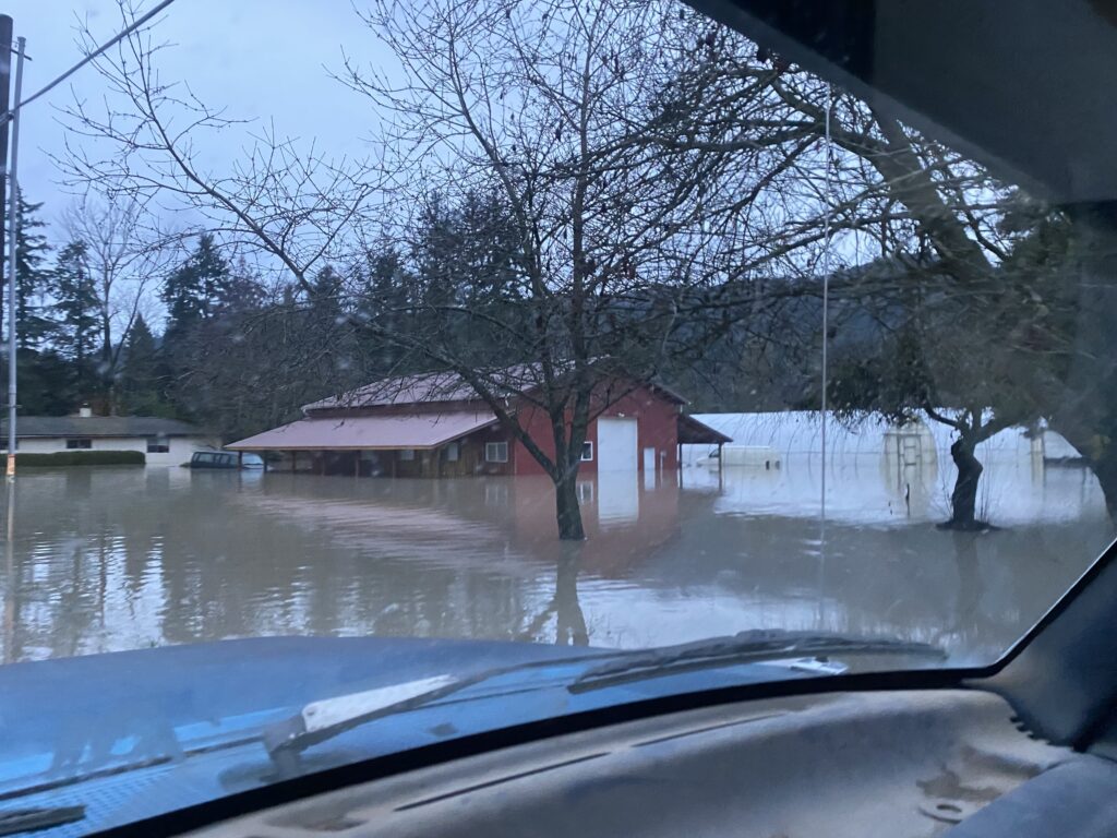
Rivers continued to rise overnight Wednesday into Thursday morning with the Skagit and Nooksack rivers expected to hit record-breaking levels. As a result, Skagit County residents living in the 100-year flood plain began evacuations.
Updated information from the NOAA is showing a slight decrease in the projected crest of the Skagit River near Concrete. The river was expected to crest at 43 feet at around 10 a.m. today, but now the gauge shows the river only hit 41.13 feet and has been slowly decreasing since.
The projected crest of the Skagit River near Mount Vernon has slightly decreased. The river is expected to hit 38.26 feet at 4 a.m. on Friday, less than one foot above the record.
In Whatcom County, the Nooksack River at North Cedarville crested at a record-breaking 150 feet Thursday morning at 3:30 a.m. — higher than records set in 2021 when entire communities were flooded and damage totaled $150 million. The river is expected to come down past action stage around 10 p.m.
Residents of Nooksack, Sumas, Everson have evacuated, as well as some people in Marietta and portions of Ferndale.
The Nooksack River at Ferndale is expected to crest at 22 feet by 4 a.m., Friday, Dec. 12.
Skagit County, including Mount Vernon, Burlington, Conway, La Conner and Edison, remains under a flash flood watch. Because of heavy rains and overflow from the Skagit River, it is possible dikes and levees could fail, resulting in flash flooding through those areas into Skagit and Padilla bays.
The National Weather Service is warning there’s an increased risk for landslides as rain continues.
Rain is expected in Whatcom and Skagit counties through the morning before tapering off in the afternoon.
Read more:
10:04 p.m.
 Robin Parker finished moving into her new residence on Dec. 10, only to be evacuated on Dec. 11. (Photo by Eli Voorhies)
 Jason Murdoch remembers barely escaping the 2021 Mount Vernon flood while sleeping in a tent. (Photo by Eli Voorhies)
Residents of New Earth Recovery in Mount Vernon had to evacuate on Thursday after one location flooded. They along with dozens of other Mount Vernon residents gathered near the city’s West Division Street bridge to watch the river flowing.
Robin Parker, who was watching the Skagit River Thursday night, said she’d have no place to return to without the center. Parker moved finished moving into her new space on Wednesday, only to be evacuated on Thursday.
As Jason Murdoch watched the Skagit River rise Thursday, he recalled a flood a few years ago when he was living near the river. Murdoch remembers waking up to water surrounding his tent, having to hack his way out of the woods.
9:05 p.m.
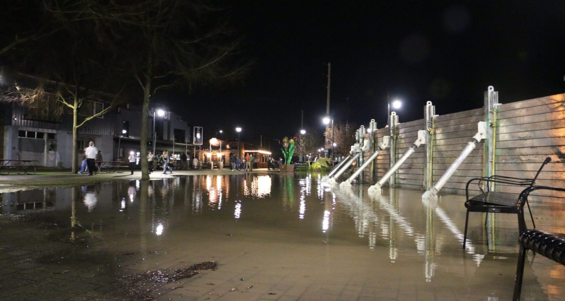
Floodwater is leaking through the floodwall in downtown Mount Vernon.
The Skagit River was last recorded at 37.16 feet as of 8:15 p.m. The record is 37.4 feet.
The river is expected to crest at 38.06 feet at 4 a.m. Friday.
The Mount Vernon Fire Department said in a Facebook post Thursday afternoon that water seepage through the floodwall is normal and expected.
A Mount Vernon police officer told CDN the river has risen about 1 foot in the previous hour. He said the wall has been leaking most of the day.
8:46 p.m.
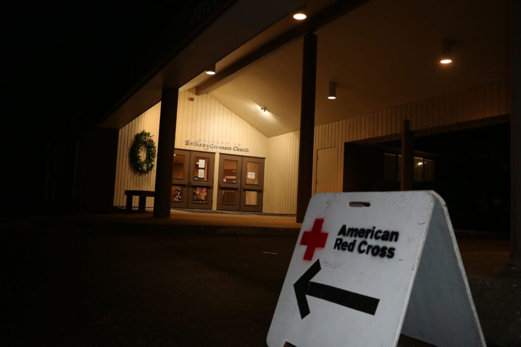 A Red Cross shelter, pictured Dec. 11, is operating out of the Bethany Covenant Church in Mount Vernon. (Photo by Eli Voorhies)
The Red Cross shelter at Bethany Covenant Church in Mount Vernon has over 100 people sheltering in it as of 8:30 p.m. Thursday. Located at 1318 S. 18th St., the Red Cross has a second shelter directly across the street.
Alex Newman, the executive director for the Red Cross’s Northwest Washington Chapter, said they will open a third shelter in Mount Vernon if need be.
“We will be here until the need is met,” Newman said Thursday night.
The shelter welcomes animals and has Spanish-speaking volunteers available to assist.
Carol Janssens, the shelter site manager, said many people have inquired about donating. The most effective way to donate is on the Red Cross’s website, Janssens and Newman said.
7:35 p.m.
The First United Methodist Church in Mount Vernon (1607 E. Division St.) is open for people in the 221 program; others are being directed to the Bethany Covenant Church on 1318 S. 18th St.
7:35 p.m.
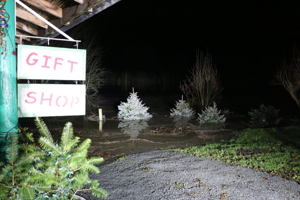 Christmas trees from Laue’s 14-acre Christmas Tree Farm in Sedro-Woolley are submerged near the gift shop. (Eli Voorhies/Cascadia Daily News)
By nightfall Thursday, 12 acres of Laue’s 14-acre Christmas Tree Farm in Sedro-Woolley were submerged.
Ann and Michael Laue, who own the farm and live on site, said the water crept in Thursday. On Wednesday, they could still see the grass, but by Thursday night, just the tops of uncut trees were visible.
“It’s like filling a bathtub,” Ann said. “We were all excited we were gonna have a record year.”
The farm, which is near the Skagit River, was having a successful business season until the floods, Ann said.
Skagit County Sheriff’s Office and a few volunteers brought sandbags Thursday evening for the Laues’ house, which sits mere yards from the water-consumed trees.
7:22 p.m.
Ferndale residents were still filling sandbags after dusk; some for their own residences and some volunteering to help others. People have been in and out of the sandbag station, located at 5532 Second Ave. near Metalworks Skatepark, all day. It is run by volunteers from Ferndale Public Works and includes an industrial filling machine.
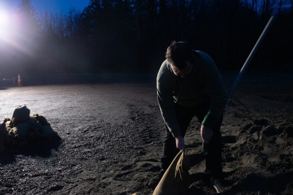 Aaron Capdeville, 42, fills a sandbag while volunteering for the City of Ferndale. “I love my community,” he said. (Photo by Eli Voorhies)
6:40 p.m.
By the end of the night, Cascade Christian Church at 534 Township St. in Sedro-Woolley expects to hold 80 people. The shelter can take up to 100 people. The Royal Order of Christian Knights, a ministry that focuses on church safety and security, operated an incident command center out of the church on Thursday.
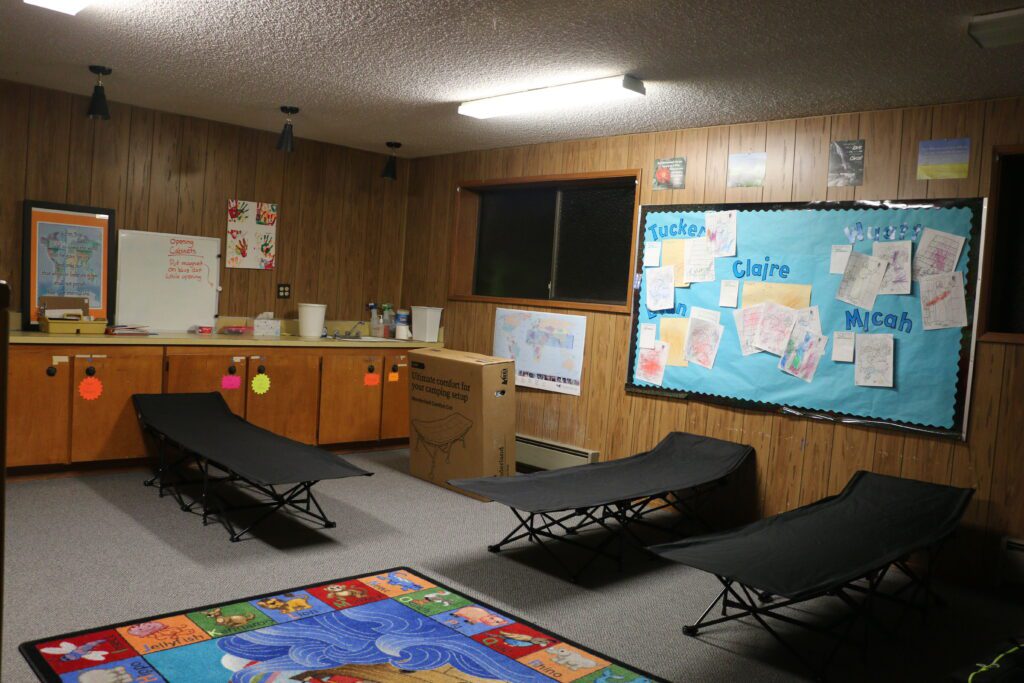 Cots sit inside a children’s classroom at Cascade Christian Church in Sedro-Woolley. (Photo by Eli Voorhies)
6:32 p.m.
Skagit County Emergency Operations is coordinating regular observation groups to monitor the levees and dikes, the county said in a Facebook post Thursday night. There are currently multiple groups of trained observers patrolling the Skagit levees. Dike district and U.S. Army Corps of Engineers teams are working to make repairs as needed.
6:10 p.m.
The emergency room at PeaceHealth United General remains open Thursday evening in Sedro-Woolley. The hospital has continued to see patients and ambulance visits throughout Thursday, some flood-related and some not, but nothing major, an emergency room employee said.
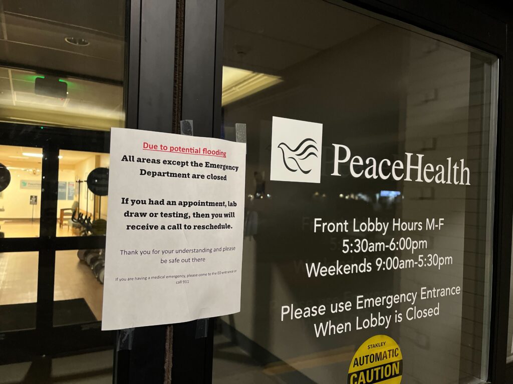 PeaceHealth United General’s emergency room remains open as of Dec. 11. (Owen Racer/Cascadia Daily News)
5:41 p.m.
Three new shelters opened today around Skagit County. A list of shelters and their contact information is on the county website. Call the shelter to inquire about special accommodations and availability, as capacity may fluctuate.
5:24 p.m.
David Top and Heather Top live in Sedro-Woolley. The couple’s home, along with the event barn, Bloem Acres, was on the side of the Skagit River that was evacuated Wednesday evening. The Tops are staying at one of their rental properties while their children are staying at a hotel.
On Thursday afternoon, David jumped on the back of a jet ski while his tenant, Ben Scott, took a boat over to the house and barn to put the fridge on stilts and assess the damage. “We did the best we could, but we didn’t get as much done as we hoped,” Heather said.
During the trek, Top turned on Christmas lights and blared music from the sound system so loudly it could be heard from across the river.
It was a nod to how Top spent the 2021 flood.
“My husband didn’t leave the house, and he just kept his eye on everything,” Heather said. “And he actually, like, was playing Christmas music from the barn.”
The Tops were hopeful the Skagit River crest would happen Thursday afternoon and that the flood waters would recede enough so that by Friday morning, they could return to their property.
5:15 p.m.
Sumas Mayor Bruce Bosch said in a 4:34 p.m. update that the flood is very similar to the 2021 floods, and has “devastated much of Sumas.”
“We are hopeful that the high water will begin to recede soon. It may take a couple of days for the floodwaters to fully leave, but once they do, we will be able to assess the damage more accurately,” Bosch said. “As the city reopens, there will be many needs to address. Please remain patient as outside assistance becomes available, and continue to monitor the city’s website for updates and resources.”
Bosch said he is “deeply sorry” that the community is facing this “hardship again,” but is relieved that most residents evacuated.
“Today, several rescues were carried out for those who chose to remain, thanks to the dedicated efforts of our fire district, police department, Borstar (a division of the U.S. Border Patrol), Whatcom County Search and Rescue, and — of course — our dedicated local farmers,” he said. “Their courage and commitment are greatly appreciated.”
4:59 p.m.
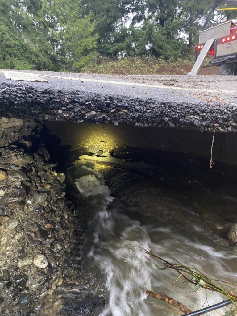
Flooding impacts have been minimal in Bellingham, the City of Bellingham said in an afternoon newsletter. But Hannegan Road is closed between Bakerview Road and Van Wyck Road due to a “substantial culvert failure caused by recent heavy rainfall.” Detour signs direct drivers to Guide Meridian and Smith Road.
“We anticipate the road being closed for the foreseeable future while we determine a plan to make necessary repairs and stabilize the roadway,” the city said.
4:54 p.m.
 Volunteers helped fill bags on Dec. 11 at Pioneer Park in Ferndale. (Owen Racer/Cascadia Daily News)
Nearly two dozen volunteers helped fill bags on Thursday at Pioneer Park in Ferndale. Ferndale Public Works employee Marcus Nightingale said this was the first flood the city’s been able to fight with the new bagging machine Ferndale got last year.
4:19 p.m.
Wiser Lake Chapel at 7121 Guide Meridian is hosting a free community lunch from 12-2 p.m. on Friday. People affected by the flooding are especially invited, according to a Facebook post.
In Sedro-Woolley, State Route 9 is now closed south of South Skagit Highway, with no detour available. State Route 20 is closed at Collins Road, but a detour is available via Cook Road using Collins Road.
4:05 p.m.
Skagit County has extended the closure of all non-essential government services, including District Court and Superior Court, through Friday, Dec. 12 due to ongoing flooding.
The county urged residents to avoid unnecessary travel, stay informed through official channels and follow any evacuation or safety advisories issued by local authorities.
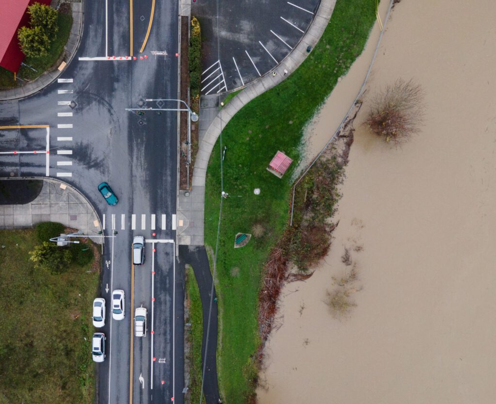
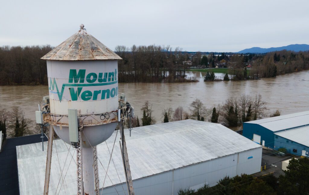 The Skagit River runs next to downtown Mount Vernon on Dec. 11. (Finn Wendt/Cascadia Daily News)
4:04 p.m.
Allison Pfeiffer, geology professor at Western Washington University, noted that the region will likely be seeing more intense precipitation and stream flow events in future years due to climate change.
That said, “two events like this in five years, that wasn’t on my bingo card for 2025,” she said. She added a repeat of the severe flooding in 2021 “is startling from a human perspective, but the science tells us that we should expect it.”
Looking ahead, Pfeiffer said she is “nervous.” The landscape is like a sponge, she said, where intense rainstorms early in the fall don’t necessarily lead to severe flooding because “the sponge is dry.”
“But we’ve had a really wet week,” she said, “and next week is forecast to bring more rain and the sponge is wet already.”
Pfeiffer stressed that nothing is clear at this point, noting she didn’t want to scare people into thinking more severe flooding is a certainty.
3:53 p.m.
Division Street Bridge in Mount Vernon will be closed starting at 6 p.m. tonight. Originally, the bridge was expected to close sooner.
3:51 p.m.
The Washington National Guard wrote on X (formerly Twitter) that aviation crews had rescued a stranded individual off the roof of a vehicle in Skagit County earlier today. “Please use caution and listen to authorities on travel advisories,” the guard said in the post.
3:49 p.m.
 The Skagit River encroaches on Lions Park in Mount Vernon. (Finn Wendt/Cascadia Daily News)
Linda Woiwod has lived in Mount Vernon her whole life — since 1948 — and expects this to be the biggest flood she’s seen. She and her husband, Tim, were watching on Thursday afternoon from the top of the Mount Vernon Library Commons parking structure as the Skagit River crept closer to downtown.
Linda hazarded a guess that downtown businesses were glad to have the flood wall erected between them and the encroaching waters. Before the wall was completed in 2018, high schoolers and other volunteers were recruited to stack sandbags eight feet high to protect Mount Vernon.
3:47 p.m.
Conway emergency shelter update: Conway School is no longer a temporary evacuation center due to staffing issues at the Red Cross, Skagit County Fire District #3 posted at 3:04 p.m.
Residents who have evacuated are instead directed to the Church of Jesus Christ of Latter Day Saints at 1700 East Hazel St in Mount Vernon, or any other shelter site in Whatcom County.
3:13 p.m.
Some water is seeping through the flood wall in Mount Vernon, but that’s “normal and expected,” said the fire department in a post at 2:39 p.m.
“The wall is working as designed, and our crews are monitoring it closely,” the fire department said. “The pavers in the plaza are specially designed to allow water to drain through and are checked every hour.”
Residents who see backups near storm drains should report it to the city’s Fire Flood Line at 360-336-3687.
3:12 p.m.
The Nooksack Indian Tribe has declared an atmospheric river and winter weather proclamation of emergency.
“As conditions continue to evolve, portions of the Reservation and nearby roadways may become impacted or temporarily inaccessible, affecting residents, emergency response and the delivery of critical services,” the tribal council wrote in the proclamation.
3:11 p.m.
State Route 20 was closed at MP 101 due to water over the roadway and debris, said Washington State Patrol Trooper Kelsey Harding on X (formerly Twitter). WSDOT North said the road was cleared between MP 100-106 at 2:25 p.m.
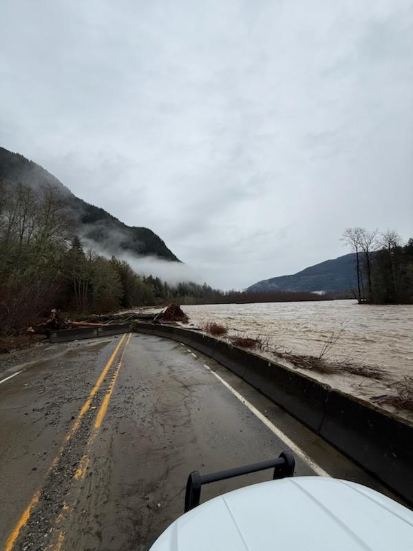 State Route 20 was closed at MP 101 due to water over the roadway and debris. (Photo courtesy of Washington State Patrol Trooper Kelsey Harding)
3:08 p.m.
In the early afternoon on Thursday, Colin Fischer was walking around his farm with his dog to assess the flooding damage. Fischer, who owns Wanderwood Farm near Everson with his partner, said the farm’s field, barns and some greenhouses are flooded.
The couple were able to get machinery, vehicles, expensive tools and electronics up high. “We’re expecting losses in that sense to be kind of minimal, but only due to the preparation,” he said.
Crop losses are “not severe, maybe around moderate,” Fischer said. The farm grows produce and flowers, and had not yet planted its winter flowers. Wanderwood is “essentially a year-round farmers market farm,” he added, and crops he’d been intending to pick to bring to markets in the next few weeks have now been damaged.
“I have yet to sit down with my partner and form an estimate of what that really looks like in terms of lost revenue,” he said. “But, I mean, it’s substantial.”
 Wanderwood Farm near Everson pictured Dec. 11. (Photo courtesy of Colin Fischer)
 Wanderwood Farm near Everson. (Photo courtesy of Colin Fischer)
2:46 p.m.
The City of Ferndale issued a voluntary evacuation notice Thursday, warning of rising flood waters into Saturday, Dec. 13.
The Nooksack River, which has not yet reached its crest, could overtop the existing levee, the city said. Ferndale has temporary shelters available at 2034 Washington St. and 1252 Axton Road.
2:34 p.m.
The emergency department at PeaceHealth United General in Sedro-Woolley remains open as of Thursday afternoon. Hospital-based outpatient appointments and procedures are canceled until Monday, Dec. 15, a hospital spokesperson said. PeaceHealth clinics in Burlington and Sedro-Woolley will remain closed until Monday, Dec. 15.
Skagit Regional Health’s Riverbend and Station Square clinics remain closed through Friday, along with the Skagit Regional Health Business Center. Incoming patients are being directed to seek same-day, walk-in care at Skagit Regional Clinics — Mount Vernon, Family Medicine Suite, effective Friday, Dec. 12, a hospital spokesperson said.
Due to phone delays, the hospital is encouraging patients calling to check appointment status to send a non-urgent message to providers though the MyChart patient portal.
2:26 p.m.
The Army Corps of Engineers took over the management of Ross Dam from Seattle City Light at about 2 p.m. on Monday in anticipation of flooding. In an emailed statement, the Corps said the dam “is nowhere near full. We are only a half foot into our reserved flood storage space. Overflow is not possible during this flood event.”
2:21 p.m.
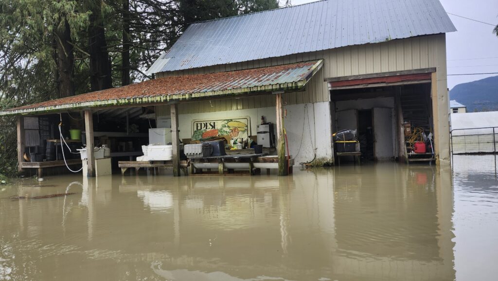
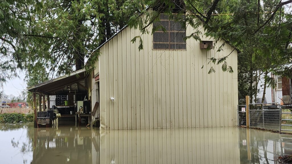
 Mariposa Farm in Everson, pictured on Dec. 11. (Photo courtesy of Nick Spring/Spring Time Farm)
Joaquin Lopez, who owns Mariposa Farm near Everson with his wife, said his house and farm are “underwater” — again. Four years ago, floodwaters reached the main floor of his house, he said.
“We just barely recovered from last time,” he said. “And then again, we’re stuck in the same hole.”
This time, Lopez said the water doesn’t look quite as high as last time, and he was able to move his vehicles to higher ground. But his home is without water and power, and “the basement is like a big pool right now.” A barn that had tools, equipment and produce inside is under 3 and a half to 4 feet of water.
“It’s really a nightmare,” he said. “It’s really sad, and (I’m) trying to be positive, but it’s really hard.”
2:19 p.m.
There is now significant water between Clear Lake and Sedro-Woolley, just south of the South Skagit Highway, the City of Sedro-Woolley said in an alert.
“Please avoid this area and do NOT attempt to drive through floodwater. Depth and current can be stronger and more dangerous than they appear,” the city said.
 The intersection of Collins and Cook roads fills with cars after State Route 9 closed on Thursday afternoon near Sedro-Woolley. (Santiago Ochoa/Cascadia Daily News)
2:15 p.m.
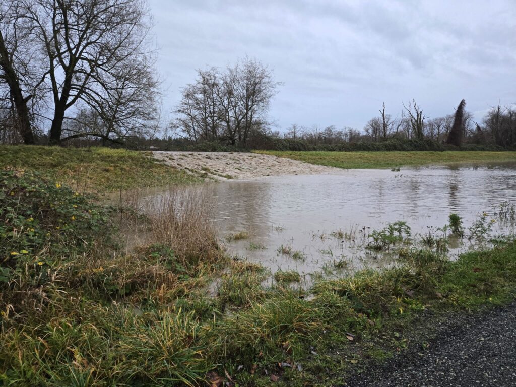
The Samish River near Burlington crested last night in the minor flood stage, and has now fallen back into the “action” stage, according to the National Weather Prediction Service.
2:02 p.m.
Despite an evacuation order, some farmworkers were still at work as of Thursday morning, said Rosalinda Guillen, founder of Community to Community Development.
A couple of organizers noticed about 30 to 40 workers harvesting Brussels sprouts near Burlington after dark Wednesday evening, Dec. 10.
[Read more: Organizers raise alarm after spotting farmworkers in fields]
1:53 p.m.
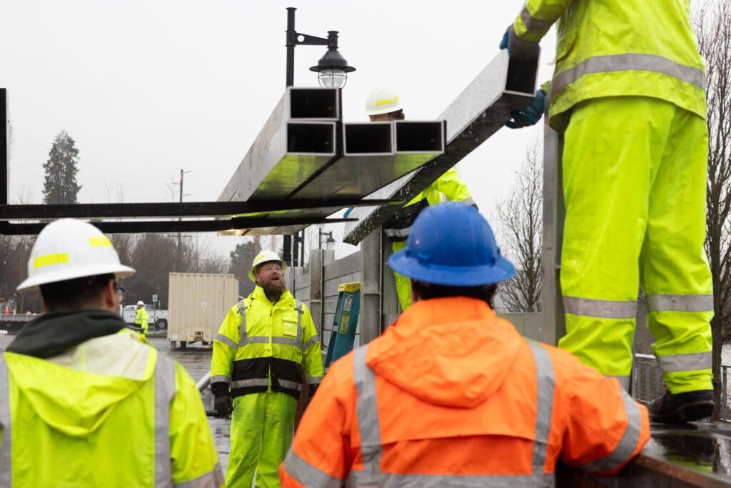 With the help of a forklift, Mount Vernon work crews stack slats of metal flood wall at the river’s edge downtown on Dec. 10. (Santiago Ochoa/Cascadia Daily News)
Skagit County is urging people in the downtown area of Mount Vernon to evacuate now. At noon, first responders began evacuating, starting in West Mount Vernon and North of College Way.
1:21 p.m.
Fir Island access will close at 2 p.m. today, according to the Skagit County Fire District No. 3. Fir Island Road at Dike Road and Best Road will be closed and manned by National Guard personnel.
“Access to the island will be through an identification verification checkpoint for access at each closure point,” the fire district wrote in an update at 12:08 p.m.
All residents in Conway and Fire Island are strongly encouraged to evacuate. Residents can seek assistance and information at the Conway Emergency Operations Center at the Conway fire station located at 21020 Greenfield St., or by phone at 360-445-4345.
The Conway School is the evacuation shelter for the area, located at 19710 State Route 534. Check in for emergency sheltering at the fire station before going to the school.
1:17 p.m.
Gov. Bob Ferguson is urging the federal government to grant an expedited emergency declaration for Washington state amid a “potentially catastrophic” situation.
The governor addressed the state during a press conference at noon Thursday from outside Skagit County’s emergency operations center, set up at Skagit Valley College.
[Read more: Gov. Ferguson asks for expedited federal help]
12:47 p.m.
The City of Abbotsford in British Columbia, just across the border from Sumas, has issued evacuation orders for 454 properties so far. Evacuation alerts are in place for 1,069 properties in Sumas Prairie East and West. Fifteen families spent the night in a shelter at the Abbotsford Recreation Center.
Farmers have also been impacted: 164 farming operations with livestock are currently in the evacuation area, with 66 under an evacuation order.
12:20 p.m.
The City of Ferndale has issued a voluntary evacuation notice for residents in low-lying areas.
That includes people living:
South of Main Street between 4th Avenue and the Nooksack River.
The area near the Whatcom Transit Authority Ferndale Station Facility, the Ferndale Food Bank, and the Pilot/McDonalds retail complex.
1580 Main St., 1625 Main St., and vicinity.
South of Washington Street and east of 2nd Avenue, north and east of the BNSF railway.
“Floodwaters may rise beginning Thursday, Dec. 11 through Saturday, Dec. 13, with additional events possible next week,” the city said in an evacuation notice issued around 11:30 a.m. “If you choose to shelter in place, please be prepared to do so for at least 24 hours, and be aware that emergency response may be delayed.”
Shelter is available at the Ferndale Severe Weather Shelter at the United Church of Ferndale (2034 Washington St.), and at Good News Fellowship (1252 Axton Road). Contact 360-380-2200 to access the severe weather shelter, and 360-510-5096 to access the fellowship.
11:48 a.m.
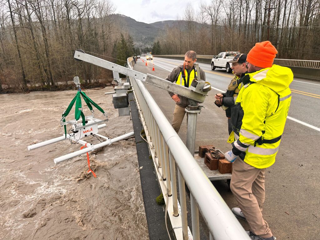 USGS workers take measurements of the Nooksack River at Cedarville. (Isaac Stone Simonelli/Cascadia Daily News)
Chris Bird, William Wright and Dan Restivo with USGS were taking measurements of the Nooksack River at Cedarville mid-morning. They’re using radars to measure velocity and depth to help calculate discharge rates.
Risk of damage to equipment requires them to use these no-contact methods rather than other traditional systems.
The data they’re collecting is important to modeling flooding in the area.
11:46 a.m.
Jenn Strang, spokesperson for Seattle City Light, said the utility has staff working around the clock and has staged equipment and supplies throughout the Skagit River Hydroelectric Project to ensure everything stays operational. The Army Corps of Engineers took over management of Ross Dam from Seattle City Light at about 2 p.m. on Monday in anticipation of flooding.
11:31 a.m.
 A Skagit Dike and Drainage District 12 employee examines rising waters at West Whitmarsh Road in Burlington. (Finn Wendt/Cascadia Daily News)
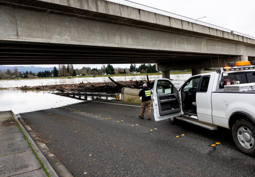
A crew from Skagit County Dike District 12 was out checking on the Burlington Boulevard bridge over the Skagit River at around 11 a.m. Like other bridges locally, the bridge piers are catching logs flowing downriver. The buildup is concerning because it causes the river current to start eating away at riprap on the water’s edge, explained Dike District 12 Construction Manager Justin Burt.
Burt was hoping to bring in machinery to dislodge the jam and relieve some of the pressure on the piers.
“The problem is with the height of the bridge; it’s tough to get enough reach to get out there,” he said.
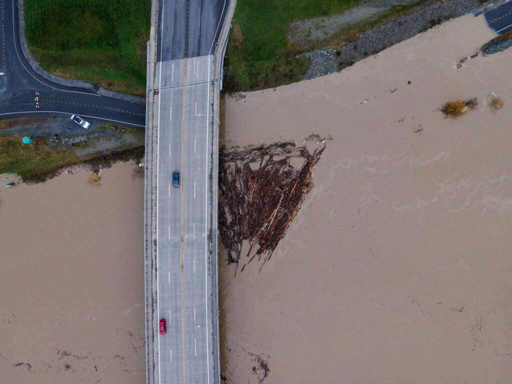 A logjam forms and water rises onto West Whitmarsh Road in Burlington. (Finn Wendt/Cascadia Daily News)
11:26 a.m.
Whatcom Ready, the county’s centralized location for emergency updates, said in a news release Thursday morning that residents of Nooksack, Sumas, Everson were evacuated, as well as some people in Marietta and portions of Ferndale.
Damage caused by the flood so far includes a mudslide on Silver Lake Road, a landslide in Kendall that damaged one home, several bridge closures, overtopping of levees and potential damage to the Twin View dike. Everson City Hall and businesses also sustained some damage.
11:18 a.m.
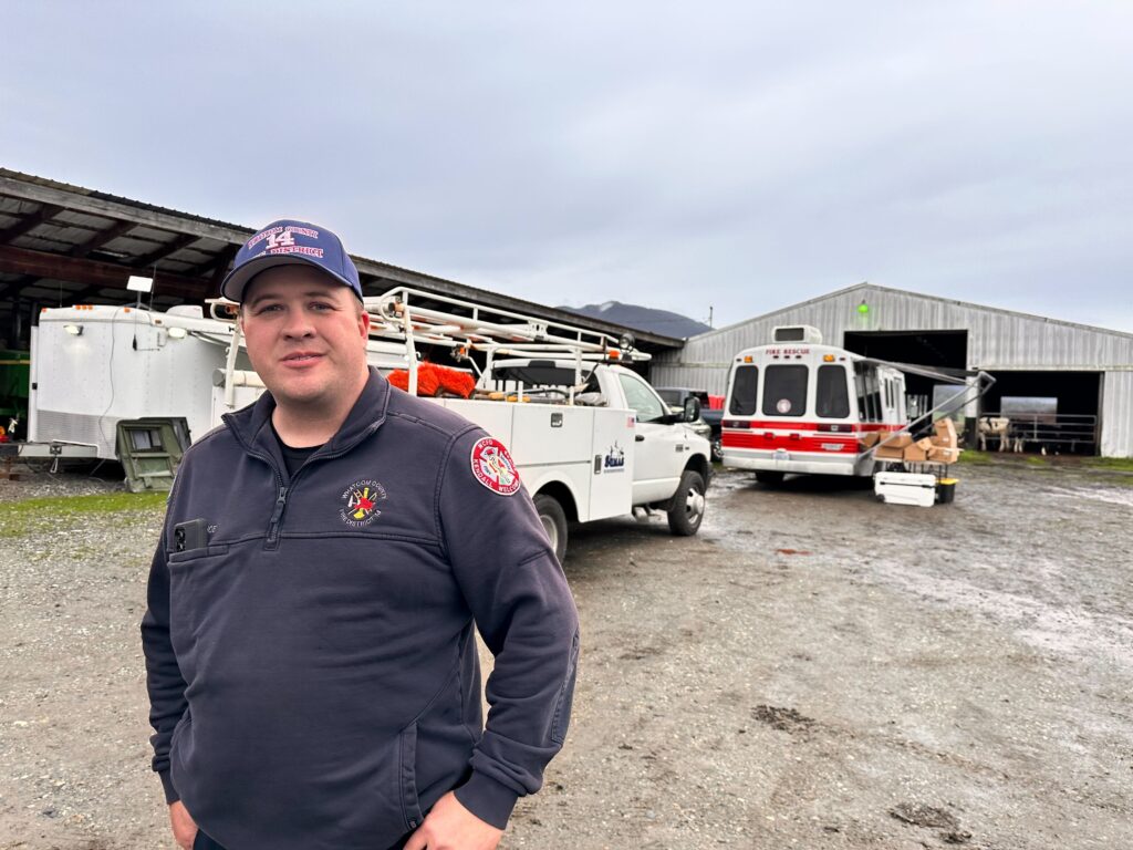 Whatcom County Fire District 14 Assistant Chief David Moe confirmed that about 90% of Sumas residents were evacuated ahead of the flooding. (Isaac Stone Simonelli/Cascadia Daily News)
Whatcom County Fire District 14 Assistant Chief David Moe confirmed that about 90% of Sumas residents were evacuated ahead of the flooding. The team is now conducting rescues for those who stayed behind and need help. He said they’ve rescued somewhere between 15-20 people — and their pets — so far.
“We’re kind of in the middle of it now,” Moe said from a command station set up next to a barn full of Jersey cows. “I haven’t seen it stop flowing over Everson yet. Until it stops there, it won’t stop here.”
11:17 a.m.
Whatcom County Sheriff’s Office is actively patrolling for “anyone who seeks to victimize members of the community by looting or engaging in illegal activities in the wake of this historic flooding event,” the office said in a Facebook post at 10:10 a.m. “Anyone arrested and engaged in these activities will be booked into the Whatcom County Jail.”
10:52 a.m.
The old Sumas Elementary flooded four years ago. The district was already in the process of building the new school when the floods hit, and peak floodwaters hit just 6 inches away from damaging the new structure.
 A photo of Sumas Elementary School amid flooding in November 2021. (Photo courtesy of Nooksack Valley School District)
The new building opened in August 2022. It includes crawl space, designed to allow water to flow through if it floods, and flood gates to protect doors. The school is also covered with waterproof paint to keep water from seeping through the walls.
10:43 a.m.
Mount Vernon’s emergency operations center is sending staff out today to canvas neighborhoods in the floodplain, said city spokesperson Candy Galindo. Staff will be passing out leaflets in English and Spanish.
The city is also looking for anyone who needs to be rescued, she said. So far, the city received one tip this morning about people needing help, but when staff got there, no one was around. Those with information about people needing rescue should contact the emergency operations center, she said. That center can be reached at 360-336-6287.
9:54 a.m.
Flooding in downtown Bellingham has largely receded. However, at the waterfront, standing water covers the train tracks.
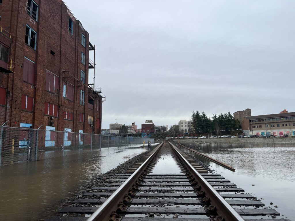 Railroad tracks by Bellingham’s Container Village are covered with water. (Owen Racer/Cascadia Daily News)
9:48 a.m.
Sedro-Woolley Police Department advised residents that Fruitdale, north of River Road, Township Street north of River Road, and 3rd Street at Sterling Street are blocked off to vehicle and pedestrian traffic.
 A road in Sedro-Woolley is covered by floodwater. (Photo courtesy of Sedro-Woolley Police Department)
 A road in Sedro-Woolley is covered by floodwater. (Photo courtesy of Sedro-Woolley Police Department)
“We have noticed a steady increase in traffic coming to those locations so that people can see the River,” the police department wrote in an update at 7:57 a.m. “Please don’t do this. Really, please don’t do this. We have residents and temporary housing in the area, and the traffic is causing problems. Also, if you get stuck on the other side of the line, emergency personnel may not be able to help you. You could also be liable for the cost of rescuing you and receive a criminal citation.”
The river continues to rise this morning, police said. “Even though levels don’t appear that high, for our regular flooding, the worst is yet to come.”
9:46 a.m.
Whatcom County Public Works is urging people not to drive around road closed signs on Dewey Road.
“This is extremely dangerous,” public works said. “The road surface may look fine, but the underlying material has been undermined by flooding and is not stable … Never drive around closure signs or through standing water—conditions can change quickly and may hide washouts or unstable ground.”
 Whatcom County Public Works is urging people not to drive around road closed signs on Dewey Road. (Photo courtesy of Whatcom County Public Works)
9:16 a.m.
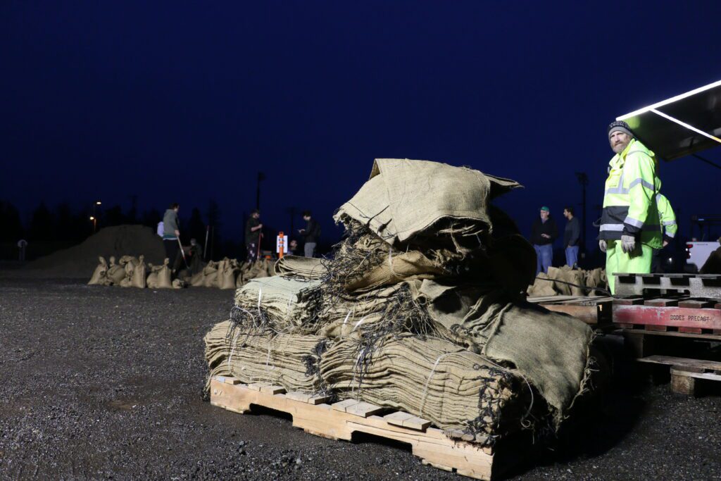
Karina Shagren, spokesperson for the Washington Military Department, said 100 National Guard members were put on “sandbagging missions” in Skagit County this morning. Another 200 troops should be on the ground in Skagit County or the Marysville area this afternoon, she said.
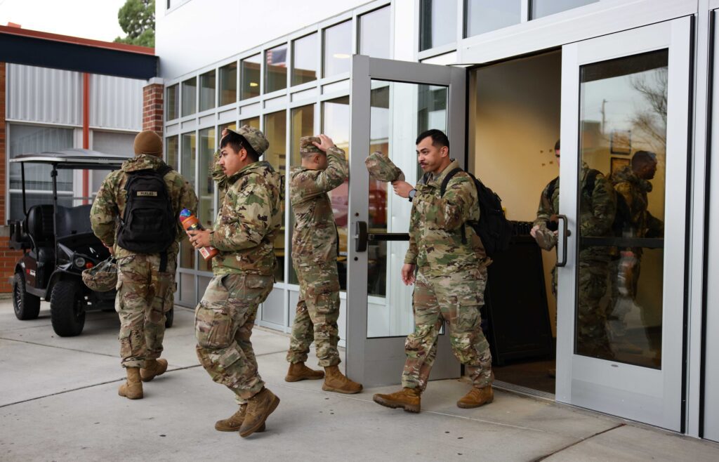 National Guard members deployed from Marysville come in and out of the Cardinal Center building on the Skagit Valley College campus. Many have been deployed to sandbagging stations across the county. (Santiago Ochoa/Cascadia Daily News)
9:07 a.m.
In Ferndale, levees are holding and crews continue to monitor levees, pump stations and “known trouble spots,” city staff said in an 8:30 a.m. update.
The Nooksack River is projected to crest in Ferndale at 4 a.m. Friday.
A public sandbag station will opened Thursday at 8 a.m. at the Phillips 66 ballfields gravel lot. No evacuations have been reported in Ferndale, but police have “conducted door-to-door notifications in areas with higher risk,” city staff said.
9:03 a.m.
Sumas city officials said all access points into the city are now closed, and floodwaters are entering the town. East Badger Road, Halverstick Road, Garrison Road and Clearbook Road are now closed due to water over the roadway.
“For your safety and the safety of our crews, please avoid the Sumas area at all costs,” the city said in a Facebook post at 8:23 a.m.
“City staff and emergency services have been working tirelessly through the night to protect our community. Let’s continue to support, encourage, and lift one another up as we face this disaster together. Stay safe, check on your neighbors, and follow official updates as they come.”
8:50 a.m.
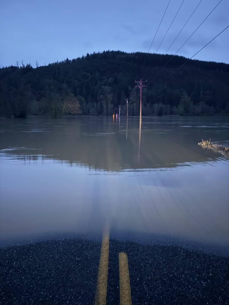
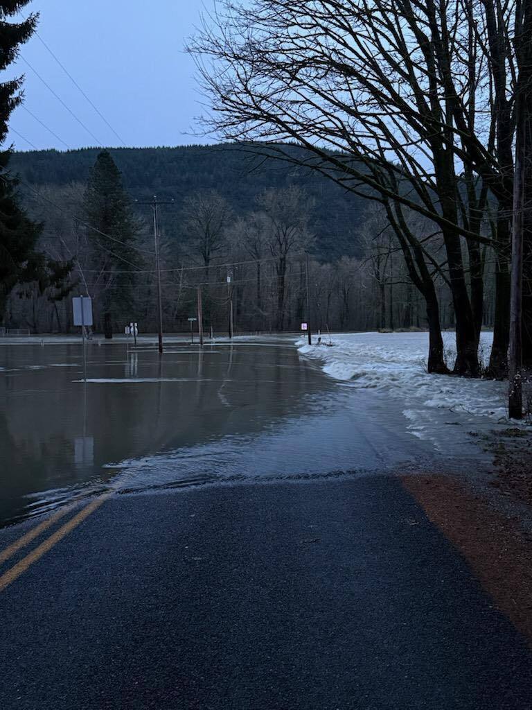
 River Road in Lynden overtopped Dec. 11. (Photo by Mark Saleeb)
7:06 a.m.
Road conditions
As for road updates, the Interstate 5 northbound on-and-off ramps in Bellingham at Iowa Street reopened overnight. Washington State Patrol is urging caution if drivers see standing water and state not to drive toward it.
Trooper were unable to check a bridge on Mount Baker Highway at milepost 32 because Nooksack River flow blocked the roadway at milepost 28, according to Kelsey Harding, a public information officer for the Washington State Patrol.
Roads remain closed at:
Both directions of State Route 546 at State Route 9;
State Route 544 eastbound at Robinson Street;
State Route 542 eastbound & westbound just east of Silver Lake Road;
State Route 9 northbound & southbound from Church Road (MP 72) to State Route 542 (MP 79) all lanes are closed;
State Route 20 westbound from Cascade Rd (MP 106) to Conrad Rd (MP 100) – all lanes are closed;
State Route 20 eastbound & westbound from State Route 530 (MP 98) to Conrad Road (MP 99) – all lanes are closed;
State Route 20 eastbound & westbound at Grassmere Road (MP 88);
State Route 530 eastbound & westbound near Illabot Creek Road.
Annie Todd is CDN’s criminal justice/enterprise reporter; reach her at annietodd@cascadiadaily.com; 360-922-3090 ext. 130.