The National Weather Service has issued winter weather advisories in 16 New Jersey counties for a fast-moving clipper system that is expected to bring several inches of snow to most of our region Saturday night into early Sunday.
Forecasters are warning drivers that some roads, highways and bridges could become slick from what will likely be the first accumulating snow of the season in many parts of the state.
ALSO: How much snow will fall in your county? See the latest weekend forecast, snow alerts.
Formal winter weather advisories have been posted for Atlantic, Burlington, Camden, Cape May, Cumberland, Gloucester, Hunterdon, Mercer, Middlesex, Monmouth, Ocean, Salem and Somerset counties.
Those advisories will go into effect at 7 p.m. Saturday and run through 1 p.m. Sunday.
Winter weather advisories have also been issued for Hudson and Union counties, along with the eastern region of Essex County. Those alerts kick in at 10 p.m. Saturday and run through 1 p.m. Sunday.
Light snow is expected to start falling Saturday night and continue into Sunday morning, followed by bitter cold temperatures and wind chills in the single digits.
The steadiest snowfall is expected between midnight and sunrise Sunday.
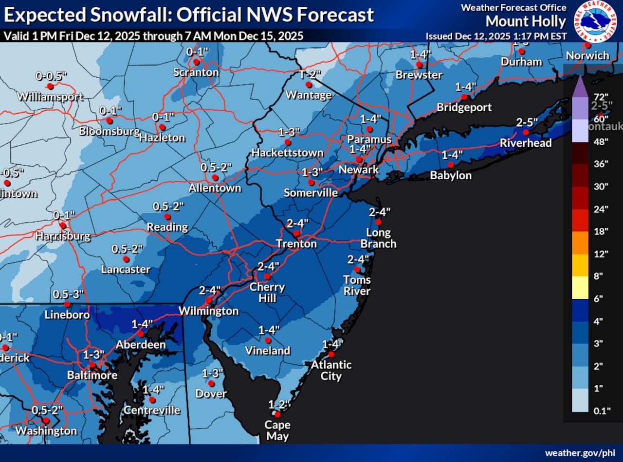 This is the latest snowfall forecast for the New Jersey region for a fast-moving storm that’s expected to arrive Saturday evening and drop light snow through early Sunday afternoon.National Weather Service
Forecasters from the National Weather Service are predicting snow totals of 2 to 4 inches for most of central New Jersey, a wide swath of southern New Jersey and much of the Jersey Shore.
Areas in northwestern New Jersey are expected to get 1 to 2 inches of snow, and the state’s northeastern region could get anywhere from 1 to 4 inches.
AccuWeather forecasters are calling for for 1 to 3 inches of snow across the entire Garden State.
Forecasters say the timing and snowfall totals could shift if the storm system speeds up or slows down.
Current weather radar