
With a steady parade of system after system, along with lake effect snow in between, it’s certainly understandable that some parts of Southern Ontario are getting pretty fed up with all the snow. The snow continues to pile up, especially across the snowbelt regions!
It was only a few days ago that the Barrie area was slammed with intense lake effect snow, with up to 70cm reported in the hardest hit community of Angus. And that doesn’t even include what was already on the ground before this round of squalls moved through.
Regions east of Lake Huron, including Grey, Bruce, Huron and Perth counties, have also seen their fair share of snow so far this winter, with frequent lake effect events adding to an already deep snowpack.
Fortunately for snow lovers, and perhaps unfortunately for everyone else, the squalls are far from finished. The lakes remain wide open, and we are just getting into the heart of colder Arctic air. That combination will continue to provide plenty of fuel for additional rounds of lake effect snow in the coming weeks.
The next round of squalls is just around the corner, with activity expected to ramp up again as early as Saturday morning. The good news for areas that were recently hammered by the Georgian Bay squall, including Barrie and Wasaga Beach, is that you should catch a bit of a break this weekend. The bulk of the activity will focus farther north and west.
Those east of Lake Huron, including Huron, Bruce and Grey counties, are not as lucky. Lake effect snow off Lake Huron is expected to target these areas once again with repeated rounds of snow through the weekend.
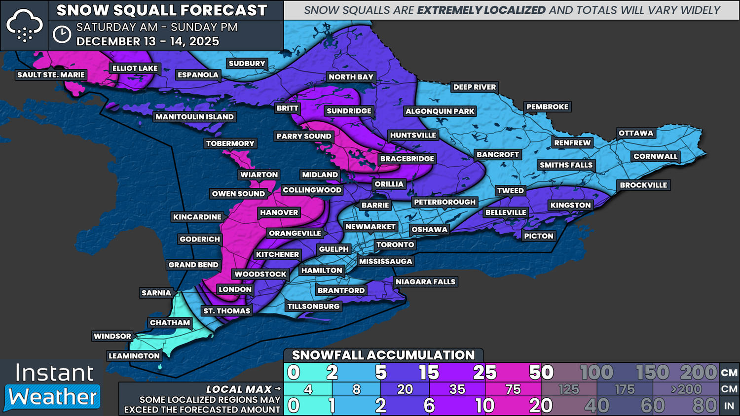
This is shaping up to be a multi-day lake effect event, with squalls persisting through the weekend and possibly into Monday. Winds are expected to be somewhat unstable, which means the squalls will tend to drift around rather than remain locked over one specific area. Because of this, it’s unlikely we’ll see extreme localized totals like the 50 to 75cm that fell southwest of Barrie earlier this week.
That said, snowfall totals will still add up. The hardest hit areas, including Parry Sound, Bracebridge, Tobermory, Owen Sound, Hanover, Collingwood, Goderich and Grand Bend, can generally expect 25 to 40cm. Some pockets, particularly across Muskoka, could push closer to the 50cm mark.