
Get ready for a wintry second half of the weekend! There’s yet another shot of arctic air on the way come Sunday. And a shot of accumulating snow tonight will precede our next cold blast, with several inches of a light and fluffy snow expected to fall overnight.

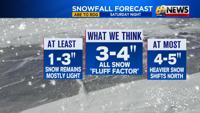
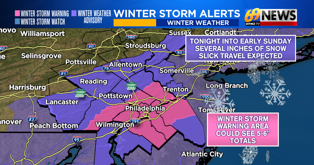
Snowfall expectations ticked up slightly Saturday morning, and that trend has continued into the afternoon, with more widespread totals of 3-4 inches now expected across a lot of the Lehigh Valley, Berks County, and the I-78 corridor. For Schuylkill County, the Poconos, and northwestern New Jersey, we expect a widespread 1-3 inches. The National Weather Service has all of these areas under Winter Weather Advisories through Sunday morning.
And speaking of those further south, it’s the Delaware Valley as well as most of central and southern New Jersey where we anticipate 3 to 5 inches of snow to fall. The highest totals are most likely to be found along the I-95 corridor where it’s also not out of the question a few 6 inch totals are seen. Winter weather advisories also continue for these southern areas with a Winter Storm Warning in effect for the I-95 corridor of the Delaware Valley and southwestern New Jersey, with anticipated slick and slippery travel overnight into early Sunday morning.
The remainder of the daytime Saturday will remain dry, and Sunday is mostly dry as well once any early morning show shuts off. So this is primarily a nighttime snowfall, with the worst travel conditions and accumulating snow occurring overnight. Snow will develop between 8pm and midnight from west to east across the area, and end from 4am to 8am Sunday morning, likewise from west to east.
For most of our area, this is an all-snow event, with no rain or mixing issues for a change (could be a brief period of some rain and sleet for those south and east of I-95 at the onset). With the cold air in place, it’s also a light and powdery snow, the kind that is easier to clean up. As winds pick up on Sunday behind the system and more cold air blows in, some blowing snow is expected during the day on Sunday. And those winds will create cold wind chills, likely in the teens and even single digits as the arctic air arrives.