
Published on Dec. 13, 2025, 1:46 PM
Updated on Dec. 14, 2025, 1:24 AM
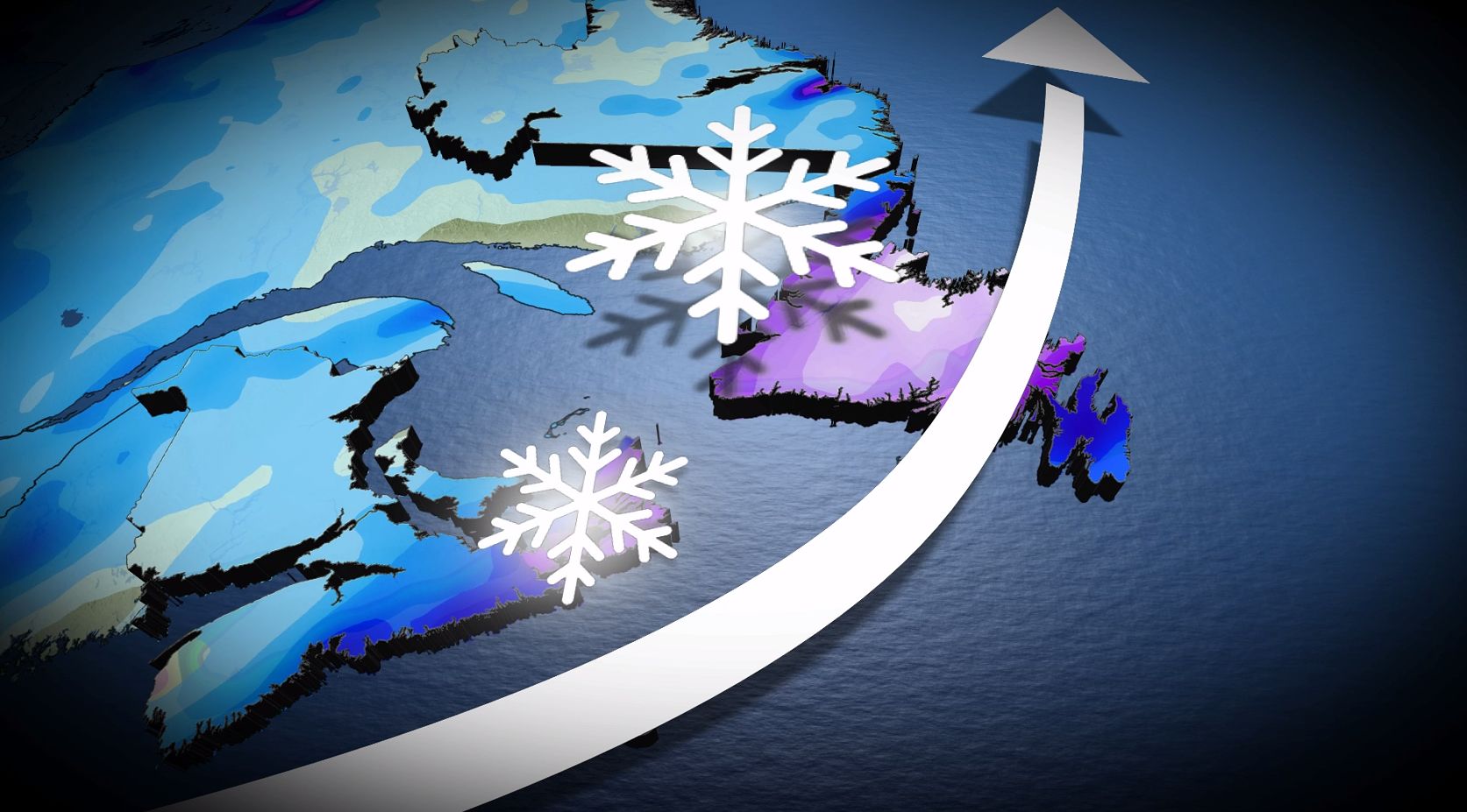
The weekend in Atlantic Canada will conclude with a powerful storm that could bring heavy snowfall and blizzard conditions to parts of the region, with impacts continuing into next week.
The weekend is set to end on a snowy, stormy note as a weather bomb makes its way up the East Coast late Sunday.
The intensifying system will track up the East Coast, reaching the Maritime provinces and Newfoundland on Sunday night. Anywhere from 5 to 40 cm of snow is possible, depending on locale, and wind gusts could hit 100-120+ km/h. Blizzard conditions are likely in parts of Newfoundland on Monday night.
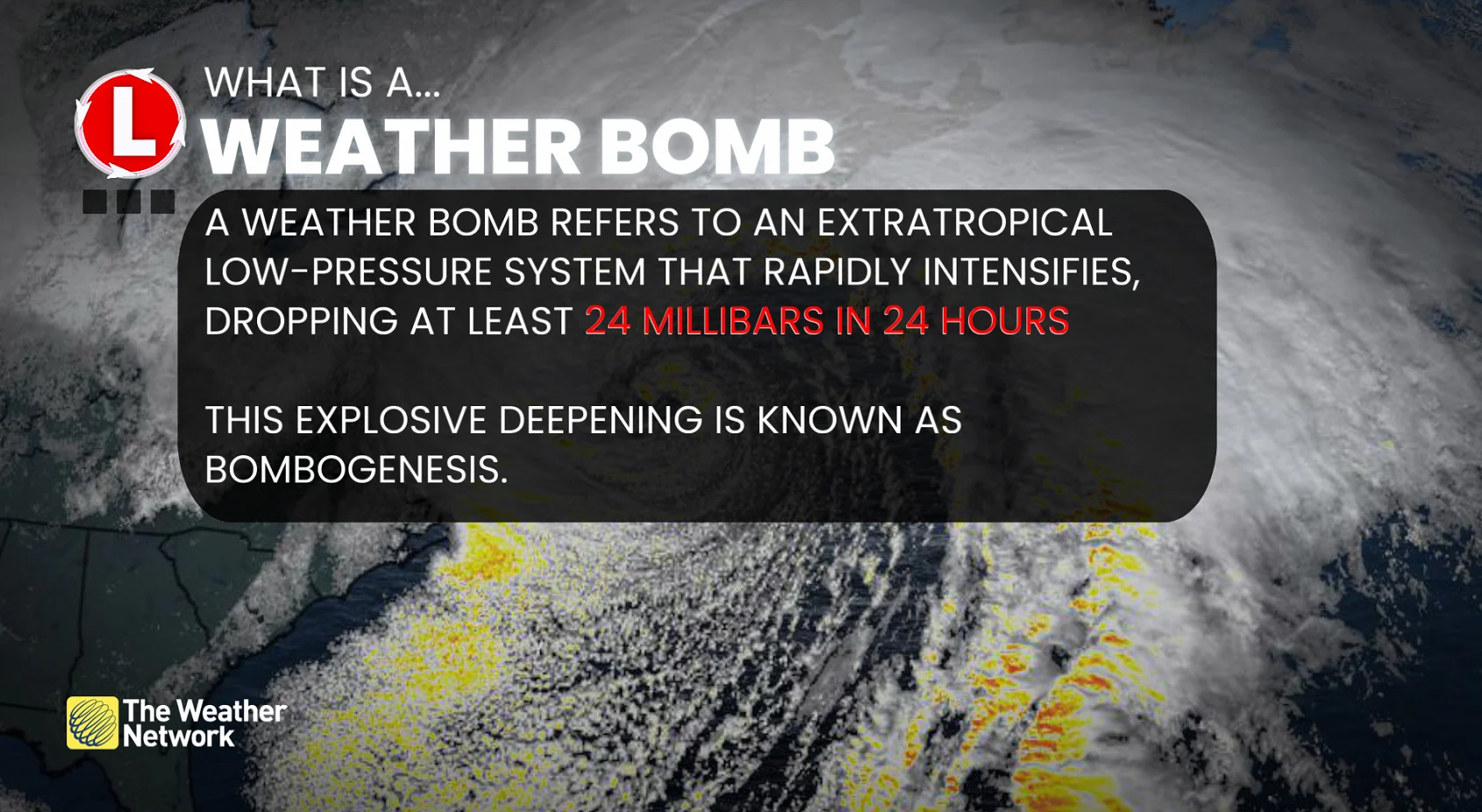
RELATED: ‘Weather bombs’: Explosive storms that create ferocious conditions
Currently, forecasters are watching the storm’s barometric pressure drop fast enough that it could become classified as a weather bomb moving through the weekend.
The forecast is subject to change quickly depending on the system’s track, which could take an unexpected turn offshore, so be sure to check back frequently to keep up-to-date on the current information.
Heavy snow brushes the Maritimes Sunday night
Snow is expected to start Sunday night as the storm sweeps by Nova Scotia and Prince Edward Island, clipping portions of southern New Brunswick on the way to Newfoundland.
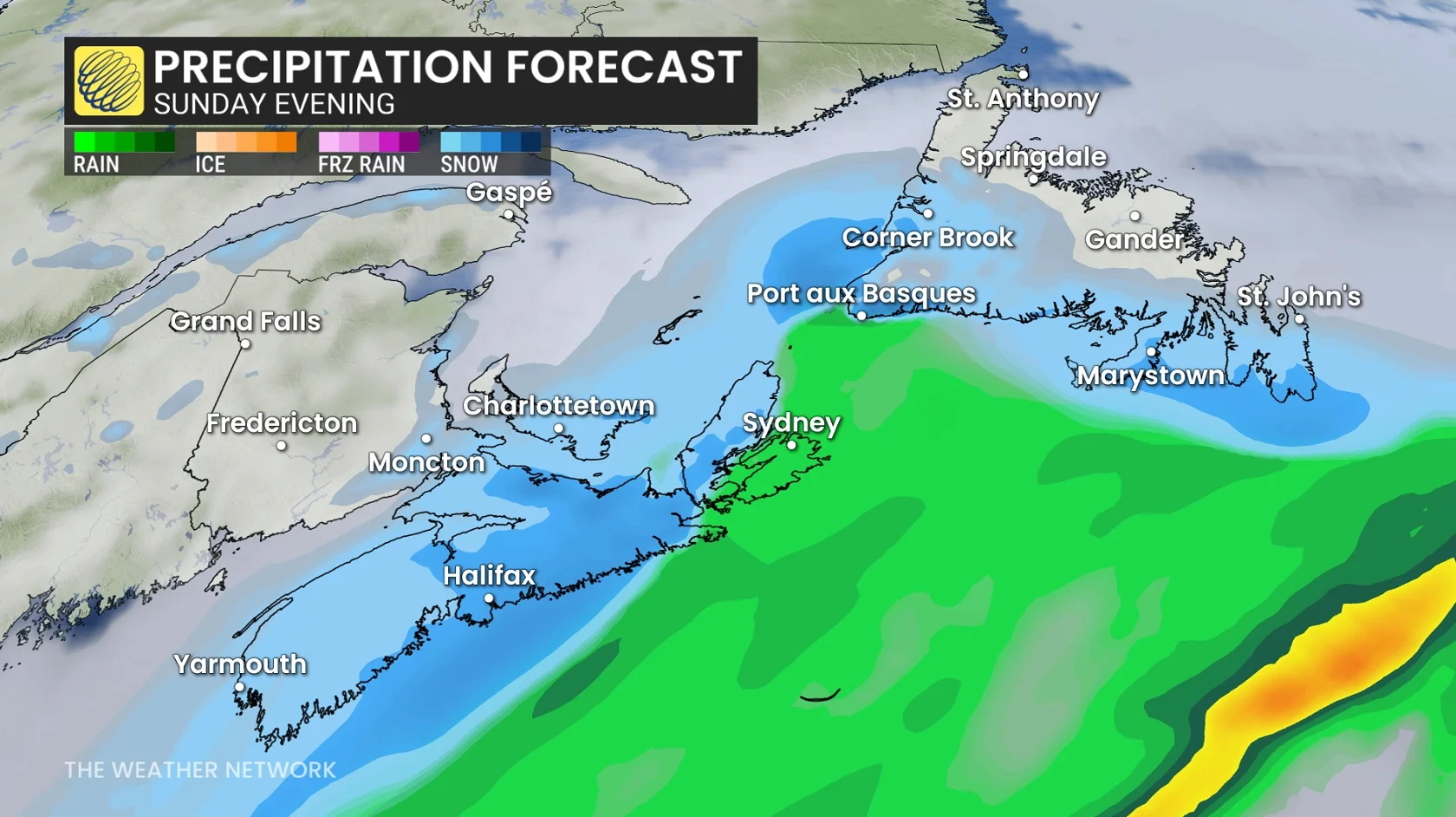
Some snow and mixed precipitation expected on Sunday with an initial, weaker low, ahead of the larger storm.