
Unsettled conditions this week, with wind and rain as well as low temperatures
07:48, 16 Dec 2025Updated 07:52, 16 Dec 2025
 Winter overview map from WX Charts for Saturday 20 December
A frosty start to Tuesday morning, and a spat of cold and stormy weather may be on the horizon.
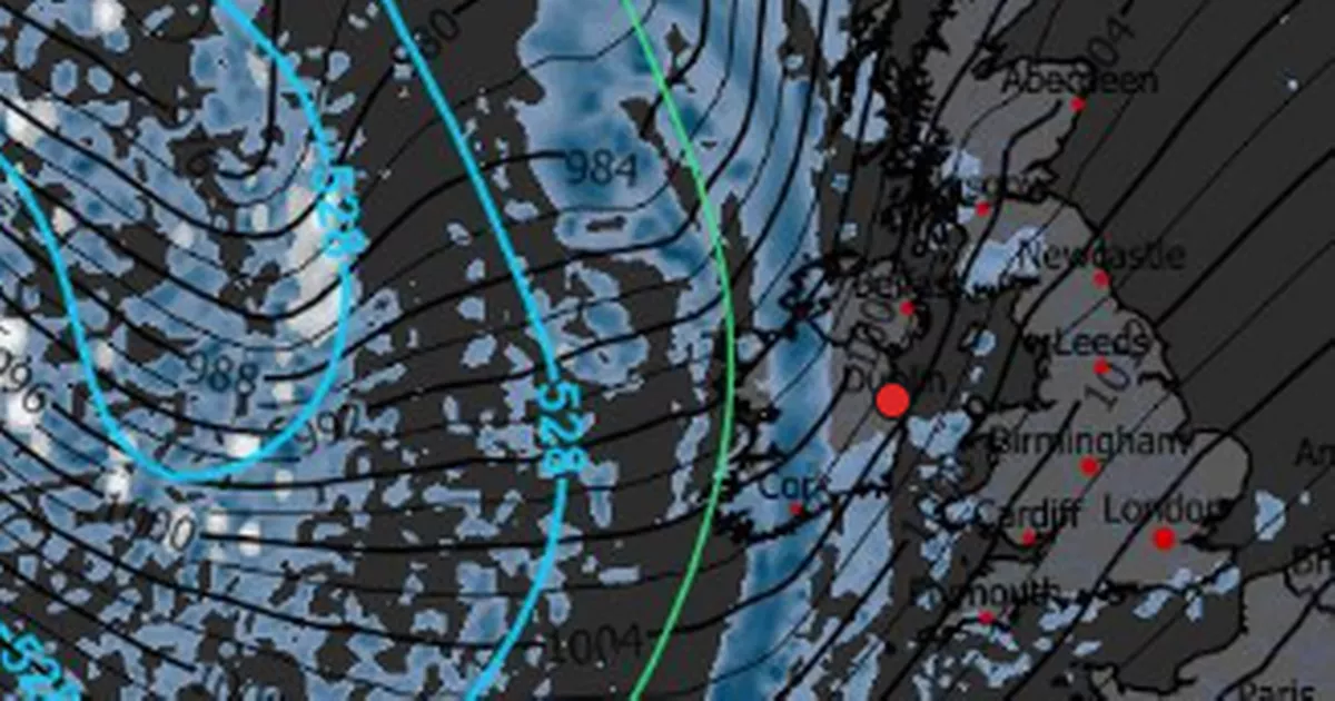
Weather Watcher shared a radar system detailing a storm moving in from the east, but said that the change will not be in the immediate days, and instead might occur late this week or early next week: “Another monster low lurking in the Atlantic today.”
Weather Watcher explained: “This will swing another wave of rainfall into Western Europe through Friday, but milder conditions remain for most areas. No big pattern change appears likely in the near future.”
However, Met Eireann’s long range forecast suggests that milder weather is coming down the line: “While unsettled conditions are set to continue for the weekend, with further spells of rain and showers on the way, there are indications that more settled conditions will develop from early next week.”
However in the coming days, there will be wet and windy conditions as well as some lower temperatures. Temperatures are set to drop to zero tonight, said Met Eireann.
Check out the forecast for the coming days, which predicts some wintry December weather:
Tuesday
Frost in many areas early this morning along with patches of mist and fog. These will gradually clear and today will be cold and mainly dry with good sunshine and a few showers in Atlantic coastal counties. Highest afternoon temperatures of 4 to 9 degrees, with a mostly light southwesterly breezes.
Tonight will be dry and cold with clear spells and lowest temperatures of 0 to 4 degrees. Cloud will increase from the west. Rain will develop in the west towards midnight and will spread eastwards to all areas overnight with fresh to strong, gusty southerly winds, strongest near western and southern coasts.
Wednesday
Outbreaks of rain and drizzle will become patchier as they clear eastwards through the morning and afternoon, with a mix of sunny spells and scattered showers following from the west. Milder than the previous two days with highest afternoon temperatures of 10 to 13 degrees. While winds will ease through the morning, it will remain breezy with moderate to fresh southwesterly winds, stronger on western and northwestern coasts.Showers will become less frequent through the night, with dry conditions developing for most. Some clear spells too. Lowest temperatures of 4 to 8 degrees, with moderate to fresh southwesterly winds easing towards morning.
Thursday
Met Eireann said: While the detail is still uncertain, Thursday will bring some wet and windy weather. Persistent rain, heavy at times, will affect parts in the morning and afternoon. As this clears eastwards, showers will feed in from the Atlantic, some of which will be heavy and with a risk of hail or isolated thunderstorms. Highest afternoon temperatures of 7 to 10 degrees. Moderate to fresh southerly winds will veer southwesterly and increase fresh to strong, with gales possible on some western coasts.
Join our Dublin Live breaking news service on WhatsApp. Click this link to receive your daily dose of Dublin Live content.
We also treat our community members to special offers, promotions, and adverts from us and our partners. If you don’t like our community, you can check out any time you like. If you’re curious, you can read our Privacy Notice.
For all the latest news from Dublin and surrounding areas visit our homepage.