

Published on Dec. 17, 2025, 2:06 AM
An expansive system has weather alerts spanning more than 4,600 km across Canada, stretching from Vancouver Island to Quebec’s North Shore.
A cross-country low soon will impact Canada from coast to coast, bringing wintry impacts across nearly every province.
The system has weather alerts spanning more than 4,600 km, stretching from Vancouver Island to Quebec’s North Shore.
British Columbia
The low-pressure system originated over central B.C, delivering widespread rain to the South Coast and snow to alpine regions.
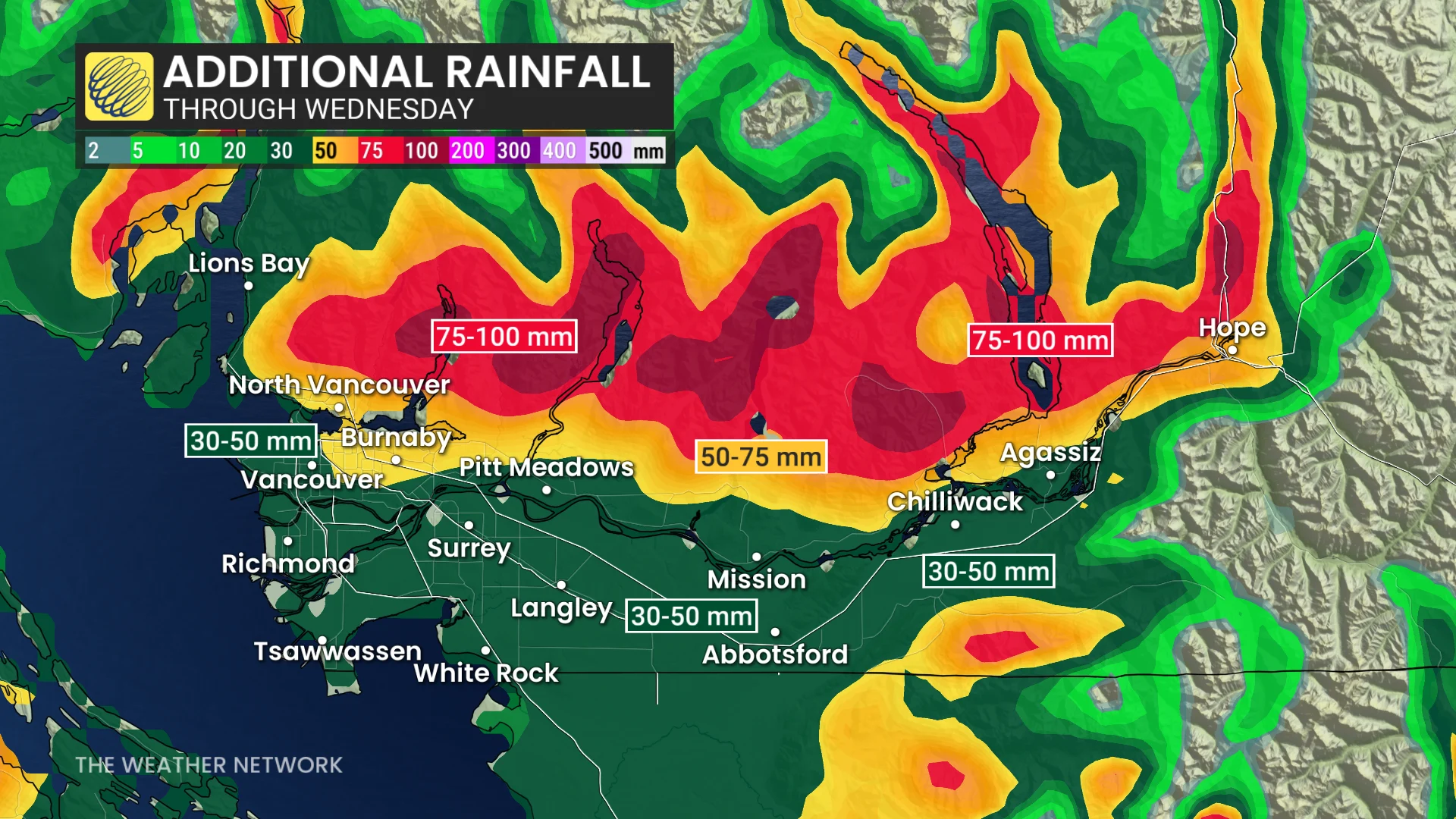
As freezing levels dropped to near 1,000 metres, Grouse and Cypress Mountains may wake up to snow Wednesday morning.
Prairies
After crossing the Rockies, the system redeveloped into an Alberta clipper. It will impact the Prairies through Wednesday and into early Thursday, bringing 10-30 cm of heavy snow and winds gusting 80-100+ km/h.
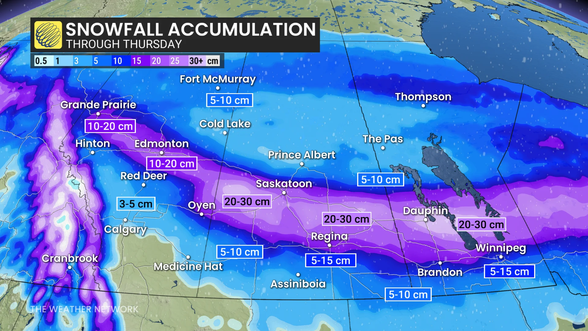
Blizzard conditions are possible from Grande Prairie, Alta., to Winnipeg, Man.
In its wake, a strong cold front will usher in frigid Arctic air across the Prairies, with some cities experiencing temperature drops of up to 30 degrees, and frigid wind chills.