
![]()
Listen to this article
Estimated 4 minutes
The audio version of this article is generated by AI-based technology. Mispronunciations can occur. We are working with our partners to continually review and improve the results.
Travel warnings are in place across central and southern Saskatchewan as an Alberta clipper moves through the province.
An orange weather alert is in place for all of southern Saskatchewan, with yellow warnings for freezing rain or high winds scattered around the province.
Up to 25 centimeters of snow is expected in locations across the province. The snow will be accompanied by strong winds — some reaching up to 100 kilometres per hour — and freezing rain.
The provincial Highway Hotline showed stretches of road not recommended for travel all the way from the Alberta border to the middle of the province. As of 8:30 a.m. CST, a large section of the Trans-Canada Highway between Swift Current and Caronport was closed.
 Saskatoon residents are already dealing with heavy snowfall, with a possibility of it piling higher than 20 centimeters. (Karin Yeske/CBC)
The City of Saskatoon issued a release indicating that its winter emergency response plan has escalated into the second level of response until Dec. 22.
Regina has pulled all recycling, garbage, and food and yard waste collection trucks off the roads. The city says a make-up collection day will happen on Saturday.
City of Regina spokesman Daryl Messier said staff are keeping an eye on the situation.
“Usually we can get a pretty good handle on things within 24 hours,” he said. “We run 24 hours a day regardless of what the weather is here in winter maintenance. So we will have our sanders (trucks) out going hard all night and all day.”
The City of Moose Jaw has reported transit services are shut down, as are garbage and recycling collection. All recreation facilities are also closed.
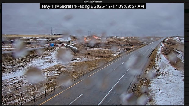
The Saskatchewan RCMP said Wednesday morning that a semi was on fire after crashing on the Trans-Canada Highway near Secretan, Sask., around 9 a.m.. At that time, officers were still on the scene.
WATCH | Highway closed after semi crashes near Secretan: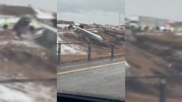
RCMP closes Trans-Canada Highway near Secretan Sask. after semi crash
A semi lit on fire on the Trans-Canada Highway near Secretan, Sask., early Wednesday, as freezing rain, snow and gusting winds made travel treacherous.
As of 1:30 p.m., the Highway Hotline said the road has reopened, but travel is still not recommended.
The storm isn’t expected to taper off until later this afternoon or into the evening.
“If you happen to have a weather bingo card, you’re probably going to be able to fill that weather bingo card today because we’ve got a mixed bag,” said highways ministry spokesman David Horth.
“We’ve got rain, we’ve got snow, we’ve got wind, we’ve got ice. It’s a good day to maybe rethink travel plans if you possibly can.”
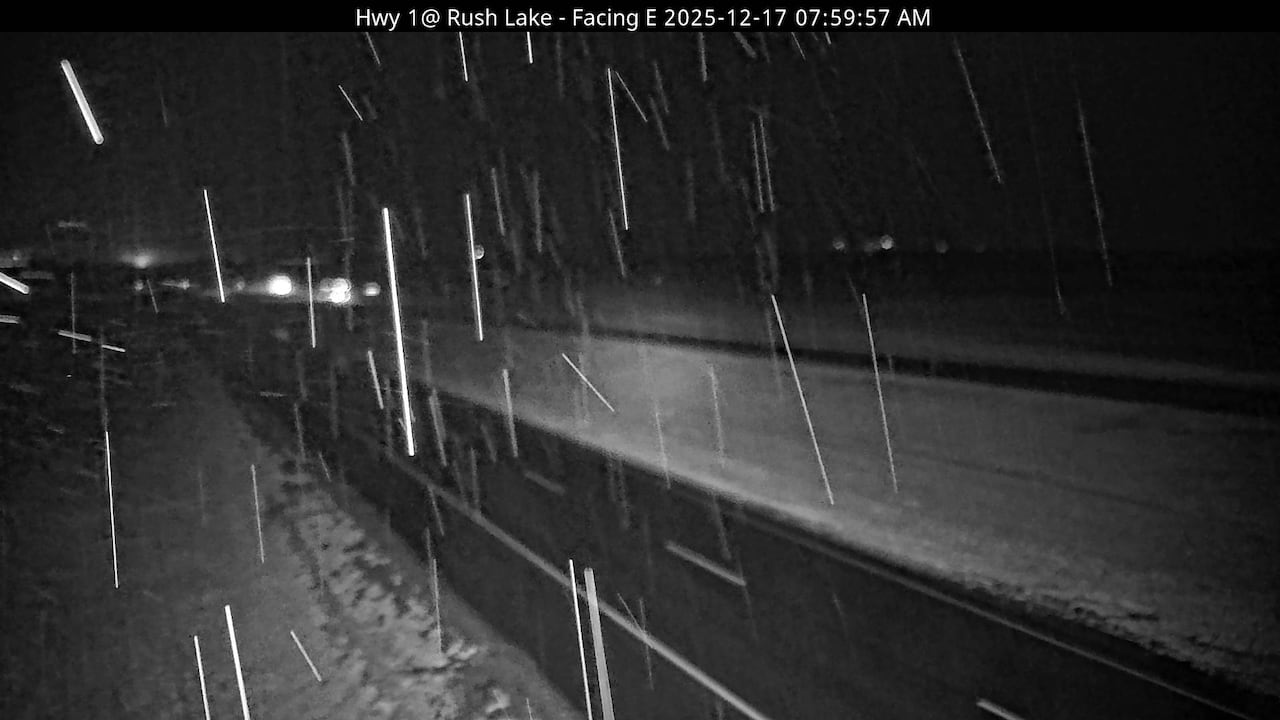 A highway camera caught the road conditions between Swift Current and Chaplin early Wednesday before the main storm. (Highway Hotline)
He advised people to drive for the weather conditions, not the posted speed limits, if they have to drive on the roads. Horth also said people should check the Highway Hotline before they go.
“We’ve got 300 pieces of equipment that can be dispatched at a moment’s notice,” Horth said, noting the plow tracking feature on Highway Hotline.
“You can see that our people are out there, they’re reporting what they’re seeing back. It’s constantly being refreshed, so we’re giving you the best real-time information that we have.”
Jenny Hagan, a severe weather specialist with Golden West, said road conditions will change quickly.
“When we have a lot of warning for these systems, we definitely should be taking those seriously and be staying off the roadways when possible. Conditions change very rapidly, so you can go to zero visibility in a hurry, where you have no idea where the roadway is,” she said.
WATCH | How Environment and Climate Change Canada’s new weather warnings work: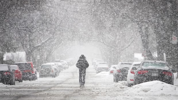
How Environment Canada’s new weather warning system works
Environment and Climate Change Canada has changed the way it classifies its weather warnings. CBC Meteorologist Ryan Snoddon explains it’s all about risk and impact.
Terri Lang, meteorologist with Environment and Climate Change Canada, said drifts will become a serious problem with the wind picking up.
“We are looking for upwards of 12 to 15 centimetres of fresh snow. Combine that with those winds gusting up to 60 or 70 kilometres per hour, and you’re going to see a lot of blowing and drifting snow, especially in the exposed areas of the city on the outskirts of the city.”
Lang said the heaviest of the snow will run along Highway 16 down from North Battleford all the way through to Yorkton, Regina and Moose Jaw, with more than 20 centimetres a real possibility.
“The real kicker will be when the winds come up later this morning and into this afternoon and lasting through this evening,” Lang said. “Combine a bunch of fresh new snow and these winds, it’s going to be getting kind of hairy.”