
Heavy rain ends late this eveningAreas of flooding and/or slides overnightCalmer through Christmas Week; showers at times most days
Don’t forget to download our FOX 12 Weather App to stay ahead of the forecast! Get real-time radar, updates from our team, and exclusive content right at your fingertips.
NEW: Check out First Alert Weather Extra – a streaming show hosted by our weather team! Tune into our FOX 12 Streaming App weekdays at 7 p.m. for a detailed forecast.
FIRST ALERT DAY TODAY FOR HEAVY RAIN & LOCAL FLOODING
Light to moderate rainfall has been ongoing across the metro area and I-5 corridor since early this morning. About an inch has fallen so far in the Portland area.
Rain intensity will pick up as a cold front approaches early this evening. After the front passes, rain turns to light and scattered showers the rest of tonight all the way through Saturday. That change from steady rain to scattered showers should occur in the metro area by 10pm at the latest. But the problem is that 2” or more rain will have fallen and it’ll be causing flooding issues.
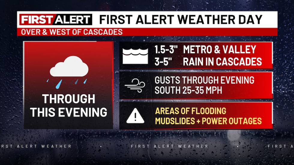 First Alert Weather Day continues this evening(KPTV)
A gusty southerly wind is entering the metro area this afternoon too. That will likely cause a few more scattered power outages on top of the outages still leftover from Tuesday night’s storm. A Wind Advisory is up for that. Wind dies down quickly after 9-10pm.
RIVER FLOODING
15 local rivers are under flood warnings right now.
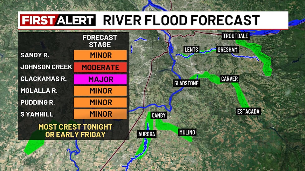 River Flood Forecast(KPTV)
Most are expected to experience MINOR to MODERATE flooding, but the upper Clackamas River may reach major stage late tonight.
Most rivers will crest late tonight or early Friday. A few of the slow-responding rivers won’t crest until late tomorrow or Saturday. This is not a huge/destructive event like the February 1996 flood, but lots of low-lying areas WILL flood in the next 24 hours.
TONIGHT
Heavy rain early changes to light and scattered showers. Be careful on roads as water will cover some areas. Watch for slides and flooding, especially if you travel into hilly or mountainous areas. Low near 40 in Portland
FRIDAY & SATURDAY
A mix of showers, sunshine, and dry spells. MUCH CALMER! Light southwest breezes and a high temperature around 50°
SUNDAY THROUGH CHRISTMAS
Next week will feature the jet stream offshore breaking up a bit, or splitting. More weather action heads into California versus the Pacific Northwest. The result isn’t much dry weather for us, but very weak systems or just scattered showers most days. We don’t see any significant wind next week either. The big message? Weather shouldn’t affect your life much during Christmas Week!
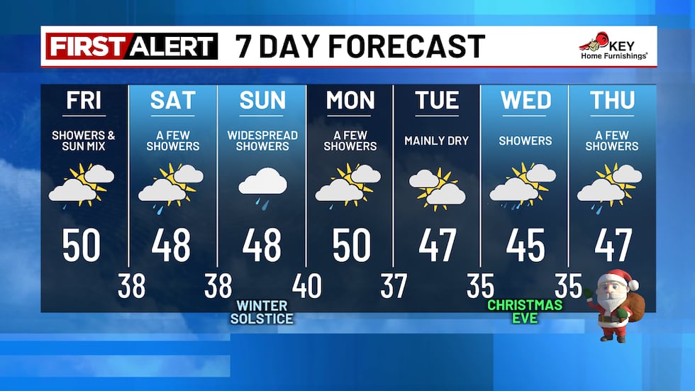 7 Day Forecast(KPTV)CASCADE SNOW UPDATE
6-10” snow falls tonight once the heavy rain ends late this evening. Then a few inches most days in the next week. It’s going to be tough to open up ski areas this weekend…maybe a run or two?
With the wet season upon us, remember you can check the radar before heading out the door on the free FOX 12 Weather App.
Copyright 2025 KPTV-KPDX. All rights reserved.