
The vast, brooding expanse of Lake George, tucked against the foothills of mountains, is a familiar sight to those travelling between Canberra and Sydney.
But beneath its depths lies an ancient geological story.
Using the vibrations from vehicles driving along the Federal Highway, scientists are piecing together the lake’s story.
A team of seismologists from the Australian National University (ANU) have harnessed the energy from passing traffic to generate 3D maps of the Lake George fault zone.
Capturing some of the clearest imagery yet of the sub-surface, these scientists’ work can help refine what we know about seismic activity just outside Canberra’s borders.
The imaging revealed a zone of broken and fractured rock up to 800 metres beneath Lake George. (Supplied: Geoscience Australia)
An innovative method for mapping faults
A fault is essentially a break in the rock caused by seismic activity like earthquakes.
“There are faults everywhere in the world, including right here near Canberra,” Dr Meghan Miller, co-author of the study said.
The Lake George fault, at 80km long, is the largest of three faults in the region. It runs along the western shoreline of Lake George and partially beneath the lake.
“Obviously as seismologists, we are eager to learn about what the seismic potential is near our region,” study lead Dr Chengxin Jiang said.
“We know that Lake George has a fault zone, but we don’t really know how active it is and what the seismic characteristics are.”
But mapping a fault zone is no easy task.
It traditionally requires researchers to measure active earthquakes or create the ground motion themselves.
As far as the ANU team were concerned, the nearby Federal Highway had untapped potential.
Scientists are still trying to understand what causes seismic activity at faults inside plates. (Supplied: ANU)
“When a truck passes by you feel the ground shaking,” Dr Jiang said.
“That wave actually travels a big distance, say a kilometre. And then these kind of ground motions can be picked up by sensors.”
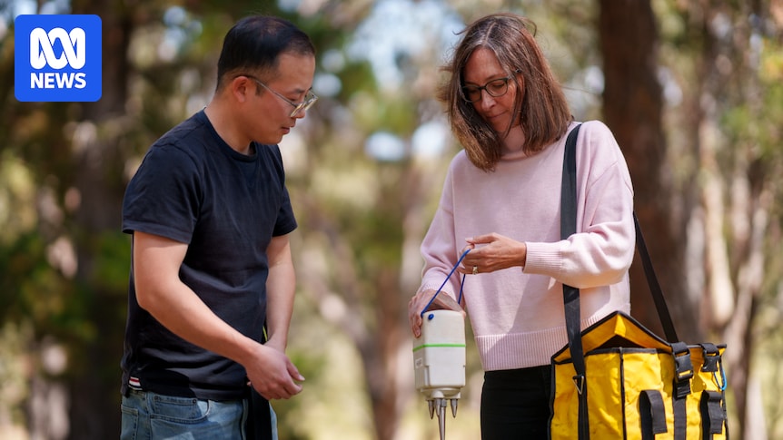
In 2020, the team planted 97 small, “beer-can-sized” sensors along the lake’s western edge.
“They are designed to record earthquakes, but they also record any other sorts of ground motions such a traffic, people walking by, cows, the wind … they’re very sensitive instruments,” Dr Miller said.
Using traffic to map fault lines opens up a lot of opportunity.
Traffic is constant, free and often in urban locations where creating vibrations can otherwise be hazardous.
And the imaging that the team captured only used a fraction of the potential ground movement recordings available in the area.
“To fully understand what the traffic signal noises are … you basically need to understand the whole ground motion response,” Dr Jiang said.
“That really takes quite a lot of time.”
Dr Meghan Miller and Dr Chengxin Jiang are harnessing the energy from passing traffic to generate 3D maps of the Lake George fault zone. (Supplied: ANU)
A snapshot of geological activity
The sensors recorded surrounding activity for 30 days — it is cutting-edge technology, and one of the first studies globally to successfully use traffic noise in this way.
And the result? A glimpse at what lies up to 800 metres beneath one of the region’s most iconic landscapes.
The imaging revealed a zone of broken and fractured rock, an indication of powerful seismic activity in the distant past.
“It’s a snapshot of geological activity,” Dr Jiang said.
“This branch of faults that we observed relating to Lake George may be the result of a magnitude 7+ earthquake in the past few hundred or thousands of years.”
These geological events may seem distant in terms of human timescales, but they have shaped what we see on the surface today.
What causes earthquakes in Australia?
Dr Meghan Miller and Dr Chengxin Jiang are using highway traffic vibrations to map Lake George. (ABC News: Yasmine Wright Gittins)
Australia sits relatively centred within the Australian tectonic plate.
While most people would be familiar with earthquakes that occur at the edges of these plates, such as in the Pacific ‘ring of fire’, scientists are still trying to understand what causes seismic activity at faults inside plates.
“Presently, the continent is moving to the north-east at about seven centimetres a year. We are kind of crashing into [Papua New Guinea] and Indonesia,” Dr Jonathan Griffin, Geoscience Australia Senior Seismologist, said.
“Our continent is getting squeezed.”
Dr Griffin explains that this ‘squeeze’ is thought to be the reason earthquakes are triggered along some faults.
Since 1960, the ACT has recorded 50 earthquakes, with the largest only around a magnitude 3.
But in the nearby Gunning-Dalton region, larger earthquakes have been recorded, including a magnitude 5.6 earthquake in Gunning in 1934.
“The south-east of Australia, including the Canberra region, is one of the relatively higher hazard parts of Australia,” Dr Griffin said.
“But it is much lower comparatively [to New Zealand].”
Dr Jonathan Griffin says being able to map faults in detail is really useful. (Supplied: Geoscience Australia)
Based on research by Geoscience Australia and ANU, the most recent period of activity on the Lake George fault began around 4.2 million years ago.
The mountains that tower above Lake George today are enduring evidence of this activity.
Forming a rugged wall, they rise sharply skyward, pushed upward metre by metre by individual earthquakes over the past 4.2 million years.
“It seems to have happened in pulses of activity,” Dr Griffin said.
“There was a paleo river there … as those hills started to come up it dammed the river, and you had the formation of the lake.”
But at some point, around 800,000 years ago, the fault fell silent.
“That’s challenging for us then we consider what hazard, what risk, does that fault pose to us now in Canberra,” he said.
The most recent period of activity on the Lake George fault began around 4.2 million years ago. (Supplied: ANU)
What to do in the event of an earthquake
The work that the ANU team and Geoscience Australia are doing cannot predict when earthquakes will occur.
But they can help inform planning and hazard assessments.
“If that fault runs through the highway for example, you’re then going to end up with a couple of steps running through your highway,” Dr Griffin said.
“Being able to map in detail where these faults are can be really useful.”
If you do experience an earthquake, Dr Griffin has some clear advice.
“Drop, cover and hold,” he said.
“We tell people to stay where they are, get down, get under something like a table that can protect you from falling debris.
“It’s not a good idea to run out the front door of the building … a lot of the injuries and fatalities that we have seen from recent earthquakes are actually caused by bits of the building falling off the outside.”