
![]()
Listen to this article
Estimated 3 minutes
The audio version of this article is generated by AI-based technology. Mispronunciations can occur. We are working with our partners to continually review and improve the results.
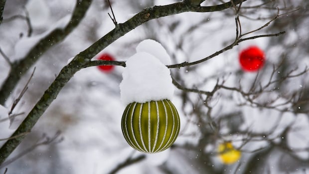
Many parts of Newfoundland and Labrador can expect a winter storm on Christmas Day.
Yellow winter storm warnings are in place for most of the island, which indicates hazardous weather with moderate, localized or short-term impacts.
On the Avalon Peninsula, around 15 to 25 centimeters of snow is expected to fall, with wind gusting between 80 to 100 km/h. It is expected to start Thursday morning.
Snowfall is expected to transition to rain or drizzle by Thursday afternoon, though some parts of the western Avalon may still get snow the entire day.
For areas along the Bay d’Espoir Highway, Connaigre and the Burin Peninsula a total snowfall amount of 10 to 14 cm is forecasted, with maximum wind gusts from 60 to 80 km/h are expected to start early Thursday morning.
Similarly, from Clarenville to the Bay of Exploits area, 15 to cm of snow with wind gusts from 80 to 100 km/h are expected to start Thursday morning.
For the Green Bay, White Bay, Grand Fall-Windsor area, a total snowfall of 10 to 20 cm is forecasted with maximum wind gusts from 70 to 90 km/h. It’s expected to start in the morning. Those winds are expected to increase to 80 to 110 km/h by the evening.
“There will also be some strong winds with the snow, so visibilities will be reduced and blowing snow throughout the day on Christmas,” said Environment Canada meteorologist Veronica Sullivan.
Winter storm watch
Winter storm watches are also in place for parts of northern Newfoundland and southern Labrador.
Environment Canada says a winter storm is expected to start in this area on Christmas Day an go into Boxing Day.
Sullivan expects these storm watches to turn into storm warnings on Wednesday.
A yellow winter storm watch is in place for the eastern part of the island’s Northern Peninsula. Around 15 to 25 cm of snow with wind gusts of 80 to 100 km/h are expected to start Thursday.
Environment Canada notes the worst conditions are expected to occur overnight Thursday, with winds expected to ease Friday.
 Meteorologist Veronica Sullivan says people in parts of Labrador should consider changing any travel plans. (Submitted by John Roberts)
In southeastern Labrador, from Cartwright to Lodge Bay, an orange winter storm watch is in place, which indicates severe weather that will have major, widespread and longer-lasting impacts.
Around 30 to 50 cm of snow with wind gusts of 100 to 120 km/h is expected to start Christmas night into Boxing Day.
Sullivan said people in these areas should consider changing any travel plans made for Christmas Day into Boxing Day.
“If you are able to move your travel plans to before the storm or after the storm…that would be ideal because it will be a messy day for sure,” she said.
Western Labrador might warm up a little for Christmas, as a yellow cold warning is expected to end Wednesday.
Download our free CBC News app to sign up for push alerts for CBC Newfoundland and Labrador. Sign up for our daily headlines newsletter here. Click here to visit our landing page.