
“Storm Floris will bring wet and unseasonably windy weather during Sunday night and Public Holiday Monday,” the national forecaster said.
It warned that potential effects include dangerous travelling conditions, knock-on impacts for outdoor events, structural damage, fallen trees, debris and loose objects, power outages, wave overtopping and localised flooding due to leaves.
A weather advisory does not reach the severity threshold of the colour coded Status Yellow, Orange and Red warning system used by Met Éireann.
Until the arrival of the storm, the weekend is set to be relatively settled but Met Éireann pointed out that a greater number of people would be exposed to these weather conditions due to large number of outdoor events and peopl camping at this time of the year.
It comes after Britain’s Met Office issued a Status Yellow warning for “unseasonably windy” conditions on from 6am Monday to 6am Tuesday, with winds of up to 140kmh on Scottish coasts.
Ahead of the windy conditions, Ireland’s August bank holiday weekend is predicted to stay largely free of rain.
Kicking off the weekend with plenty of cloud cover, this morning will begin with some rainfall in the north and east of the country.
However, sunnier skies will predominate for most of the afternoon thereafter, bringing temperatures of up to 21C before cooling down to 13C by night.
Saturday morning will have dry sunny spells, but cloud from the west may cause isolated rainfall in some parts, with highest temperatures of 16C to 21C.
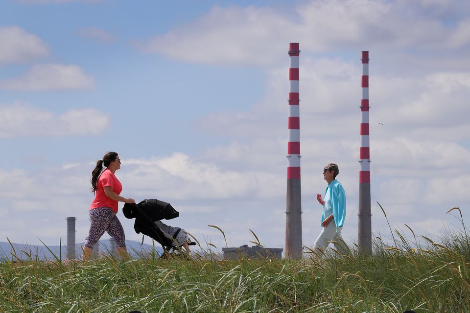
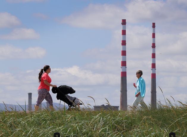
Walkers in the sunshine on the Bull Wall, Clontarf. Photo: Frank McGrath
7 Day Weather Forecast – 29th July – 4th August
The night will be mostly cloudy too, bringing persistent rain particularly in the west which should clear up by the morning.
That clearing will bring drier and brighter conditions with some showers confined to the northwest, while cloud will begin to build up again from the southwest as the evening approaches.
However, Sunday evening is where the weather will become damp and unsettled as rain starts to come in from the west.
Met Éireann says bank holiday Monday will consist of “unseasonably” strong and gusty westerly winds with widespread rain covering the northwest before moving eastwards in the afternoon.
Winds are expected to ease later in the day followed by sunny spells and scattered rainfall with highest temperatures of 16C to 21C.
Storm Floris, which was named by the UK’s Met Office, has not formed yet, and is expected to track to the northwest of Ireland bringing a spell of heavy rain and very strong winds.
An unusually strong Jet stream for the time of year will carry the system towards Ireland through the weekend, with the storm deepening rapidly.
“There is still some uncertainty in the details so the full impacts of the system cannot yet be determined,” said Met Éireann forecaster Andrew Doran-Sherlock. “By Saturday though, the event will be within the range of our high-resolution DINI forecasting model and warnings will be issued.
“However, as this is a Public Holiday Weekend with a large number of outdoor events and with many people going camping, etc, and with an increased usage of temporary structures such as tents, more people will be at a greater risk of exposure than would normally be the case.
“And while we are in a period of neap tides, with lowest tidal ranges of this cycle expected on Sunday and Monday, strong onshore winds and high waves may cause wave overtopping in low-lying coastal areas in the northwest and west.
“Our advice would be to pay attention to the weather forecasts and warnings issued over the weekend and take them into consideration with any plans you have. And as always, please heed the advice of local authorities.”