

An Arctic front arrives early Monday. This front will send temperatures plunging, introducing a snowier and colder pattern into the new year.
CLEVELAND — The WKYC Weather Team has declared this coming Monday a Weather Impact Alert Day.
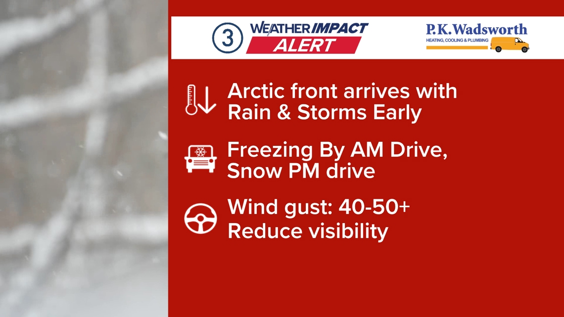
Sunday’s warmth will dramatically conclude with the passage of an Arctic front arriving very early Monday. This front will bring showers and storms with gusty winds possible.

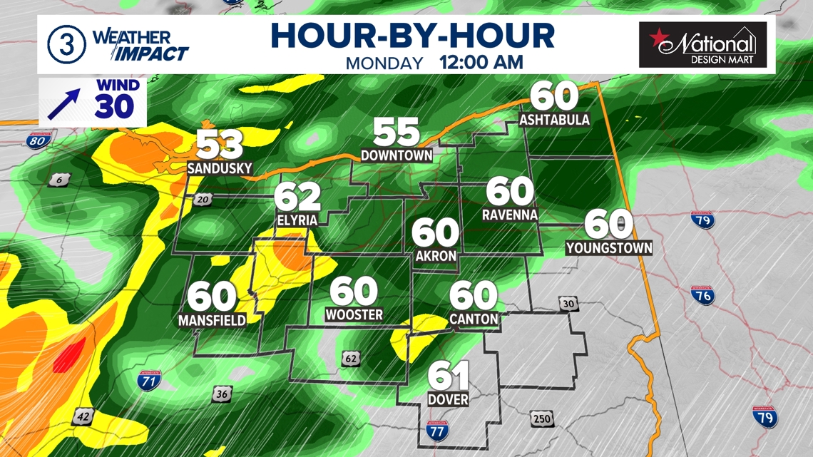
Midnight temperatures will be in the 50s and low 60s to start Monday, but cold air will wrap in behind the front, and temps will fall below freezing by sunrise. This will be a gut punch to the system: Some communities will go from the 60s Sunday night to the 20s by the Monday morning drive.

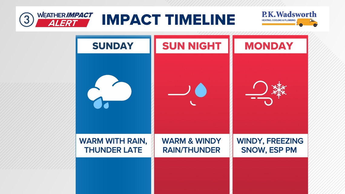
The main impact Monday morning will be the the rapid drop in temperatures. Areas of standing water could freeze as temperatures drop quickly. Cold air and gusty winds settle in for the day and will be compounded with lake snow showers developing by the afternoon. These showers will be accompanied by gusty winds, and the combination of the two will create visibility issues on the roads for the PM drive.

Frigid air stays in place for the rest of the week with lake effect remaining possible through at least Tuesday.
Stay tuned for future updates.