
MARQUETTE, MI – An intense winter storm that is forecast to bring blizzard conditions to part of Michigan’s Upper Peninsula overnight and into Monday has shifted its track – and the expected snowfall totals have increased, the National Weather Service said.
The blizzard conditions slated to develop over the northern tier of the U.P. are expected to create areas of zero visibility. This will be especially true near the Lake Superior shoreline area, where heavy lake-effect snow is set to coincide with high wind gusts topping 60 mph.
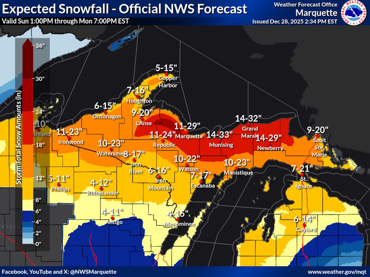
When the storm track shifted earlier today, the NWS meteorologists in Marquette also adjusted the areas and amounts of heavy snowfall that’s expected between now and early Tuesday.
“Important update: Trends in storm track have resulted in a southeast shift of the heaviest snowfall axis. Areas of 1 to 2 feet will be common from the high terrain of the central UP eastward along and north of M-28,” the NWS team said.
“Strong northerly winds may result in downed trees and power outages. Please take extreme caution if you must travel over the next 24 hours. Stay safe! Check in on your neighbors!”
Currently, the snowfall forecast is for up to 33 inches near Munising, up to 32 inches near Grand Marais, and up to 29 inches near Newberry and Marquette.
Snowfall rates could be as high as 2+ inches per hour in the higher terrain areas of Baraga and Marquette counties, the NWS said.
Initially the snow will be heavy and wet. As it intensifies, the snow will become lighter and drier – easier to blow around in the high winds.
To see the latest update on this storm coverage, follow our headlines on the MLive Weather page.