
Weather models show heavy snow is forecast across the UK in early January, with up to 48cm (19 inches) possible in the far north of Scotland and major cities set to be impacted.
Peter Davidson and Ethan Blackshaw Social News Content Editor
19:40, 28 Dec 2025
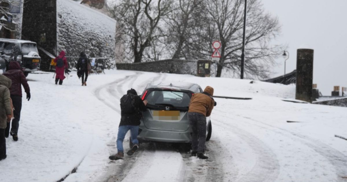
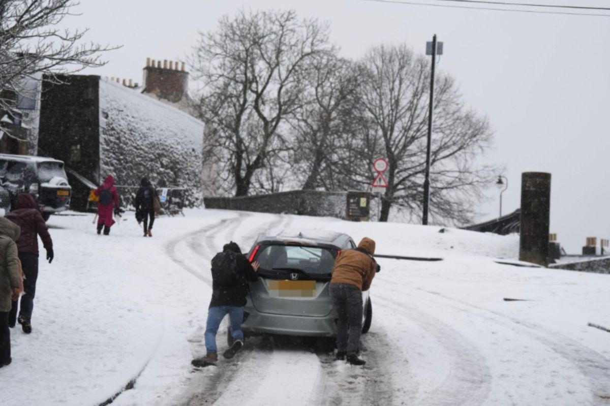 Snow is forecast for parts of Scotland(Image: PA)
Up to 19 inches of snow could soon blanket parts of the Scotland as a series of blizzards are forecasted to strike in January.
The ECMWF weather model indicates that nearly all areas, bar one, will experience snowfall, affecting major cities such as London, Birmingham, Cardiff, Manchester, Liverpool, Belfast, Leeds, Newcastle, Edinburgh and Glasgow.
Scotland is predicted to see snowfall throughout the initial days of January, but by January 7, the maps suggest wintry showers could shift southwards, impacting Northern Ireland, Wales and England as well.
Around midday on January 7, snow could be falling at a rate of approximately four inches per hour in the north-west of England and North Wales. The maps indicate heavy snow in South Wales at midnight, with flurries also affecting the south-west and the Midlands around this time.
This heavy snowfall is then projected to move eastward, covering vast areas of England – including parts of London – by 6am on January 8. Where the flurries are most intense, particularly around central and eastern England, snow could be falling at a rate of about four inches per hour, reports the Mirror.
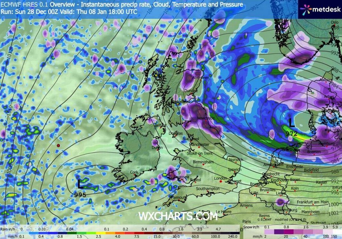 (Image: WX Charts)
Another bout of snow could then hit the north-east and Scotland on the evening of January 8, with additional flurries also possible in Northern Ireland and parts of Wales around 6pm.
Snow coverage charts reveal that almost every corner of the country could be affected by snow during this period. The very south of England seems to be the only region without snow on the ground by midday on January 8.
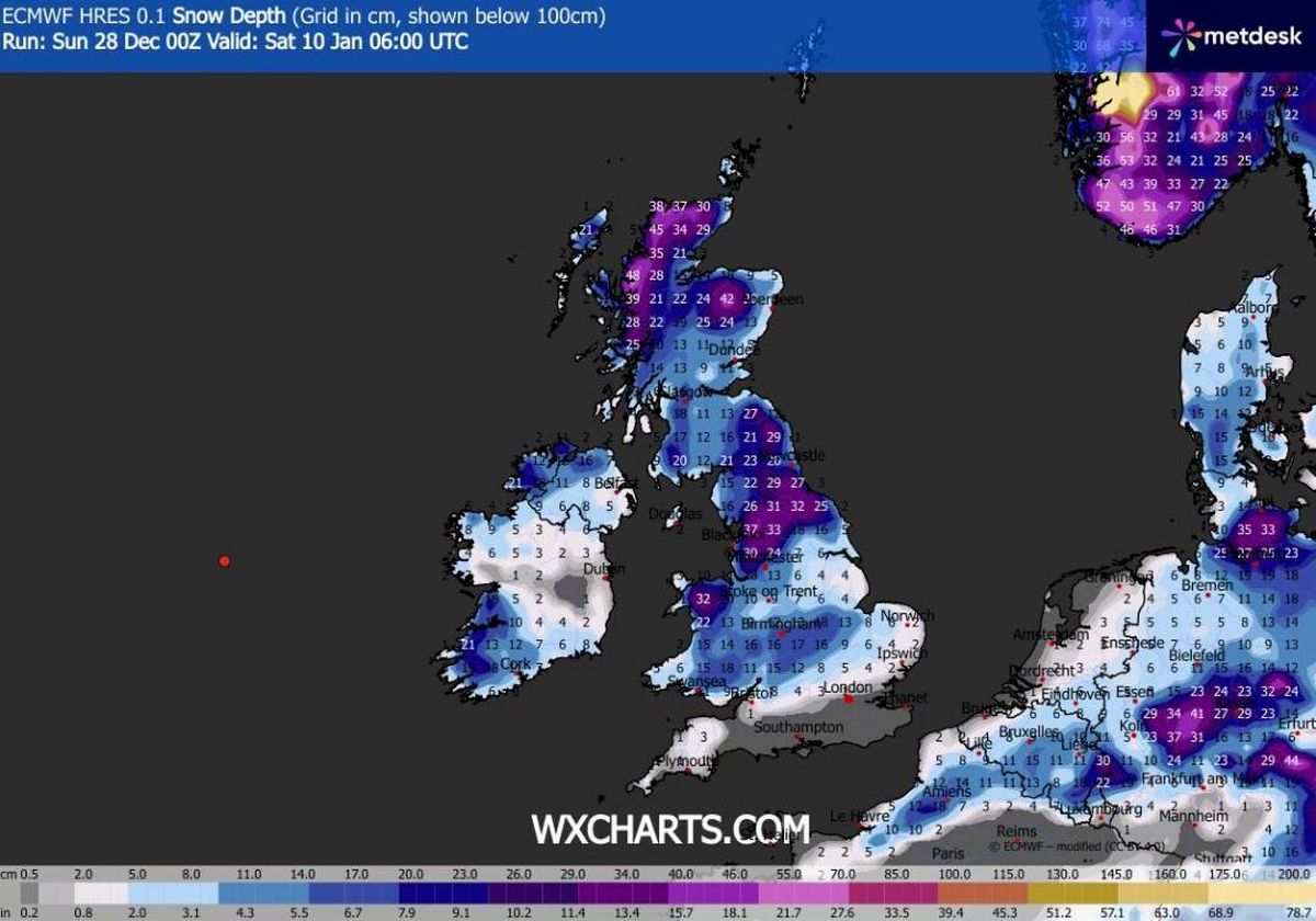
Snow depth projections reveal substantial accumulations of the white stuff are anticipated across the country. The heaviest falls are forecast for Scotland’s far north, where depths could reach 48cm (19 inches), though significant snowfall may also affect lower-lying areas across England, Wales and Northern Ireland.
North-west England could witness accumulations of up to 37cm (11 inches), according to the data. South Wales might experience 18cm (seven inches), whilst Northern Ireland could see 16cm (six inches).
Join the Daily Record WhatsApp community!
Get the latest news sent straight to your messages by joining our WhatsApp community today.
You’ll receive daily updates on breaking news as well as the top headlines across Scotland.
No one will be able to see who is signed up and no one can send messages except the Daily Record team.
All you have to do is click here, select ‘Join Community’ and you’re in!
We also treat our community members to special offers, promotions, and adverts from us and our partners. If you don’t like our community, you can check out any time you like.
To leave our community click on the name at the top of your screen and choose ‘exit group’.
If you’re curious, you can read our Privacy Notice.
The Met Office has now confirmed snow is likely across multiple regions as we enter next month. The national forecaster’s outlook for January 2 to 11 explains: “Cold northerly winds, initially across Scotland are now expected to become dominant across the whole UK in the first week of January.
“These will bring wintry showers (often of snow) to many coastlines (and areas just inland of these) that are exposed to onshore winds. Subtle day-to-day changes in wind direction from northeast to northwest will change the places most exposed to the showers, but many inland locations across central and southern areas will remain mostly dry but cold.
 (Image: WX Charts)
“There are likely to be some more coherent bands of rain, sleet and snow working south, and these may bring a risk of more prolonged wintry precipitation affecting some inland areas. Towards the second half of this period, slightly milder conditions will attempt to move in from the west.”
Meanwhile, an amber cold health alert has been issued for the North East and North West of England from 8pm today until 12pm on January 5. These areas are forecast to see temperatures plummet to approximately 3-5C.
The UKHSA has warned that the conditions are “likely” to cause significant impacts across health and social care services, including a “rise in deaths” among those with health conditions or aged 65 or over.