
![]()
Listen to this article
Estimated 3 minutes
The audio version of this article is generated by AI-based technology. Mispronunciations can occur. We are working with our partners to continually review and improve the results.
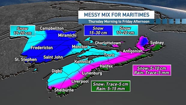
2026 will begin with another weather system tracking through the Maritimes.
An incoming Alberta clipper will move into the region throughout the day on Thursday, bringing flurries and then snow, or a mix with rain for some, followed by gusty winds into Friday.
The system is set to strengthen as it moves into the Gulf of Maine and then across the region on Thursday and Thursday night, which makes forecasting the snowfall a bit more challenging.
As of now, it appears the heaviest snowfall will land across western Nova Scotia, much of New Brunswick and P.E.I., where amounts of 10 to 20 centimetres are looking likely. Parts of central and northeastern New Brunswick could see totals closer to 30 centimetres through Friday afternoon.
Rain will mix in along the Atlantic coastline and across eastern areas of Nova Scotia, including Cape Breton, keeping totals lower in these areas.
Timing
The timing of the system will be key for those with travel plans, so let’s take a closer look at those details.
Thursday itself will be mainly cloudy with some bands of flurries ahead of the developing system. Showers are looking set to mix in along the Atlantic coastline. We’ll see steadier snow developing Thursday afternoon in the southwest of Nova Scotia and New Brunswick.
That snow is then expected to move in across the rest of Nova Scotia, New Brunswick and P.E.I. throughout Thursday evening.
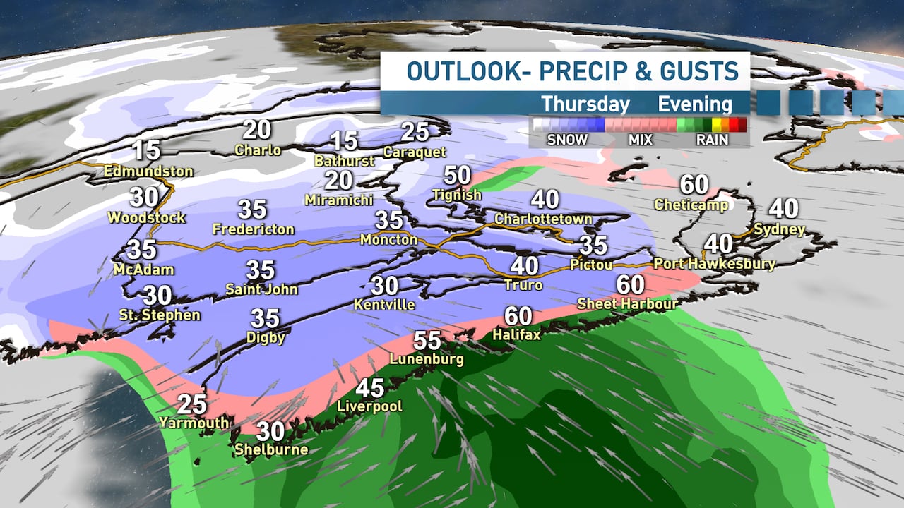 Thursday evening will see snow, rain and a mix of the two sweeping across the region. (Ryan Snoddon/CBC)
Again, the snow looks set to mix with rain along the Atlantic coastline and then across eastern areas of Nova Scotia throughout the evening and into early overnight.
By Friday morning, the centre of the low will be over the Gaspe region with lingering bands of flurries and strong northwest winds wrapping into the region behind the system.
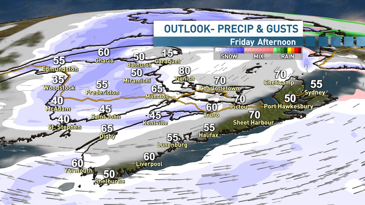 Friday morning will see winds gusting up to 70 km/h in some parts of the Maritimes. (Ryan Snoddon/CBC)
Those northwest winds gusting 50 to 70 km/h will lead to some blowing and drifting snow for open and exposed areas throughout Friday, especially across northeast New Brunswick, P.E.I. and northern Cape Breton. There will be a risk of snow squalls and blowing snow for northwestern Nova Scotia.
Quieter conditions are on tap for the weekend, with some very cold air settling into the region, especially for Sunday.
MORE TOP STORIES