
![]()
Listen to this article
Estimated 2 minutes
The audio version of this article is generated by AI-based technology. Mispronunciations can occur. We are working with our partners to continually review and improve the results.
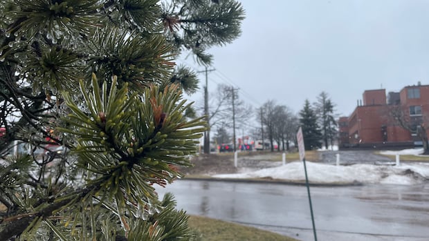
Prince Edward Island could see a mix of wintry precipitation that may lead to a messy Wednesday afternoon commute.
A special weather statement is in effect for all three counties for Wednesday afternoon and evening.
Environment Canada said a low-pressure system is expected to track just south of Nova Scotia, with precipitation expected to start as rain before changing to snow early Wednesday evening. The weather agency warns freezing rain is possible during the transition.
CBC P.E.I. meteorologist Jay Scotland said western areas of the province are most likely to see the precipitation fall as wet snow, while eastern areas will see mostly rain. The central part of the Island can expect a messy mix.
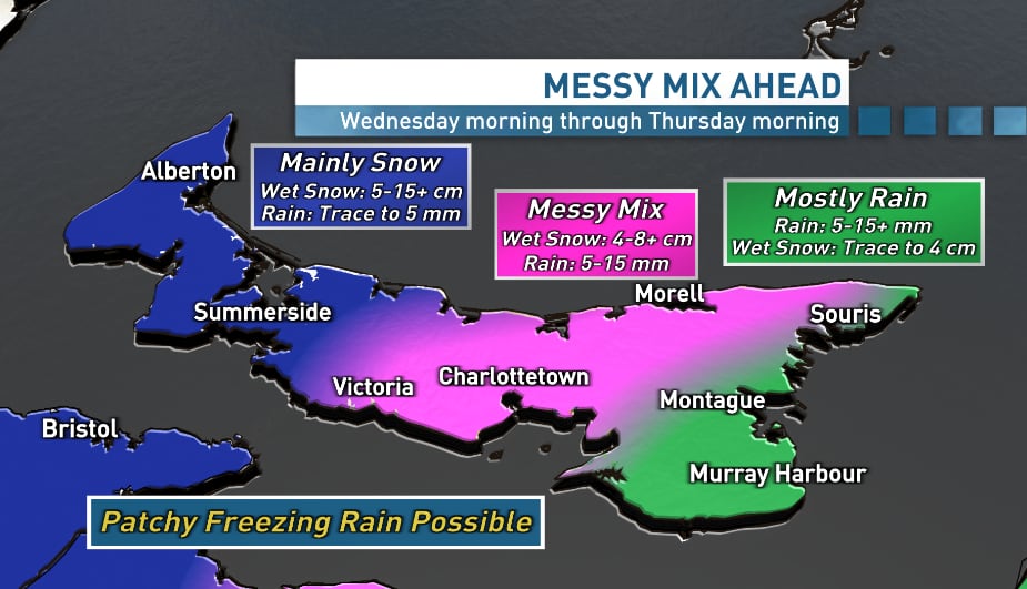 CBC News meteorologist Jay Scotland says the heaviest snow potential is for western areas, where five to 15 centimeters is possible before tapering off Wednesday night into Thursday morning. (Jay Scotland/CBC)
“Wet snow, melting snow and rain will make roads slushy and/or soggy for Wednesday afternoon and evening,” Scotland said.
“As the temperature edges back down Wednesday night into early Thursday, untreated surfaces may become icy, and some fresh snow will also fall during that time.”
Environment Canada said snowfall amounts could total 10 to 15 centimetres or more in some areas, while freezing rain could last for one to two hours in eastern regions of P.E.I.
It said snowfall warnings may be required as the low-pressure system approaches.