

![]()
Listen to this article
Estimated 3 minutes
The audio version of this article is generated by AI-based technology. Mispronunciations can occur. We are working with our partners to continually review and improve the results.
The B.C. River Forecast Centre is issuing a high streamflow advisory for much of B.C.’s coast, including the south and north coasts, north and west Vancouver Island and Haida Gwaii.
The advisory means river levels are expected to rise rapidly but no major flooding is expected, though minor flooding in low-lying areas is possible.
A high streamflow advisory is the least severe of agency’s three flood warning levels.
The forecast centre said a series of atmospheric rivers are expected to affect the B.C. coast this weekend and into next week.
“Prolonged periods of moderate to heavy rain are possible, along with warmer temperatures and additional runoff from rain-on-snow melt,” said the forecast centre’s bulletin Friday.
The heaviest period of rain for the North Coast, Haida Gwaii, Central Coast and Vancouver Island is expected from Saturday to Sunday, while on the South Coast and Lower Mainland, it’s expected mid-day Sunday through Monday.
In the northern regions, peak river levels are expected on the weekend and, on the Island and the South Coast, from Sunday to Monday.
“Extra vigilance is appropriate through the weekend and into Monday, with the expectation that this weather pattern could lead to escalating flood hazard.”
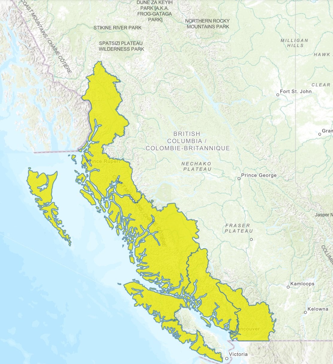 Much of the B.C. coastline is under a high streamflow advisory issued Friday. (B.C. River Forecast Centre)
Emergency Info B.C. is warning residents to avoid fast-flowing rivers and potentially unstable riverbanks, according to a post on X.
Rainfall, wind warnings in the North
Environment Canada has issued rain and wind warnings in parts of the North Coast, including Prince Rupert, and inland including Kitimat and Terrace from Friday to Saturday.
Between 50 to 100 millimetres of rain could fall, after five to 10 centimetres of snow fell inland sections of Highway 16 and 37 and near Terrace.
“An atmospheric river continues to impact the North Coast today bringing significant rainfall over a 24 to 36 hour period. Temperatures are cool enough inland that a mix of snow and rain continues early this morning before changing to rain.”
Strong winds that could cause damage are expected on Haida Gwaii, the north and central coasts and North Vancouver Island’s exposed coastal sections.
Winds could blow between 80 to 100 km/h, and up to 120 km/h Friday afternoon and night.
Environment Canada said there is an increased risk of power outages, and reminded residents to secure loose objects and stay away from fallen power lines.
Heavy snowfall is expected inland on the North Coast, including Stewart, according to Environment Canada, predicting the snow would turn into rain through the weekend.