
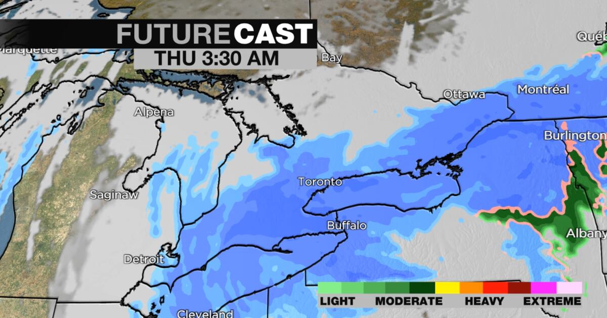
Environment Canada has issued a yellow snowfall warning for Toronto, forecasting significant amounts to begin falling Wednesday night.
Environment Canada (EC) has issued a yellow snowfall warning for Toronto, forecasting significant amounts to begin falling Wednesday night and lasting through to Thursday afternoon.
The weather advisory says amounts of 10 to 20 centimetres are expected to fall, leading to reduced visibility and blowing snow.
In addition to the snowfall warning, Environment Canada is warning of a temperature drop “leading to cold wind chills by Thursday morning.”
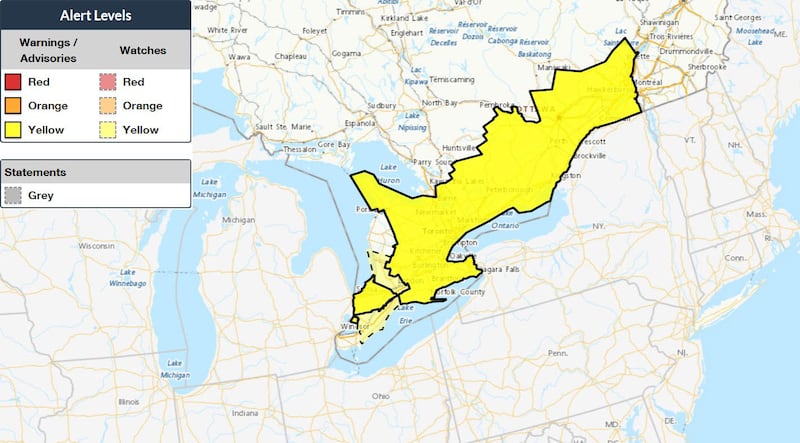 Weather advisories in southern Ontario Map highlights where weather advisories and statements have been issued in southern Ontario as of Tuesday afternoon. (Environment Canada)
The temperature could drop to -9 C and feel as cold as -22 on Thursday morning, according to Environment Canada. The frigid cold will linger throughout the day with the temperature still feeling like – 16 on Thursday afternoon.
Cities in Durham, York, Peel, Halton, Hamilton, and Niagara regions are also under the same yellow snowfall warning.
“Thursday’s morning commute is likely to be impacted by snow,” said CTV News Toronto weather anchor Lyndsay Morrison. “It looks like we could be in for five to 15 centimetres of snow overnight tonight and through Thursday morning for parts of the GTA and across the 401 corridor. Hardest hit areas could even see up to 20 centimetres, and that could include areas like Niagara and Prince Edward County.”
Morrison added that temperatures in many areas of the GTA will be in the minus double digits throughout the day on Thursday, and lake effect snow could impact regions south and east of Georgian Bay and Lake Huron.
If the forecasted 10 to 20 centimetres materializes, it could mark the snowiest day in Toronto so far this winter. The most snow recorded in one day at Toronto Pearson International Airport so far this season was 12 centimetres on December 26.