Arctic air will bring heavy snow and extreme wind chills to WNY.
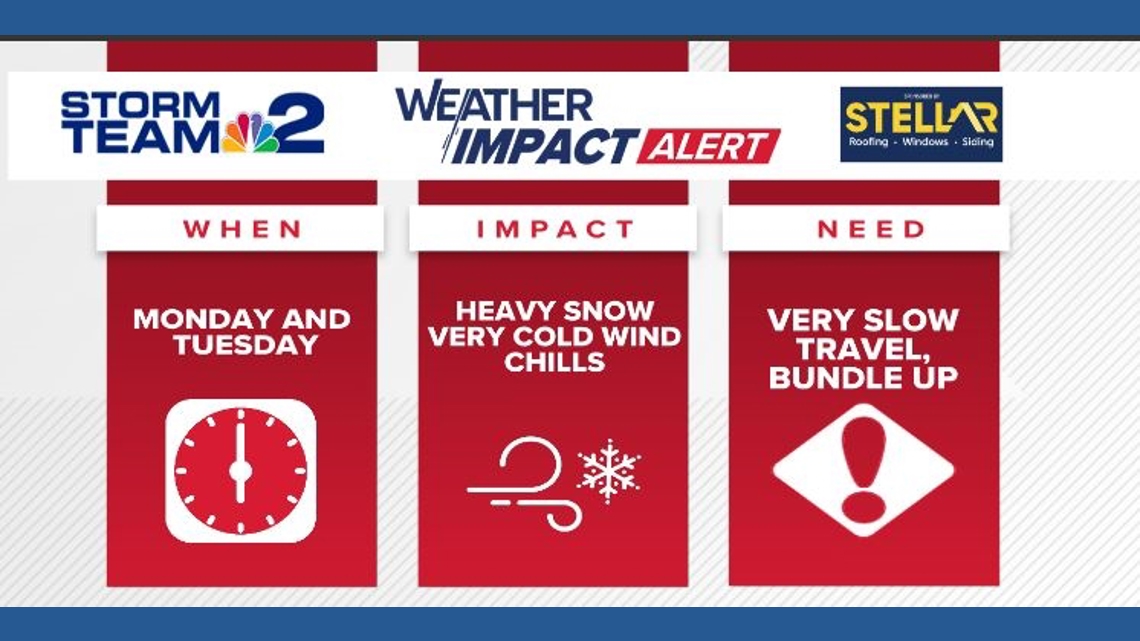
BUFFALO, N.Y. — Storm Team 2 has issued a Weather Impact Alert for Monday and Tuesday of next week due to snow and very cold wind chills.
Light snow is expected later Friday evening and into Saturday with relatively mild temperatures. Minor accumulations are expected.
Colder air begins to arrive on Sunday, and as a result, lake effect snow will develop on Sunday especially from Buffalo to Niagara Falls. The Southtowns and Southern Tier may avoid snow on Sunday.
Then an arctic front moves into Western New York on Monday setting the stage for bursts of heavy snow.
A Winter Storm Watch has been issued for Niagara, Erie, Chautauqua, Cattaraugus, Orleans, Genesee, and Wyoming counties. The watch goes into effect Sunday evening and continues through Wednesday afternoon. Over half a foot of snow is likely in the areas where the heaviest bands of snow set up, with locally higher amounts possible. Plan for difficult travel Monday and Tuesday with even some school delays or closures.
In addition to the heavy snow, temperatures will be very cold heading into next week with the coldest air of the season so far expected on Tuesday as wind chill values could fall to between 10 and 20 below zero.
The exact location of the heaviest lake effect snow could still change over the next several days, but most should expect to see periods of snow, heavy at times, throughout much of the week. Stay tuned to Storm Team 2 for the latest updates on location and timing of this upcoming lake effect event.