

Published on Jan. 18, 2026, 1:18 PM
A potent nor’easter is on the way to Atlantic Canada to close out the weekend, threatening much of the region with heavy snowfall and blustery conditions into Monday
A strong nor’easter is knocking on the doorsteps of Atlantic Canada and will soon bring impactful, wintry conditions to the region as the weekend ends and the week begins.
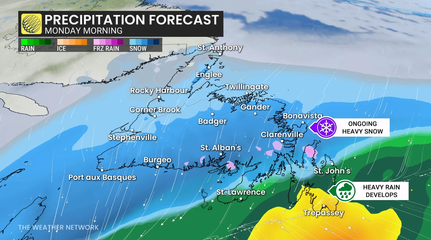
Residents should prepare for potential travel issues, including a dicey Monday morning commute, as well as the risk for power outages in areas where winds gust to more than 100 km/h. As well, anticipate school delays or closures with a swath of 10-30 cm of snow, depending on location.
DON’T MISS: Second half of January looking much colder across Canada
Roads and walkways will likely be difficult to navigate due to accumulating snow. Local utility outages are possible. Be sure to keep up with the latest highway conditions before hitting the road.
Nor’easter threatens snow and high winds
Forecasters are watching a developing storm off the U.S. East Coast that will affect Atlantic Canada late Sunday and into Monday. This system will rapidly intensify as it approaches the region, potentially meeting weather bomb criteria.
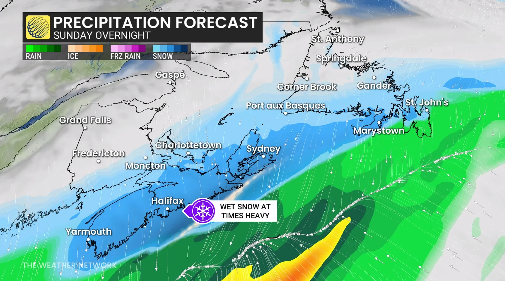
Cold air to the north combined with subtropical moisture pushing in from the south will lead to widespread precipitation spreading over the Maritimes on Sunday overnight and into Newfoundland through the overnight hours.
MUST SEE: El Niño incoming? Forecasters see signs of big changes ahead
Slick roads and slushy conditions are forecast across Nova Scotia roads, with heavy, accumulating snow.