
SEE ALSO: Blue Monday: Tips for a healthy winter routine to help manage SAD
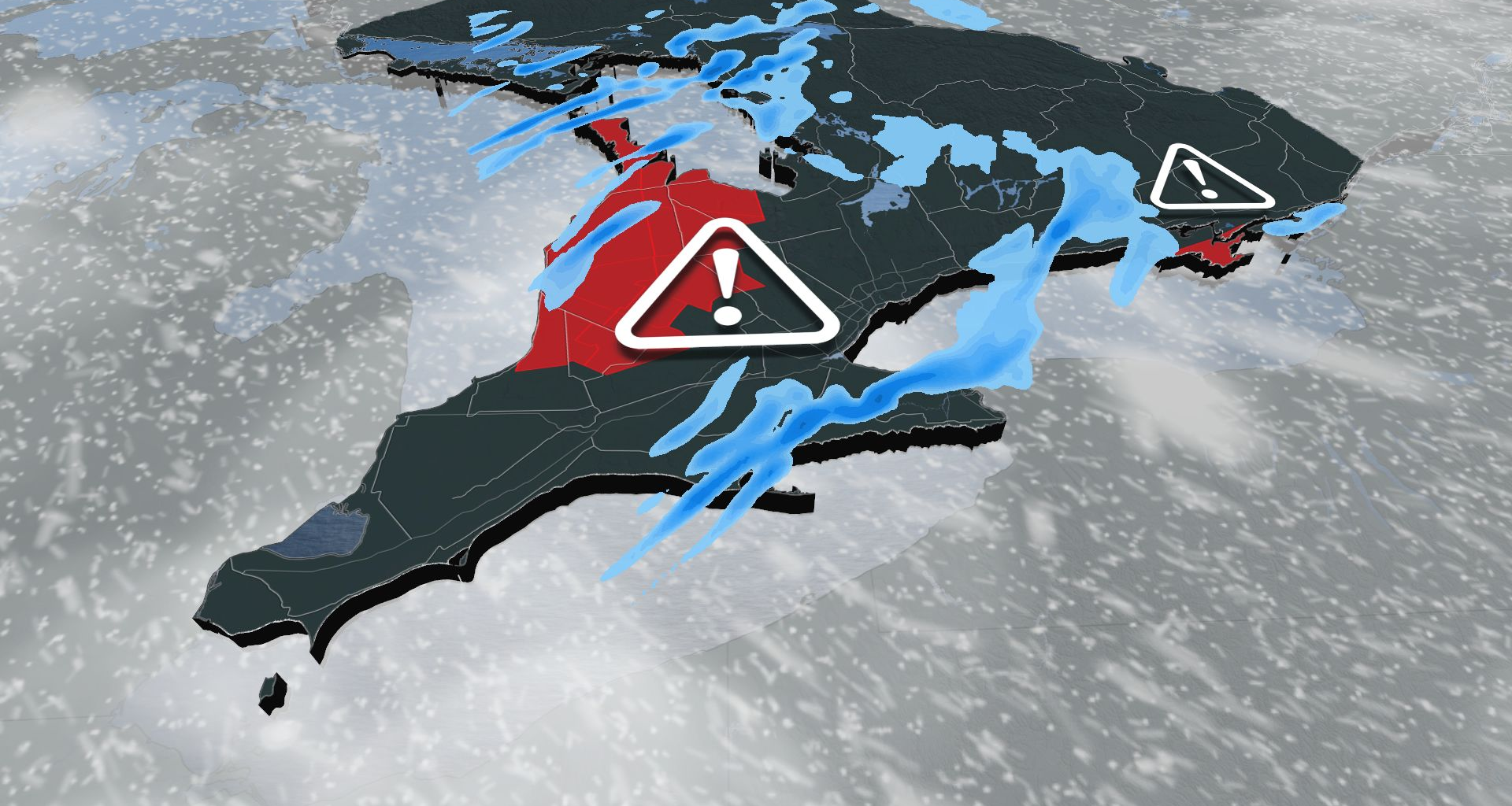
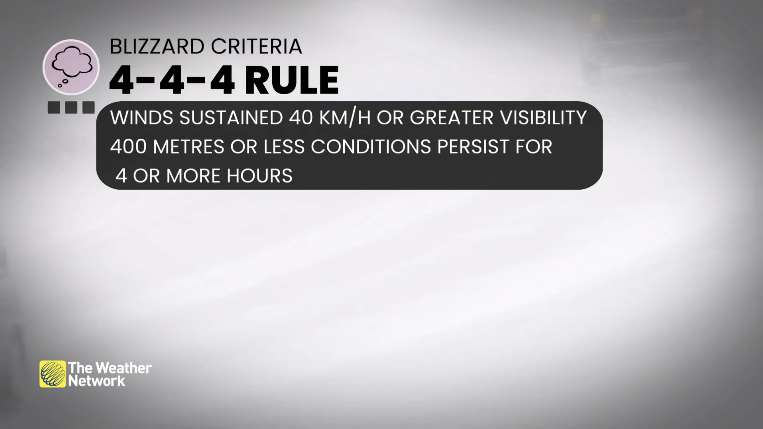
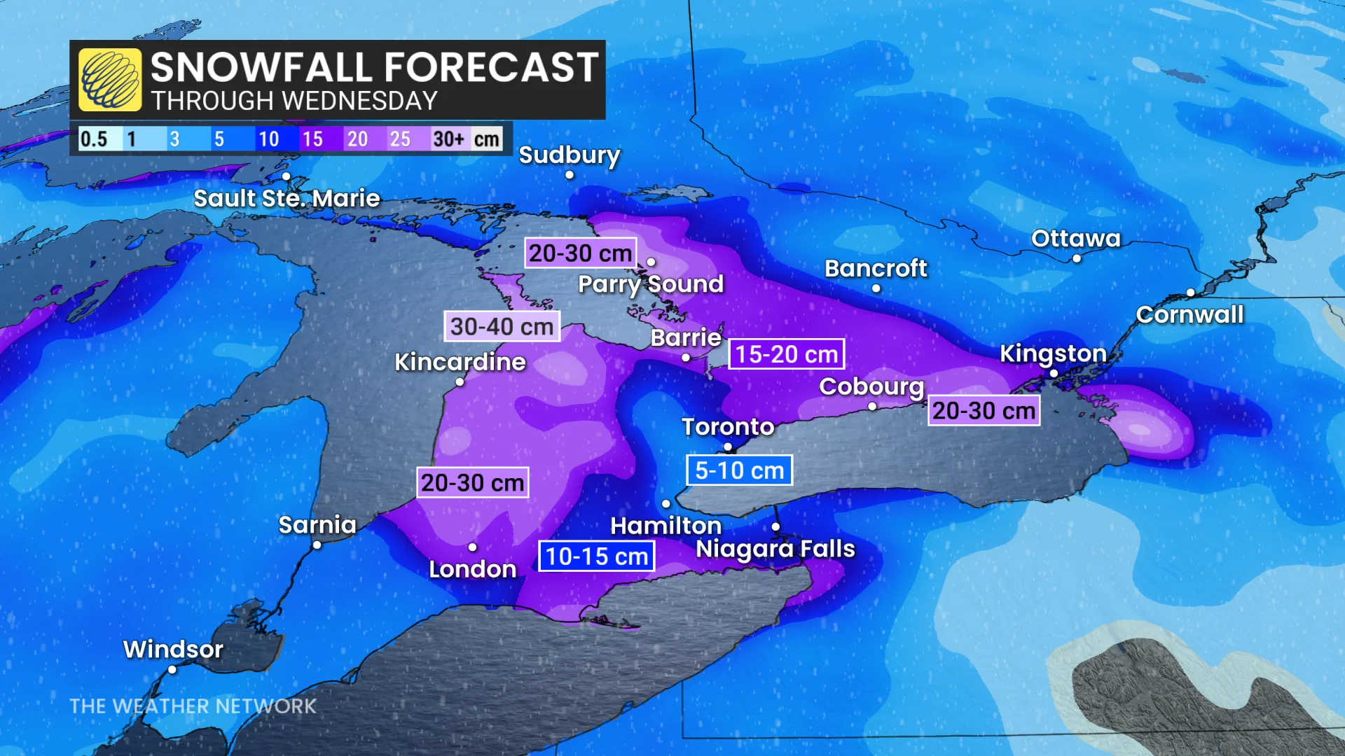
From Kingston to Cobourg and west to Oshawa along Highway 401, including Prince Edward County, bands of heavy snow and blowing snow will significantly impact visibility. Prince Edward County is under a blizzard warning, with 70-90 km/h wind gusts and 20-30 cm of snowfall expected. A widespread blowing snow advisory is also in effect.
The snowbelts off Lake Huron and Georgian Bay will feel prolonged impacts, with 70-90 km/h gusts and snowfall amounts between 20-40 cm. The north shore of Lake Erie, including Niagara Falls, Welland, and Fort Erie, has snowsquall warnings, with 10-20 cm of snowfall and similar wind gusts.
Areas downwind of Georgian Bay should stay particularly alert by Monday evening, as traditional snow squalls with cooler westerly winds bring an additional 15-25 cm by Tuesday morning. Rapidly changing conditions and near-zero visibility within squalls will likely cause travel disruptions.
RELATED: When is the cold too cold? How extreme cold warnings are issued
Blowing snow continues Tuesday as a another snow system arrives
Blowing snow will persist into Tuesday morning before gradually lifting northward and easing through the day. However, another system from the Prairies will bring widespread snowfall to southern Ontario mid-week, with 5-10 cm expected in the Greater Toronto Area (GTA).
By the weekend, frigid Arctic air will settle over the Great Lakes Basin. Daytime highs are forecast to remain in the minus teens for much of Ontario on Saturday.
Dangerous cold snap takes hold by the weekend
The cold snap will keep temperatures below seasonal averages through the rest of January. In Ottawa, overnight lows could dip to -21°C on Saturday, marking the city’s coldest temperature in 10 years if the forecast holds.