A storm system could impact Georgia late Saturday into Sunday, bringing widespread precipitation. While cold rain is possible, freezing rain or snow could develop.
ATLANTA, Georgia — Confidence is growing that we’ll see an impactful winter storm in Georgia this weekend.
While there is still uncertainty in what type(s) of precipitation we will see, we are anticipating a long-duration wintry mix to evolve over north Georgia that will last for most of the weekend. to Georgia this weekend. While there is still uncertainty in the fine details of the forecast, we feel confident that significant snow, sleet, or freezing rain could occur.
When
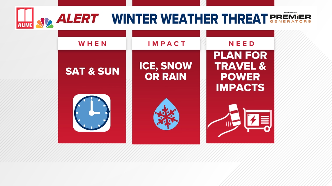
Winter Precipitation would start Saturday during the day, and continue through at least Sunday evening. As the event begins, precipitation may start light. That will change. Very deep moisture will produce heavier rates of whatever falls from the sky, with the heaviest between 8 p.m. Saturday and 5 p.m. Sunday.
Impact
Travel: Prepare for Difficult if not Impossible Travel on untreated surfaces. This threat will be at its worst if we end up with more ice and less snow/sleet.
Power Outages: The power outage threat is growing. If we see mostly freezing rain, power outages could become widespread.
Closures: We expect most businesses to be closed this weekend, with the exception of a few that may stay open Saturday early before the winter threat increases. Schools will likely be impacted early next week, depending on the extent of power outages and how long it takes for roads to be cleared.
Pipes: Although pipes will be okay early in this event, colder air arrives behind it. For buildings that loose power this weekend, loosing internal heat, the chance of pipes freezing could increase by next Tuesday morning as the cold air lingers.
Need
Mentally prepare yourself for an impactful winter storm this weekend that will keep you at home for several days.
What food and gas do you need to get through 2-4 days? If you loose power, do you have supplies?
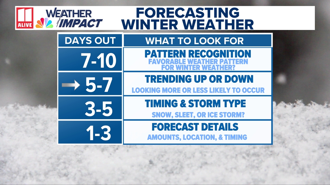
Avoid focusing on exact snowfall or ice amounts right now, as those details are likely to change. If you have weekend travel plans, be prepared to adjust if conditions worsen.
We’ll continue refining the forecast as new data comes in and will update you frequently as confidence increases.

Precipitation Types
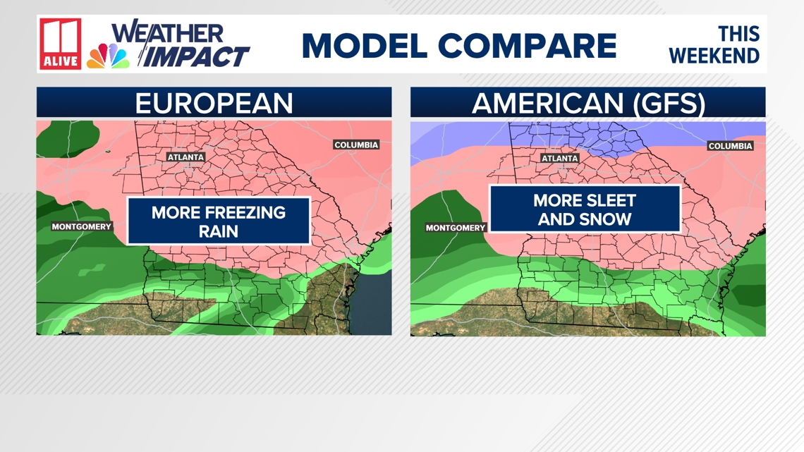
This setup is complicated, and that’s why confidence is still limited. An arctic air mass is expected to push south from Canada and meet moisture streaming in from the Gulf of Mexico. Where that boundary sets up will determine what type of precipitation Georgia sees.
Some areas may experience nothing more than a cold, steady rain. However, if cold air becomes entrenched at the surface, parts of north and central Georgia could see freezing rain and possibly some snow. Even small changes in temperatures or storm track could make a big difference in outcomes.

Forecast guidance shows a growing signal for wintry weather potential across the region. While this is not a locked-in winter storm, there is enough risk to warrant early awareness. Ice is a particular concern in Georgia, as even light icing can quickly lead to slick roads, travel disruptions, and isolated power outages.
Key factors we’re still watching include:
How strong the cold air near the surface becomes
Whether upper-level weather features enhance precipitation
The exact path of a developing area of low pressure