
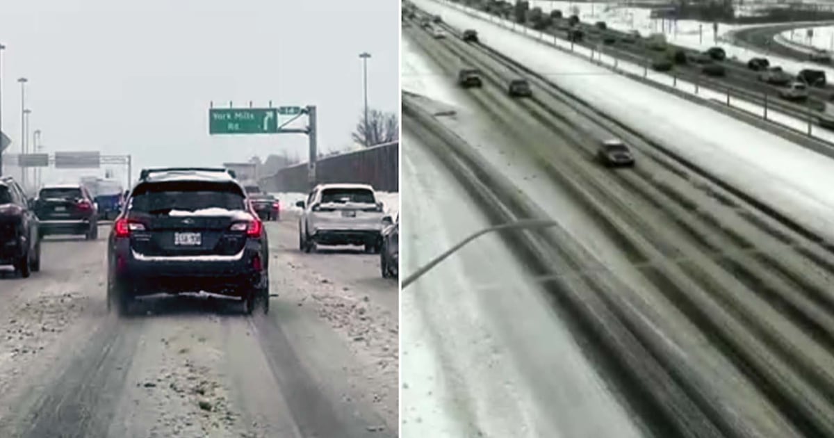
An Alberta Clipper dumped more snow on Toronto on Wednesday and created hazardous travel conditions on roadways.
Here is what you need to know about today’s weather event.
Key updates:
The yellow snowfall warning for Toronto has been lifted, but the advisory for municipalities within southern Durham regions remains in place.As much as 10 cm of snow could fall on WednesdayEnvironment Canada says the snow will end in the late afternoon or early eveningThe snow comes amid an extended cold snap in the city3:01 p.m.
According to Environment Canada, “the coldest air of the season along with very cold wind chills is expected this weekend with the potential for significant snow on Sunday.”
At the moment, the temperature could dip to a low of -22 C on Friday and will only climb to a daytime high of -15 C on Saturday.
It is not clear how much snow the GTA could see on Sunday.
2:42 p.m.
The snowfall warning for Toronto has ended, but it remains in effect for parts of the southern Durham Region.
According to Environment Canada, while the snow is expected to taper off later this afternoon, it could still impact the evening commute.
12:30 p.m.
The TTC says buses are bypassing some problematic stops due to weather conditions.
29 Dufferin: Buses are not stopping near Dufferin St at Davenport Rd North Side due to weather conditions.
— TTC Service Alerts (@TTCnotices) January 21, 2026
12 p.m.
Salters are out in Mississauga as the city deals with ongoing flurries.
11 a.m.
Geoff Coulson, a warning preparedness meteorologist with Environment Canada, said eastern parts of the GTA will see significantly more snow than western parts of the region.
“As we get into Scarborough, Pickering, Oshawa, Whitby, those areas (are) likely looking at closer to 10 centimetres,” he told CP24.
Downtown and western parts of the GTA will likely only see about five centimetres, he added.
“Lake effect snow is going to continue to play a part in this system,” Coulson said.
“Right now it is still getting itself together, but certainly as we get into overnight hours and into the day on Thursday, with winds coming from the west off of Lake Huron and Georgian Bay, those traditional snow belt areas are probably looking at locally heavier amounts.”
He added that flurries are possible in Toronto on Thursday.
“Our ongoing weather story for the coming days… is going to be the colder than normal conditions,” he said.
“Another potential system that we are looking at on Sunday could bring even more snow across the GTA as well.”
9:30 a.m.
OPP Sgt. Kerry Schmidt said snow is now falling north of Toronto.
“We’re going to see a bigger system come through in the next hour or so,” he said, warning of blowing snow that could reduce visibility for drivers.
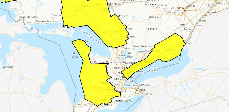 map, jan. 21 Parts of the GTA are under a snowfall warning, yellow alert, as an Alberta Clipper arrives in the region. (Environment Canada) 8:30 a.m.
CP24 Meteorologist Bill Coulter said very light snow has started falling in parts of the GTA.
“The snow will be coming down fairly lightly throughout the course of the day,” he added.
“The next big system could be more impactful on Sunday. Two of three major models are predicting 10 (to) 20 centimetres, possibly even more because it is going to be so cold and less dense snow.”
7 a.m.
Toronto police are warning people to be careful along Lake Ontario and within the Toronto Harbour.
“Over the past several weeks, fluctuating temperatures, high winds, and wave action have prevented ice from forming consistently,” police said in a news release.
“While temperatures are now feeling like minus 20 degrees (C) and colder, any ice that begins to form will be new, unstable ice and is not safe.”
6:30 a.m.
No school bus cancellations have been reported in advance on Wednesday’s inclement weather. Both Toronto’s public and Catholic boards have said buses are running and schools are open.
6:15 a.m.
Wednesday snow comes as Toronto continues to grapple with bitterly cold temperatures. The city will see a high of -1 C this morning but it will feel like -16 with the wind chill. Wednesday is expected to be the warmest day of the week. Temperatures will plummet to a high of -11 C on Saturday.
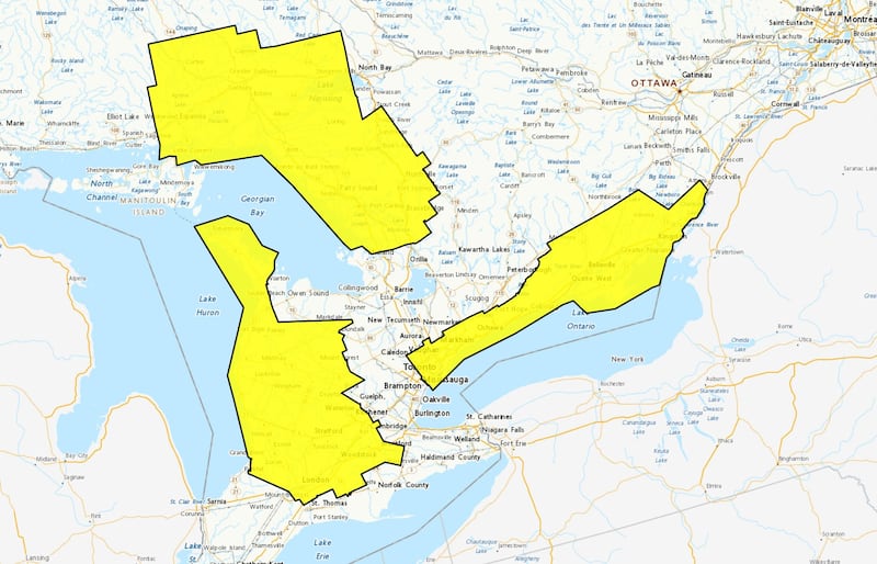 Weather alerts GTHA driving snow Environment Canada weather alerts in the GTHA and parts of southern Ontario as of 8:40 a.m., Jan. 21, 2026. 6 a.m.
Environment Canada says Wednesday’s system will create slippery roadways and poor visibility for drivers during the morning commute.
“An Alberta clipper will push into the region with snow beginning this morning impacting the morning commute. The snow will ease through the afternoon or early evening potentially impacting the evening commute as well,” the national weather agency said.
“Travel will likely be challenging. Roads and walkways will likely be difficult to navigate due to accumulating snow. There may be a significant impact on rush hour traffic. Visibility will likely be reduced at times.”