
A major storm system is set to bring “potentially catastrophic” winter weather across the southern U.S. this weekend, bringing snow, freezing rain and ice pellets to a substantial swath of the country.
It could be the “storm that defines the entire winter,” according to some meteorologists.
Overall, nearly 30 states could feel the effects from New Mexico all the way to New York starting Friday.
The National Weather Service warns that not only will this be a significant storm event but that there will be dangerously cold temperatures both before and after it passes — and in places that aren’t accustomed to such frigid conditions.
But there’s still “a lot of uncertainty,” David Nadler, a warning co-ordination meteorologist with the NWS in Peachtree City, Ga., said in a special briefing Wednesday afternoon.
He says the forecast and the breadth of the storm could shift in the next couple of days, meaning watches and warnings may change.
And, as the weekend goes on, the severe weather could have an impact on parts Canada toward the start of next week.
When is it hitting — and where will be affected?
Storm conditions are expected to begin on Friday and continue all the way into Monday.
Forecast maps show that the system will stretch all the way from New Mexico and the southern Rocky Mountains to northern Georgia, the Carolinas and the mid-Atlantic states, before moving northward into the northeast and Great Lakes.
That’s an area that’s home to about 55 per cent of the population of the contiguous United States, including major cities from Dallas and Nashville to Washington and Baltimore, that could be affected at the peak of the storm — likely to be on Sunday.
 An satellite image of weather systems over the United States generated from data captured by the National Oceanic and Atmospheric Administration’s (NOAA) GOES satellite on Jan. 21. (NOAA)What’s expected?
Depending on where you are in the U.S., it could be a mix of heavy snow, sleet or heavy but cold rainfall.
At this point, the storm’s track through parts of Texas and Oklahoma all the way to North Carolina will be most likely to see significant snowfall with the potential to cause widespread travel disruptions.
But the risk of freezing rain is greatest in southeastern Texas, through much of Louisiana and eastward through Georgia and South Carolina.
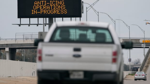
Some of the storm’s earliest impacts could be in Texas on Friday, as an Arctic air mass slides south through much of the state, National Weather Service forecaster Sam Shamburger said on Tuesday.
While it’s not unusual to get winter weather in the Deep South, this may be may be a “generational storm” for people living there, says Pam Knox, director of the University of Georgia Weather Network.
Aside from treacherous road conditions, there’s a big risk of ice-covered trees and powerlines coming down, leaving people without electricity to heat their homes in the days that follow when temperatures remain well below freezing, she explains.
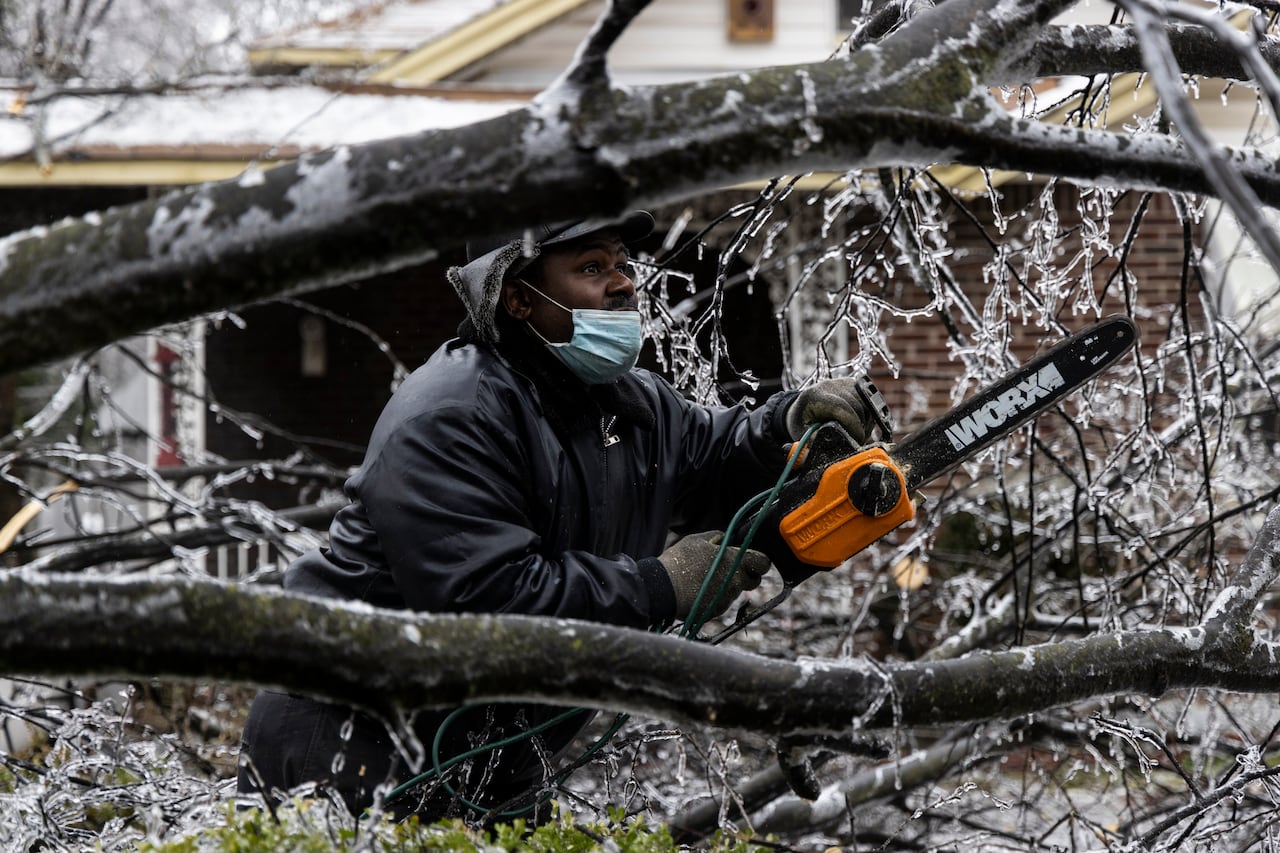 A man works to clear a downed tree at his mother’s house in Memphis, Tenn., in February 2022, after a massive storm, blasted Midwestern states with snow and freezing rain. (Brad Vest/Getty Images)
“There’s a lot of people down here, the younger people, that really haven’t gone through anything like this,” she told CBC News in an interview from Athens, Ga.
And without the experience or resources, she says, it may be a struggle for some people to stay safe and warm — or cook food — during longer power outages.
What about Canada?
Much of Canada will already be experiencing a deep freeze due to the fact that the cold air fuelling the storm is coming from this country, says Geoff Coulson, a weather preparedness meteorologist with Environment and Climate Change Canada.
While he says it’s too soon to predict just how significantly it will hit this country, Eastern and Atlantic Canada face the possibility of another big snowfall.
“We could be looking at notable snowfall amounts in the lower Great Lakes in Ontario during the day on Sunday and possible snow impacts into Atlantic Canada early next week,” he said.
While Environment and Climate Change Canada has issued a number of yellow and orange level weather alerts across parts the Prairie and Eastern Canada related to extreme cold, the agency had yet to issue any advisories related to the storm as of Wednesday evening.
WATCH | Huge winter storm blows through eastern Ontario, record snowfall in some places: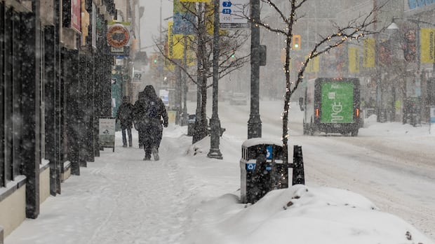
Eastern Ontario digs out after winter storm
Eastern Ontario is digging out after a huge snowstorm blew through Thursday. CBC’s Natalia Goodwin shares an update Friday.Why is this storm going to be so big?
There are three factors that will contribute to this storm brewing into such a beast, says Coulson.
There’s an atmospheric river moving in from the Pacific Coast packed with precipitation. That system, he says, is going to collide with warm, moist air from the Gulf of Mexico and the polar vortex pushing Arctic air from Canada down to the Deep South.
All of this, he says, is “giving this system lots to play with.”
He says the “thermal contrast” between those two air masses is dramatic, with temperatures in the -20 C range in Canada and much of the northern U.S. but in the 20 C range along the Gulf Coast heading into the weekend.
WATCH | Hurricane hunter planes tracking how climate change is charging atmospheric rivers:
Hurricane hunter planes turn their sights to atmospheric rivers
Atmospheric rivers — and the flooding they bring — are intensifying with climate change.
For the past decade, the same hurricane hunter planes used to study cyclones have been flying straight into these West Coast rain-makers. Why? Because the data they collect proves these flights can significantly improve forecasts. CBC’s Johanna Wagstaffe looks at how that evidence is driving a major expansion of the program.
That temperature difference “increases the amount of energy that goes into a storm,” said Knox.
And with all of the “pieces of activity that all are interacting with each other,” making predictions about how exactly the storm will play out this weekend is proving to be difficult.
“It’s like trying to model a bunch of toddlers in a room together,” she said.